 |
|
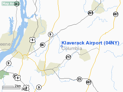
Location & QuickFacts
| FAA Information Effective: | 2008-09-25 |
| Airport Identifier: | 04NY |
| Airport Status: | Operational |
| Longitude/Latitude: | 073-41-46.4390W/42-15-44.3130N
-73.696233/42.262309 (Estimated) |
| Elevation: | 250 ft / 76.20 m (Estimated) |
| Land: | 0 acres |
| From nearest city: | 3 nautical miles N of Hudson, NY |
| Location: | Columbia County, NY |
| Magnetic Variation: | 14W (1985) |
Owner & Manager
| Ownership: | Privately owned |
| Owner: | Robert & Leah Brew |
| Address: | Rural Delivery Route 1
Hudson, NY 12534 |
| Phone number: | 518-828-6149 |
| Address: |
|
Airport Operations and Facilities
| Airport Use: | Private
PERSONAL USE. |
| Wind indicator: | Yes |
| Segmented Circle: | Yes |
| Control Tower: | No |
| Sectional chart: | New York |
| Region: | AEA - Eastern |
| Boundary ARTCC: | ZBW - Boston |
| Tie-in FSS: | BTV - Burlington |
| FSS on Airport: | No |
| FSS Toll Free: | 1-800-WX-BRIEF |
Runway Information
Runway 02/20
| Dimension: | 5200 x 50 ft / 1585.0 x 15.2 m |
| Surface: | TURF, |
| |
Runway 02 |
Runway 20 |
| Traffic Pattern: | Right | Left |
| Displaced threshold: | 0.00 ft | 1700.00 ft |
|
Radio Navigation Aids
| ID |
Type |
Name |
Ch |
Freq |
Var |
Dist |
| GBR | FAN MARKER | Sheffield | | | 13W | 16.9 nm |
| PSF | FAN MARKER | Abyss | | | 13W | 24.4 nm |
| SKU | FAN MARKER | Stanwyck | | | 12W | 46.8 nm |
| PFH | NDB | Philmont | | 272.00 | 13W | 1.3 nm |
| GBR | NDB | Great Barrington | | 395.00 | 14W | 13.9 nm |
| DXT | NDB | Dalton | | 370.00 | 15W | 26.5 nm |
| HEU | NDB | Hunter | | 356.00 | 14W | 37.0 nm |
| PO | NDB | Meier | | 403.00 | 12W | 43.0 nm |
| SKU | NDB | Stanwyck | | 261.00 | 12W | 46.8 nm |
| PWL | VOR/DME | Pawling | 090X | 114.30 | 12W | 29.9 nm |
| CTR | VOR/DME | Chester | 098X | 115.10 | 13W | 33.3 nm |
| IGN | VOR/DME | Kingston | 123X | 117.60 | 12W | 36.3 nm |
| CAM | VOR/DME | Cambridge | 097X | 115.00 | 14W | 46.7 nm |
| ALB | VORTAC | Albany | 100X | 115.30 | 13W | 29.5 nm |
| BAF | VORTAC | Barnes | 077X | 113.00 | 14W | 44.0 nm |
| BDL | VORTAC | Bradley | 027X | 109.00 | 14W | 48.9 nm |
| ALB | VOT | Albany County | | 108.20 | | 29.4 nm |
| BDL | VOT | Bradley Intl | | 111.40 | | 49.2 nm |
Remarks
- CONSTRUCTION ON ARPT.
- SEE AIRSPACE LTR DATED 1/27/88 FOR CONDITIONS.
Images and information placed above are from
http://www.airport-data.com/airport/04NY/
We thank them for the data!
| General Info
|
| Country |
United States
|
| State |
NEW YORK
|
| FAA ID |
04NY
|
| Latitude |
42-15-44.313N
|
| Longitude |
073-41-46.439W
|
| Elevation |
250 feet
|
| Near City |
HUDSON
|
We don't guarantee the information is fresh and accurate. The data may
be wrong or outdated.
For more up-to-date information please refer to other sources.
|
|


