|
|
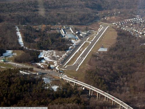
| The Kingston-Ulster Airport |
| IATA: none – ICAO: none – FAA LID: 20N |
| Summary |
| Owner |
Kingston-Ulster Airport, Inc. |
| Operator |
River Aviation |
| Serves |
Ulster County, New York |
| Location |
Ulster, New York |
| Elevation AMSL |
149 ft / 45 m |
| Coordinates |
41°59′07″N 73°57′51″W / 41.98528°N 73.96417°W / 41.98528; -73.96417Coordinates: 41°59′07″N 73°57′51″W / 41.98528°N 73.96417°W / 41.98528; -73.96417 |
| Runways |
| Direction |
Length |
Surface |
| ft |
m |
| 15/33 |
3100 |
945 |
asphalt |
| Source: DAFIF |
The Kingston-Ulster Airport (FAA LID: 20N) is a public use airport located in the Town of Ulster, Ulster County, New York. Facilities and services
The FAA identifier is 20N. Field elevation is 149 ft (45 m) MSL (Mean Sea Level). Magnetic Variation 13 degrees west. It utilizes a single 3,100 x 60 foot runway designated as 15/33. The fixed base operator (FBO), River Aviation, offers aircraft rentals, flight instruction (recreational, private, instrument, commercial training, and ATP), and sight seeing flights around the Hudson Valley. The airport mostly serves Ulster County.
Statistics
| Airport Operations |
| Airport use: |
Open to the public |
| Activation date: |
09/1961 |
| Sectional chart: |
NEW YORK |
| Control tower: |
no |
| Pattern altitude: |
1200 ft. MSL 1000' AGL (Above Ground Level) |
| Wind indicator: |
lighted |
| Segmented circle: |
yes |
| Airport Communications |
| CTAF/UNICOM: |
122.8 |
| NEW YORK APPROACH: |
132.75 |
| NEW YORK DEPARTURE: |
132.75 |
| Airport Operational Statistics |
| Aircraft based on the field: |
41 |
| Single engine airplanes: |
40 |
| Multi engine airplanes: |
1 |
| Aircraft operations: |
avg 22/day |
| local general aviation |
88% |
| transient general aviation |
12% |
The above content comes from Wikipedia and is published under free licenses – click here to read more.
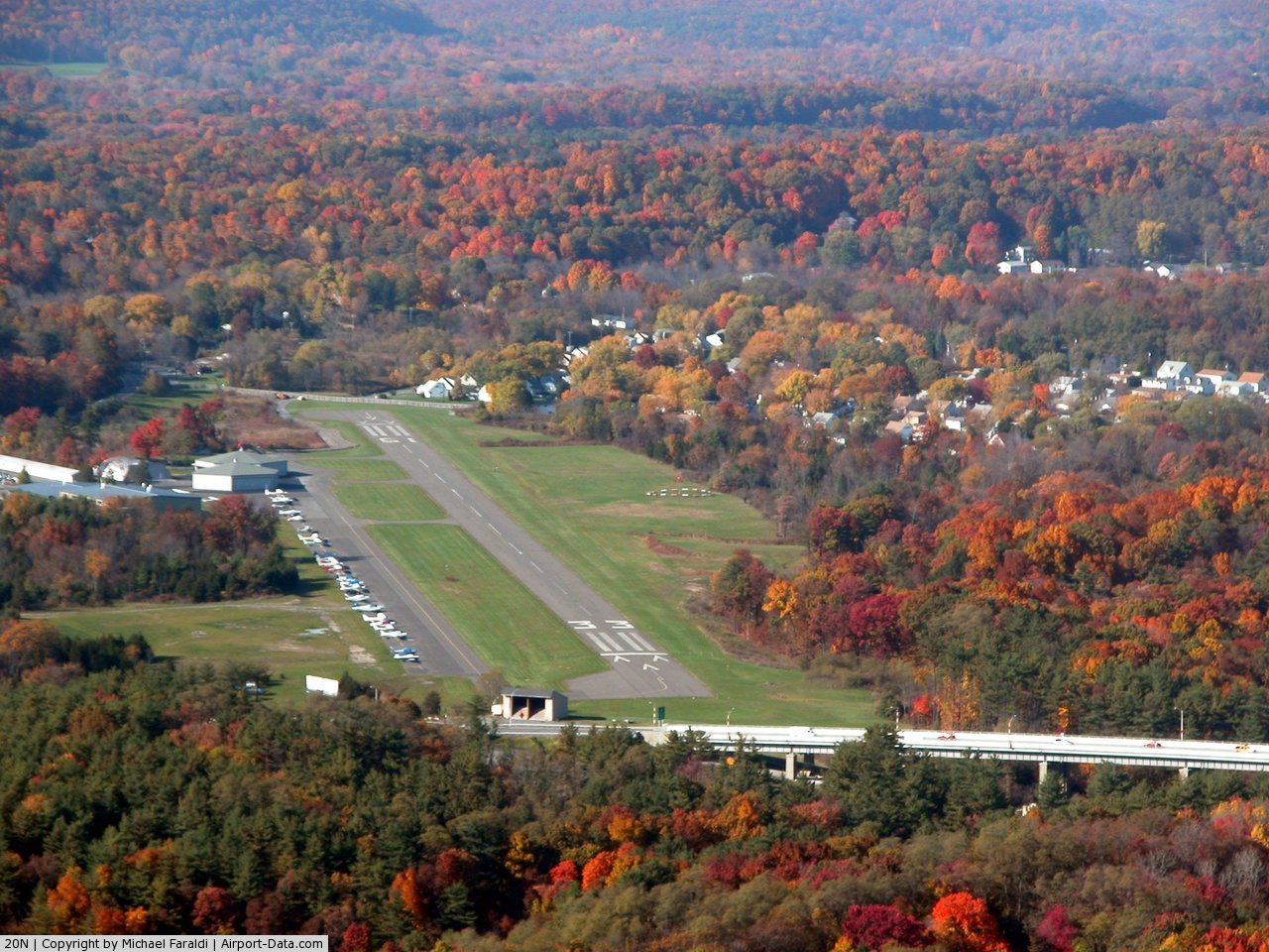
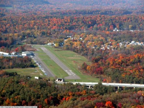 |
(Click on the photo to enlarge) |
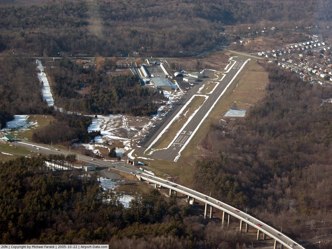
 |
(Click on the photo to enlarge) |
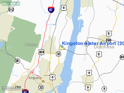
Location & QuickFacts
| FAA Information Effective: | 2008-09-25 |
| Airport Identifier: | 20N |
| Airport Status: | Operational |
| Longitude/Latitude: | 073-57-50.7500W/41-59-06.9090N
-73.964097/41.985253 (Estimated) |
| Elevation: | 149 ft / 45.42 m (Surveyed) |
| Land: | 87 acres |
| From nearest city: | 4 nautical miles N of Kingston, NY |
| Location: | Ulster County, NY |
| Magnetic Variation: | 13W (1985) |
Owner & Manager
| Ownership: | Privately owned |
| Owner: | Kingston-ulster Arpt Inc. |
| Address: | 1161 Flatbush Rd
Kingston, NY 12401 |
| Phone number: | 845-336-8400 |
| Manager: | Jim Walleur |
| Address: | 1161 Flatbush Rd
Kingston, NY 12401 |
| Phone number: | 845-336-7700 |
Airport Operations and Facilities
| Airport Use: | Open to public |
| Wind indicator: | Yes |
| Segmented Circle: | Yes |
| Control Tower: | No |
| Lighting Schedule: | RDO-CTL
ACTVT PAPI RYS 15 & 33 - 123.3. MIRL RY 15/33; REIL RY 33 & TWY LGTS OPERATE 123.3 DUSK-DAWN. |
| Landing fee charge: | Yes |
| Sectional chart: | New York |
| Region: | AEA - Eastern |
| Traffic Pattern Alt: | 1051 ft |
| Boundary ARTCC: | ZBW - Boston |
| Responsible ARTCC: | ZNY - New York |
| Tie-in FSS: | ISP - New York |
| FSS on Airport: | No |
| FSS Toll Free: | 1-800-WX-BRIEF |
| NOTAMs Facility: | ISP (NOTAM-d service avaliable) |
| Federal Agreements: | NGY |
Airport Communications
| CTAF: | 122.800 |
| Unicom: | 122.800 |
Airport Services
| Fuel available: | 100LL |
| Airframe Repair: | MAJOR |
| Power Plant Repair: | MAJOR |
| Bottled Oxygen: | NONE |
| Bulk Oxygen: | NONE |
Runway Information
Runway 15/33
| Dimension: | 3100 x 60 ft / 944.9 x 18.3 m |
| Surface: | ASPH, Good Condition |
| Weight Limit: | Single wheel: 12500 lbs. |
| Edge Lights: | Medium |
| |
Runway 15 |
Runway 33 |
| Longitude: | 073-58-04.0050W | 073-57-37.4960W |
| Latitude: | 41-59-18.6000N | 41-58-55.2190N |
| Elevation: | 148.00 ft | 134.00 ft |
| Alignment: | 127 | 127 |
| Traffic Pattern: | Left | Left |
| Markings: | Non-precision instrument, Good Condition | Non-precision instrument, Good Condition |
| Displaced threshold: | 235.00 ft | 310.00 ft |
| VASI: | 2-light PAPI on left side | 2-light PAPI on left side |
| Runway End Identifier: | No | Yes |
| Obstruction: | 59 ft trees, 265.0 ft from runway, 91 ft right of centerline, 1:1 slope to clear
APCH RATIO 8:1 TO DSPLCD THLD.
RY 15 HAS +39 FT LIGHT POLE 136 FT FM THLD 123 FT LEFT. | 31 ft pole, 279.0 ft from runway, 62 ft left of centerline, 2:1 slope to clear
RY 33 HAS +63 FT TREES, 700 FT FM RY, 63 FT RT. APCH SLOPE 16:1 BASED ON DSPLCD THLD.
RY 33 HAS +7 FT FENCE, 164 FT FM THLD. |
| Decleard distances: | Take off run available 3100.00 ft
Take off distance available 3100.00 ft
Actual stop distance available 3010.00 ft
Landing distance available 2775.00 ft
| Take off run available 3100.00 ft
Take off distance available 3100.00 ft
Actual stop distance available 2939.00 ft
Landing distance available 2630.00 ft
|
|
Radio Navigation Aids
| ID |
Type |
Name |
Ch |
Freq |
Var |
Dist |
| SKU | FAN MARKER | Stanwyck | | | 12W | 27.7 nm |
| GBR | FAN MARKER | Sheffield | | | 13W | 28.1 nm |
| PSF | FAN MARKER | Abyss | | | 13W | 43.8 nm |
| PFH | NDB | Philmont | | 272.00 | 13W | 19.3 nm |
| PO | NDB | Meier | | 403.00 | 12W | 24.7 nm |
| GBR | NDB | Great Barrington | | 395.00 | 14W | 27.7 nm |
| SKU | NDB | Stanwyck | | 261.00 | 12W | 27.7 nm |
| SW | NDB | Neely | | 335.00 | 14W | 32.3 nm |
| MS | NDB | Monga | | 359.00 | 12W | 42.2 nm |
| DXT | NDB | Dalton | | 370.00 | 15W | 45.8 nm |
| TBY | NDB | Waterbury | | 257.00 | 14W | 45.9 nm |
| IGN | VOR/DME | Kingston | 123X | 117.60 | 12W | 20.2 nm |
| PWL | VOR/DME | Pawling | 090X | 114.30 | 12W | 20.8 nm |
| HUO | VOR/DME | Huguenot | 108X | 116.10 | 11W | 44.6 nm |
| CMK | VOR/DME | Carmel | 113X | 116.60 | 12W | 45.7 nm |
| DNY | VOR/DME | De Lancey | 058X | 112.10 | 11W | 45.8 nm |
| CTR | VOR/DME | Chester | 098X | 115.10 | 13W | 48.8 nm |
| ALB | VORTAC | Albany | 100X | 115.30 | 13W | 46.4 nm |
| ALB | VOT | Albany County | | 108.20 | | 45.9 nm |
Remarks
- NO ULTRALIGHT OPERATIONS.
- NO LINE OF SIGHT BTN RY 33 HOLD LINE & ACFT IN FINAL .25 MI OF APCH TO RY 33.
- RY 33 HAS +21 FT FENCE, 237 FT FM THLD.
- PAEW ADJACENT TWY/RWY.
- NOISE ABATEMENT PROCEDURES IN EFFECT CALL (845) 336-8400. AVOID OVERFLIGHT OF HOUSING DEVELOPMENT ADJ TO N END OF RY.
- PREFERRED ARRIVAL RY 33; DEP RY 15.
- NO FLT TRNG LCL OR TSNT 2200-0600.
- NIGHT TGL PROHIBITED.
- NO RUNUPS AT RY 15 THLD.
- EXISTED PRIOR TO 1959.
Images and information placed above are from
http://www.airport-data.com/airport/20N/
We thank them for the data!
| General Info
|
| Country |
United States
|
| State |
NEW YORK
|
| FAA ID |
20N
|
| Latitude |
41-59-06.909N
|
| Longitude |
073-57-50.750W
|
| Elevation |
149 feet
|
| Near City |
KINGSTON
|
We don't guarantee the information is fresh and accurate. The data may
be wrong or outdated.
For more up-to-date information please refer to other sources.
|
|