 |
|
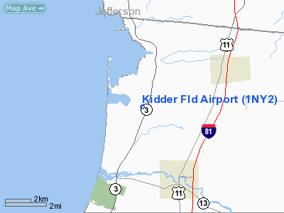
Location & QuickFacts
| FAA Information Effective: | 2008-09-25 |
| Airport Identifier: | 1NY2 |
| Airport Status: | Operational |
| Longitude/Latitude: | 076-09-45.7340W/43-37-00.2460N
-76.162704/43.616735 (Estimated) |
| Elevation: | 360 ft / 109.73 m (Estimated) |
| Land: | 0 acres |
| From nearest city: | 3 nautical miles SE of Pulaski, NY |
| Location: | Oswego County, NY |
| Magnetic Variation: | 13W (1985) |
Owner & Manager
| Ownership: | Privately owned |
| Owner: | Criss Kidder, Jr., Md |
| Address: | 220 Maple Lane
North Syracuse, NY 13212 |
| Address: |
|
Airport Operations and Facilities
| Airport Use: | Private |
| Wind indicator: | No |
| Segmented Circle: | No |
| Control Tower: | No |
| Landing fee charge: | No |
| Sectional chart: | New York |
| Region: | AEA - Eastern |
| Boundary ARTCC: | ZBW - Boston |
| Tie-in FSS: | BTV - Burlington |
| FSS on Airport: | No |
| FSS Toll Free: | 1-800-WX-BRIEF |
Airport Services
| Airframe Repair: | NONE |
| Power Plant Repair: | NONE |
Runway Information
Runway E/W
| Dimension: | 1800 x 50 ft / 548.6 x 15.2 m |
| Surface: | TURF, |
| |
Runway E |
Runway W |
| Traffic Pattern: | Left | Left |
|
Radio Navigation Aids
| ID |
Type |
Name |
Ch |
Freq |
Var |
Dist |
| GTB | NDB | Drum | | 257.00 | 13W | 32.9 nm |
| BK | NDB | Plein | | 329.00 | 12W | 38.0 nm |
| GSS | TACAN | Griffiss | 057X | | 12W | 40.1 nm |
| ART | VORTAC | Watertown | 035X | 109.80 | 12W | 20.6 nm |
| SYR | VORTAC | Syracuse | 117X | 117.00 | 11W | 27.5 nm |
Images and information placed above are from
http://www.airport-data.com/airport/1NY2/
We thank them for the data!
| General Info
|
| Country |
United States
|
| State |
NEW YORK
|
| FAA ID |
1NY2
|
| Latitude |
43-37-00.246N
|
| Longitude |
076-09-45.734W
|
| Elevation |
360 feet
|
| Near City |
PULASKI
|
We don't guarantee the information is fresh and accurate. The data may
be wrong or outdated.
For more up-to-date information please refer to other sources.
|
|


