 |
|
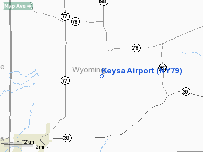
Location & QuickFacts
| FAA Information Effective: | 2008-09-25 |
| Airport Identifier: | NY79 |
| Airport Status: | Operational |
| Longitude/Latitude: | 078-20-25.0570W/42-35-48.2220N
-78.340294/42.596728 (Estimated) |
| Elevation: | 1620 ft / 493.78 m (Estimated) |
| Land: | 10 acres |
| From nearest city: | 4 nautical miles NW of Bliss, NY |
| Location: | Wyoming County, NY |
| Magnetic Variation: | 10W (1985) |
Owner & Manager
| Ownership: | Privately owned |
| Owner: | Thomas P. Keysa |
| Address: | 6208 Java Lake Rd
Arcade, NY 14009 |
| Phone number: | 716-492-5111 |
| Address: |
|
Airport Operations and Facilities
| Airport Use: | Private |
| Segmented Circle: | No |
| Control Tower: | No |
| Sectional chart: | Detroit |
| Region: | AEA - Eastern |
| Boundary ARTCC: | ZOB - Cleveland |
| Tie-in FSS: | BUF - Buffalo |
| FSS on Airport: | No |
| FSS Toll Free: | 1-800-WX-BRIEF |
Runway Information
Runway 18/36
| Dimension: | 1860 x 60 ft / 566.9 x 18.3 m |
| Surface: | TURF, |
| |
Runway 18 |
Runway 36 |
| Traffic Pattern: | Left | Left |
|
Radio Navigation Aids
| ID |
Type |
Name |
Ch |
Freq |
Var |
Dist |
| LYS | NDB | Olean | | 360.00 | 09W | 18.8 nm |
| EL | NDB | Halos | | 269.00 | 09W | 34.8 nm |
| AVN | NDB | Avon | | 344.00 | 09W | 35.4 nm |
| IAG | TACAN | Niagara Falls | 047X | | 10W | 41.3 nm |
| BUF | VOR/DME | Buffalo | 111X | 116.40 | 08W | 24.1 nm |
| GEE | VOR/DME | Geneseo | 019X | 108.20 | 09W | 30.4 nm |
| JHW | VOR/DME | Jamestown | 094X | 114.70 | 07W | 42.5 nm |
| ELZ | VORTAC | Wellsville | 051X | 111.40 | 09W | 34.0 nm |
| DKK | VORTAC | Dunkirk | 109X | 116.20 | 07W | 41.8 nm |
| ROC | VORTAC | Rochester | 037X | 110.00 | 09W | 43.1 nm |
| BUF | VOT | Buffalo | | 109.00 | | 26.9 nm |
Remarks
- 934' LGTD TOWER 2.9 NM NE.
- PRIOR TO OPNS, COORDINATE NEED FOR NON-STANDARD TFC PATS WITH MGR BUFFALO ATCT; IF NON-STANDARD TFC PATS ARE REQUIRED, ENTER INTO LOA WITH OPERATORS OF ARCADE & ROBERTS ROOST ARPTS & SEND COPY TO REGIONAL OFFICE.
Images and information placed above are from
http://www.airport-data.com/airport/NY79/
We thank them for the data!
| General Info
|
| Country |
United States
|
| State |
NEW YORK
|
| FAA ID |
NY79
|
| Latitude |
42-35-48.222N
|
| Longitude |
078-20-25.057W
|
| Elevation |
1620 feet
|
| Near City |
BLISS
|
We don't guarantee the information is fresh and accurate. The data may
be wrong or outdated.
For more up-to-date information please refer to other sources.
|
|


