 |
|
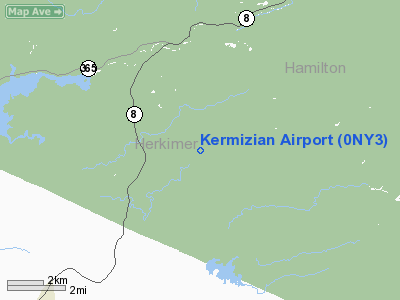
Location & QuickFacts
| FAA Information Effective: | 2008-09-25 |
| Airport Identifier: | 0NY3 |
| Airport Status: | Operational |
| Longitude/Latitude: | 074-55-55.5640W/43-18-50.2470N
-74.932101/43.313958 (Estimated) |
| Elevation: | 1440 ft / 438.91 m (Estimated) |
| Land: | 0 acres |
| From nearest city: | 3 nautical miles SE of Ohio, NY |
| Location: | Herkimer County, NY |
| Magnetic Variation: | 13W (1985) |
Owner & Manager
| Ownership: | Privately owned |
| Owner: | Michael S. Kermizian |
| Address: | Rd 1, Box 122a
Cold Brook, NY 13324 |
| Address: |
|
Airport Operations and Facilities
| Airport Use: | Private |
| Wind indicator: | Yes |
| Segmented Circle: | No |
| Control Tower: | No |
| Landing fee charge: | No |
| Sectional chart: | New York |
| Region: | AEA - Eastern |
| Boundary ARTCC: | ZBW - Boston |
| Tie-in FSS: | BUF - Buffalo |
| FSS on Airport: | No |
| FSS Toll Free: | 1-800-WX-BRIEF |
Runway Information
Runway 13/31
| Dimension: | 1600 x 100 ft / 487.7 x 30.5 m
300' OVERRUNS EACH END. |
| Surface: | GRAVEL, |
| |
Runway 13 |
Runway 31 |
| Traffic Pattern: | Left | Left |
| Obstruction: | 40 ft trees | 40 ft trees |
|
Radio Navigation Aids
| ID |
Type |
Name |
Ch |
Freq |
Var |
Dist |
| CJY | NDB | Clay | | 275.00 | 12W | 21.4 nm |
| BK | NDB | Plein | | 329.00 | 12W | 24.7 nm |
| JJH | NDB | Johnstown | | 523.00 | 14W | 32.4 nm |
| GSS | TACAN | Griffiss | 057X | | 12W | 21.5 nm |
| UCA | VORTAC | Utica | 049X | 111.20 | 12W | 20.1 nm |
Images and information placed above are from
http://www.airport-data.com/airport/0NY3/
We thank them for the data!
| General Info
|
| Country |
United States
|
| State |
NEW YORK
|
| FAA ID |
0NY3
|
| Latitude |
43-18-50.247N
|
| Longitude |
074-55-55.564W
|
| Elevation |
1440 feet
|
| Near City |
OHIO
|
We don't guarantee the information is fresh and accurate. The data may
be wrong or outdated.
For more up-to-date information please refer to other sources.
|
|


