 |
|
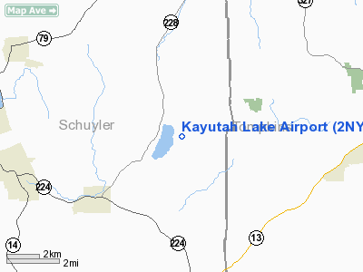
Location & QuickFacts
| FAA Information Effective: | 2008-09-25 |
| Airport Identifier: | 2NY9 |
| Airport Status: | Operational |
| Longitude/Latitude: | 076-43-20.8230W/42-22-12.2640N
-76.722451/42.370073 (Estimated) |
| Elevation: | 1385 ft / 422.15 m (Estimated) |
| Land: | 0 acres |
| From nearest city: | 3 nautical miles N of Alpine, NY |
| Location: | Schuyler County, NY |
| Magnetic Variation: | 11W (1985) |
Owner & Manager
| Ownership: | Privately owned |
| Owner: | James W. Allen |
| Address: | 2725 County Rt. 6
Alpine, NY 14805 |
| Phone number: | 607-594-2305 |
| Manager: | Kayutah Lake Development Corp |
| Address: | 2725 County Rt. 6
Alpine, NY 14805 |
| Phone number: | 607-594-2305 |
Airport Operations and Facilities
| Airport Use: | Private |
| Wind indicator: | Yes |
| Segmented Circle: | No |
| Control Tower: | No |
| Landing fee charge: | No |
| Sectional chart: | New York |
| Region: | AEA - Eastern |
| Boundary ARTCC: | ZNY - New York |
| Tie-in FSS: | BUF - Buffalo |
| FSS on Airport: | No |
| FSS Toll Free: | 1-800-WX-BRIEF |
Airport Services
| Airframe Repair: | NONE |
| Power Plant Repair: | NONE |
Runway Information
Runway 04W/22W
| Dimension: | 5000 x 150 ft / 1524.0 x 45.7 m
08/26 300' OVERRUN ON EAST END. |
| Surface: | WATER, |
| |
Runway 04W |
Runway 22W |
| Traffic Pattern: | Left | Left |
|
Runway 08/26
| Dimension: | 2400 x 70 ft / 731.5 x 21.3 m
08/26 300' OVERRUN ON EAST END. |
| Surface: | TURF, |
| |
Runway 08 |
Runway 26 |
| Traffic Pattern: | Left | Right |
|
Radio Navigation Aids
| ID |
Type |
Name |
Ch |
Freq |
Var |
Dist |
| ALP | NDB | Alpine | | 245.00 | 12W | 8.1 nm |
| PYA | NDB | Penn Yan | | 260.00 | 12W | 22.1 nm |
| ITH | VOR/DME | Ithaca | 055X | 111.80 | 10W | 13.9 nm |
| ULW | VOR/DME | Elmira | 033Y | 109.65 | 12W | 21.4 nm |
| CFB | VORTAC | Binghamton | 059X | 112.20 | 10W | 29.0 nm |
| GGT | VORTAC | Georgetown | 125X | 117.80 | 11W | 47.0 nm |
Images and information placed above are from
http://www.airport-data.com/airport/2NY9/
We thank them for the data!
| General Info
|
| Country |
United States
|
| State |
NEW YORK
|
| FAA ID |
2NY9
|
| Latitude |
42-22-12.264N
|
| Longitude |
076-43-20.823W
|
| Elevation |
1385 feet
|
| Near City |
ALPINE
|
We don't guarantee the information is fresh and accurate. The data may
be wrong or outdated.
For more up-to-date information please refer to other sources.
|
|


