 |
|
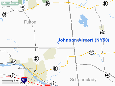
Location & QuickFacts
| FAA Information Effective: | 2008-09-25 |
| Airport Identifier: | NY50 |
| Airport Status: | Operational |
| Longitude/Latitude: | 074-08-10.0000W/42-59-30.0000N
-74.136111/42.991667 (Estimated) |
| Elevation: | 760 ft / 231.65 m (Estimated) |
| Land: | 0 acres |
| From nearest city: | 2 nautical miles E of Perth, NY |
| Location: | Fulton County, NY |
| Magnetic Variation: | () |
Owner & Manager
| Ownership: | Privately owned |
| Owner: | Roger N. Johnson |
| Address: | 227 County Hwy 132
Hagaman, NY 12086 |
| Phone number: | 518-843-4586 |
| Manager: | Roger N. Johnson |
| Address: | 227 County Hwy 132
Hagaman, NY 12086 |
| Phone number: | 518-843-4586 |
Airport Operations and Facilities
| Airport Use: | Private |
| Segmented Circle: | Yes |
| Control Tower: | No |
| Sectional chart: | New York |
| Region: | AEA - Eastern |
| Boundary ARTCC: | ZBW - Boston |
| Tie-in FSS: | BTV - Burlington |
| FSS Toll Free: | 1-800-WX-BRIEF |
Runway Information
Runway 09/27
| Dimension: | 2810 x 40 ft / 856.5 x 12.2 m |
| Surface: | TURF, |
| |
Runway 09 |
Runway 27 |
| Traffic Pattern: | Left | Left |
| Displaced threshold: | 600.00 ft
DSPLCD THLD MKD WITH ORANGE CONES. | 0.00 ft |
| Obstruction: | 40 ft trees, 200.0 ft from runway | |
|
Radio Navigation Aids
| ID |
Type |
Name |
Ch |
Freq |
Var |
Dist |
| JJH | NDB | Johnstown | | 523.00 | 14W | 8.6 nm |
| HEU | NDB | Hunter | | 356.00 | 14W | 12.2 nm |
| PFH | NDB | Philmont | | 272.00 | 13W | 48.0 nm |
| CJY | NDB | Clay | | 275.00 | 12W | 49.7 nm |
| CAM | VOR/DME | Cambridge | 097X | 115.00 | 14W | 34.8 nm |
| ALB | VORTAC | Albany | 100X | 115.30 | 13W | 20.8 nm |
| GFL | VORTAC | Glens Falls | 039X | 110.20 | 14W | 31.2 nm |
| UCA | VORTAC | Utica | 049X | 111.20 | 12W | 45.3 nm |
| ALB | VOT | Albany County | | 108.20 | | 20.4 nm |
Images and information placed above are from
http://www.airport-data.com/airport/NY50/
We thank them for the data!
|
|


