 |
|
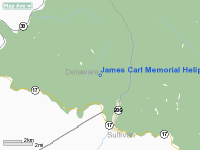
James Carl Memorial Heliport |
Location & QuickFacts
| FAA Information Effective: | 2008-09-25 |
| Airport Identifier: | 8NY1 |
| Airport Status: | Operational |
| Longitude/Latitude: | 074-56-04.5860W/41-59-06.3180N
-74.934607/41.985088 (Estimated) |
| Elevation: | 1863 ft / 567.84 m (Estimated) |
| Land: | 4000 acres |
| From nearest city: | 4 nautical miles N of Roscoe, NY |
| Location: | Delaware County, NY |
| Magnetic Variation: | 13W (1985) |
Owner & Manager
| Ownership: | Privately owned |
| Owner: | Donald's Mountain Farm |
| Address: | 281 Liberty St
Little Ferry, NJ 07643 |
| Phone number: | 201-440-4700 |
| Manager: | Ron Barone |
| Address: | 281 Liberty St
Little Ferry, NJ 07643 |
| Phone number: | 607-498-5983 |
Airport Operations and Facilities
| Airport Use: | Private
MEDICAL USE. |
| Wind indicator: | Yes |
| Segmented Circle: | No |
| Control Tower: | No |
| Lighting Schedule: | RDO-CTL
ACTVT PERIMETER LGTS & ROTG BCN - 123.75. |
| Beacon Color: | Clear-Green-Yellow (heliport) |
| Sectional chart: | New York |
| Region: | AEA - Eastern |
| Boundary ARTCC: | ZBW - Boston |
| Tie-in FSS: | BUF - Buffalo |
| FSS on Airport: | No |
| FSS Toll Free: | 1-800-WX-BRIEF |
Airport Communications
Runway Information
Helipad H1
| Dimension: | 60 x 60 ft / 18.3 x 18.3 m |
| Surface: | ASPH, |
| |
Runway H1 |
Runway |
| Traffic Pattern: | Left | Left |
|
Radio Navigation Aids
| ID |
Type |
Name |
Ch |
Freq |
Var |
Dist |
| SKU | FAN MARKER | Stanwyck | | | 12W | 48.4 nm |
| MS | NDB | Monga | | 359.00 | 12W | 13.5 nm |
| SW | NDB | Neely | | 335.00 | 14W | 43.6 nm |
| SKU | NDB | Stanwyck | | 261.00 | 12W | 48.4 nm |
| PO | NDB | Meier | | 403.00 | 12W | 50.0 nm |
| DNY | VOR/DME | De Lancey | 058X | 112.10 | 11W | 11.7 nm |
| HNK | VOR/DME | Hancock | 115X | 116.80 | 11W | 17.7 nm |
| RKA | VOR/DME | Rockdale | 073X | 112.60 | 11W | 31.9 nm |
| HUO | VOR/DME | Huguenot | 108X | 116.10 | 11W | 37.9 nm |
| LHY | VORTAC | Lake Henry | 045X | 110.80 | 10W | 39.3 nm |
Images and information placed above are from
http://www.airport-data.com/airport/8NY1/
We thank them for the data!
| General Info
|
| Country |
United States
|
| State |
NEW YORK
|
| FAA ID |
8NY1
|
| Latitude |
41-59-06.318N
|
| Longitude |
074-56-04.586W
|
| Elevation |
1863 feet
|
| Near City |
ROSCOE
|
We don't guarantee the information is fresh and accurate. The data may
be wrong or outdated.
For more up-to-date information please refer to other sources.
|
|


