 |
|
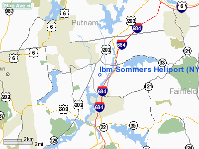
Location & QuickFacts
| FAA Information Effective: | 2008-09-25 |
| Airport Identifier: | NY44 |
| Airport Status: | Operational |
| Longitude/Latitude: | 073-40-47.4680W/41-19-01.3390N
-73.679852/41.317039 (Estimated) |
| Elevation: | 495 ft / 150.88 m (Estimated) |
| Land: | 0 acres |
| From nearest city: | 1 nautical miles NW of Somers, NY |
| Location: | Westchester County, NY |
| Magnetic Variation: | 13W (1985) |
Owner & Manager
| Ownership: | Privately owned |
| Owner: | Ibm Corp. |
| Address: | Dutchess Co Arpt
Wappingers Falls, NY 12590 |
| Phone number: | 914-435-2720 |
| Manager: | John F. Krause |
| Address: | Ibm Corp,dutchess Co Apt
Wappingers Falls, NY 12590 |
| Phone number: | 914-435-2700 |
Airport Operations and Facilities
| Airport Use: | Private |
| Wind indicator: | Yes |
| Segmented Circle: | No |
| Control Tower: | No |
| Sectional chart: | New York |
| Region: | AEA - Eastern |
| Boundary ARTCC: | ZBW - Boston |
| Tie-in FSS: | BUF - Buffalo |
| FSS Toll Free: | 1-800-WX-BRIEF |
Runway Information
Helipad H1
| Dimension: | 100 x 100 ft / 30.5 x 30.5 m |
| Surface: | ASPH, |
| |
Runway H1 |
Runway |
| Traffic Pattern: | Left | Left |
|
Radio Navigation Aids
| ID |
Type |
Name |
Ch |
Freq |
Var |
Dist |
| SKU | FAN MARKER | Stanwyck | | | 12W | 20.8 nm |
| EWR | FAN MARKER | Maryann | | | 11W | 43.5 nm |
| PO | NDB | Meier | | 403.00 | 12W | 20.1 nm |
| SKU | NDB | Stanwyck | | 261.00 | 12W | 20.8 nm |
| SW | NDB | Neely | | 335.00 | 14W | 26.7 nm |
| TBY | NDB | Waterbury | | 257.00 | 14W | 27.3 nm |
| PNJ | NDB | Paterson | | 347.00 | 12W | 30.8 nm |
| OP | NDB | Old Field Point Light | | 316.00 | 13W | 32.6 nm |
| MMK | NDB | Meriden | | 238.00 | 14W | 40.1 nm |
| BBN | NDB | Babylon | | 275.00 | 14W | 41.0 nm |
| OGY | NDB | Bridge | | 414.00 | 12W | 46.0 nm |
| CAT | NDB | Chatham | | 254.00 | 11W | 48.5 nm |
| CMK | VOR/DME | Carmel | 113X | 116.60 | 12W | 5.0 nm |
| IGN | VOR/DME | Kingston | 123X | 117.60 | 12W | 21.9 nm |
| BDR | VOR/DME | Bridgeport | 25X | 108.80 | 12W | 26.8 nm |
| PWL | VOR/DME | Pawling | 090X | 114.30 | 12W | 27.4 nm |
| LGA | VOR/DME | La Guardia | 078X | 113.10 | 12W | 33.0 nm |
| TEB | VOR/DME | Teterboro | 021X | 108.40 | 11W | 33.1 nm |
| DPK | VOR/DME | Deer Park | 124X | 117.70 | 12W | 35.9 nm |
| HVN | VOR/DME | New Haven | 035X | 109.80 | 13W | 36.0 nm |
| JFK | VOR/DME | Kennedy | 106X | 115.90 | 12W | 41.3 nm |
| HUO | VOR/DME | Huguenot | 108X | 116.10 | 11W | 41.5 nm |
| CRI | VOR/DME | Canarsie | 070X | 112.30 | 11W | 43.5 nm |
| MAD | VOR/DME | Madison | 041X | 110.40 | 13W | 44.6 nm |
| CCC | VOR/DME | Calverton | 119X | 117.20 | 13W | 46.2 nm |
| SAX | VORTAC | Sparta | 104X | 115.70 | 11W | 41.6 nm |
| BDR | VOT | Bridgeport | | 109.25 | | 26.7 nm |
| JFK | VOT | Kennedy | | 115.10 | | 41.3 nm |
| ISP | VOT | Long Island Mac Arthur | | 109.40 | | 41.4 nm |
Remarks
- IBM BUSINESS ONLY, NOISE SENSITIVE AREA NORTH, EAST & WEST, DO NOT OVERFLY.
- PROVIDED VFR USE ONLY, WINDSOCK IS MAINTAINED, FLAG POLE BE RELOCATED, WARNING SIGNS BE ERRECTED
Images and information placed above are from
http://www.airport-data.com/airport/NY44/
We thank them for the data!
| General Info
|
| Country |
United States
|
| State |
NEW YORK
|
| FAA ID |
NY44
|
| Latitude |
41-19-01.339N
|
| Longitude |
073-40-47.468W
|
| Elevation |
495 feet
|
| Near City |
SOMERS
|
We don't guarantee the information is fresh and accurate. The data may
be wrong or outdated.
For more up-to-date information please refer to other sources.
|
|


