 |
|
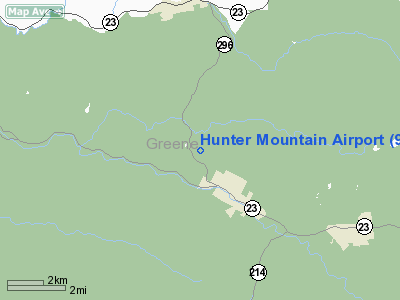
Location & QuickFacts
| FAA Information Effective: | 2008-09-25 |
| Airport Identifier: | 97NY |
| Airport Status: | Operational |
| Longitude/Latitude: | 074-14-15.5160W/42-14-03.3130N
-74.237643/42.234254 (Estimated) |
| Elevation: | 2000 ft / 609.60 m (Estimated) |
| Land: | 15 acres |
| From nearest city: | 1 nautical miles NW of Hunter, NY |
| Location: | Greene County, NY |
| Magnetic Variation: | 13W (1985) |
Owner & Manager
| Ownership: | Privately owned |
| Owner: | Sheepskin Hills Corporation |
| Address: | Route 296
Jewett, NY 12442 |
| Phone number: | 518-263-4268 |
| Manager: | Eagles Landing Fbo Llc |
| Address: | Airport Road Route 296
Jewett, NY 12442 |
| Phone number: | 518-965-2210 |
Airport Operations and Facilities
| Airport Use: | Private |
| Wind indicator: | Yes |
| Segmented Circle: | No |
| Control Tower: | No |
| Landing fee charge: | No |
| Sectional chart: | New York |
| Region: | AEA - Eastern |
| Boundary ARTCC: | ZBW - Boston |
| Tie-in FSS: | BTV - Burlington |
| FSS on Airport: | No |
| FSS Toll Free: | 1-800-WX-BRIEF |
Airport Communications
Airport Services
Runway Information
Runway N/S
| Dimension: | 2550 x 75 ft / 777.2 x 22.9 m |
| Surface: | GRVL, Good Condition |
| |
Runway N |
Runway S |
| Traffic Pattern: | Left | Left |
| Obstruction: | 25 ft tree, 50.0 ft from runway, 40 ft left of centerline, 2:1 slope to clear | 30 ft trees, 20.0 ft from runway, 75 ft right of centerline |
|
Radio Navigation Aids
| ID |
Type |
Name |
Ch |
Freq |
Var |
Dist |
| GBR | FAN MARKER | Sheffield | | | 13W | 39.5 nm |
| SKU | FAN MARKER | Stanwyck | | | 12W | 43.3 nm |
| PSF | FAN MARKER | Abyss | | | 13W | 47.4 nm |
| PFH | NDB | Philmont | | 272.00 | 13W | 22.9 nm |
| GBR | NDB | Great Barrington | | 395.00 | 14W | 37.2 nm |
| HEU | NDB | Hunter | | 356.00 | 14W | 39.5 nm |
| MS | NDB | Monga | | 359.00 | 12W | 39.6 nm |
| PO | NDB | Meier | | 403.00 | 12W | 41.5 nm |
| SKU | NDB | Stanwyck | | 261.00 | 12W | 43.3 nm |
| SW | NDB | Neely | | 335.00 | 14W | 45.0 nm |
| JJH | NDB | Johnstown | | 523.00 | 14W | 46.2 nm |
| DXT | NDB | Dalton | | 370.00 | 15W | 49.5 nm |
| DNY | VOR/DME | De Lancey | 058X | 112.10 | 11W | 32.2 nm |
| IGN | VOR/DME | Kingston | 123X | 117.60 | 12W | 38.9 nm |
| PWL | VOR/DME | Pawling | 090X | 114.30 | 12W | 39.9 nm |
| RKA | VOR/DME | Rockdale | 073X | 112.60 | 11W | 46.6 nm |
| HNK | VOR/DME | Hancock | 115X | 116.80 | 11W | 49.2 nm |
| ALB | VORTAC | Albany | 100X | 115.30 | 13W | 36.4 nm |
| ALB | VOT | Albany County | | 108.20 | | 35.7 nm |
Remarks
- RWY N SLOPES UPHILL.
- VFR USE ONLY.
Images and information placed above are from
http://www.airport-data.com/airport/97NY/
We thank them for the data!
| General Info
|
| Country |
United States
|
| State |
NEW YORK
|
| FAA ID |
97NY
|
| Latitude |
42-14-03.313N
|
| Longitude |
074-14-15.516W
|
| Elevation |
2000 feet
|
| Near City |
HUNTER
|
We don't guarantee the information is fresh and accurate. The data may
be wrong or outdated.
For more up-to-date information please refer to other sources.
|
|


