 |
|
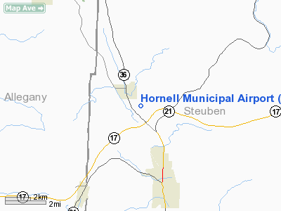
Location & QuickFacts
| FAA Information Effective: | 2008-09-25 |
| Airport Identifier: | 4G6 |
| Airport Status: | Operational |
| Longitude/Latitude: | 077-40-55.6000W/42-22-55.7000N
-77.682111/42.382139 (Estimated) |
| Elevation: | 1220 ft / 371.86 m (Surveyed) |
| Land: | 54 acres |
| From nearest city: | 3 nautical miles N of Hornell, NY |
| Location: | Steuben County, NY |
| Magnetic Variation: | 11W (2000) |
Owner & Manager
| Ownership: | Publicly owned |
| Owner: | City Of Hornell
SHAWN HOGAN, MAYOR |
| Address: | City Hall/po Box 627
Hornell, NY 14843 |
| Phone number: | 607-324-7421 |
| Manager: | James Caneen |
| Address: | 1100 Airport Road
Hornell, NY 14843 |
| Phone number: | 607-324-2742 |
Airport Operations and Facilities
| Airport Use: | Open to public |
| Wind indicator: | Yes |
| Segmented Circle: | Yes |
| Control Tower: | No |
| Lighting Schedule: | DUSK-DAWN
ACTVT MIRL & REILS RY 18/36 - CTAF . |
| Beacon Color: | Clear-Green (lighted land airport) |
| Landing fee charge: | No |
| Sectional chart: | Detroit |
| Region: | AEA - Eastern |
| Traffic Pattern Alt: | 1000 ft |
| Boundary ARTCC: | ZOB - Cleveland |
| Tie-in FSS: | BUF - Buffalo |
| FSS on Airport: | No |
| FSS Toll Free: | 1-800-WX-BRIEF |
| NOTAMs Facility: | BUF (NOTAM-d service avaliable) |
| Federal Agreements: | NGY3 |
Airport Communications
| CTAF: | 122.700 |
| Unicom: | 122.700 |
Airport Services
| Fuel available: | 100LLA |
| Airframe Repair: | NONE |
| Power Plant Repair: | NONE |
| Bottled Oxygen: | NONE |
| Bulk Oxygen: | NONE |
Runway Information
Runway 18/36
| Dimension: | 5000 x 75 ft / 1524.0 x 22.9 m |
| Surface: | ASPH, Good Condition |
| Surface Treatment: | Saw-cut or plastic Grooved |
| Edge Lights: | Medium |
| |
Runway 18 |
Runway 36 |
| Longitude: | 077-41-04.6574W | 077-40-46.5814W |
| Latitude: | 42-23-19.4706N | 42-22-31.9361N |
| Elevation: | 1220.00 ft | 1194.00 ft |
| Alignment: | 127 | 127 |
| Traffic Pattern: | Left | Left |
| Crossing Height: | 0.00 ft | 40.00 ft |
| Displaced threshold: | 500.00 ft | 0.00 ft |
| VASI: | | 4-light PAPI on left side |
| Visual Glide Angle: | 0.00° | 3.00° |
| Runway End Identifier: | Yes
REILS RWY 18/36 OTS INDEFLY. | Yes |
| Obstruction: | 172 ft trees, 2207.0 ft from runway, 105 ft left of centerline, 11:1 slope to clear
RWY 18, 15:1 SLOPE FROM DISPL THRES. | 62 ft tree, 1260.0 ft from runway, 80 ft right of centerline, 17:1 slope to clear |
|
Radio Navigation Aids
| ID |
Type |
Name |
Ch |
Freq |
Var |
Dist |
| EL | NDB | Halos | | 269.00 | 09W | 19.4 nm |
| LYS | NDB | Olean | | 360.00 | 09W | 29.6 nm |
| PYA | NDB | Penn Yan | | 260.00 | 12W | 31.9 nm |
| AVN | NDB | Avon | | 344.00 | 09W | 37.9 nm |
| ALP | NDB | Alpine | | 245.00 | 12W | 41.7 nm |
| GEE | VOR/DME | Geneseo | 019X | 108.20 | 09W | 27.3 nm |
| ULW | VOR/DME | Elmira | 033Y | 109.65 | 12W | 34.0 nm |
| SFK | VOR/DME | Stonyfork | 023X | 108.60 | 08W | 42.9 nm |
| ELZ | VORTAC | Wellsville | 051X | 111.40 | 09W | 22.6 nm |
| ROC | VORTAC | Rochester | 037X | 110.00 | 09W | 44.4 nm |
Images and information placed above are from
http://www.airport-data.com/airport/4G6/
We thank them for the data!
| General Info
|
| Country |
United States
|
| State |
NEW YORK
|
| FAA ID |
4G6
|
| Latitude |
42-22-55.720N
|
| Longitude |
077-40-55.605W
|
| Elevation |
1220 feet
|
| Near City |
HORNELL
|
We don't guarantee the information is fresh and accurate. The data may
be wrong or outdated.
For more up-to-date information please refer to other sources.
|
|


