 |
|
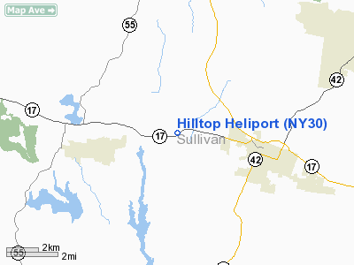
Location & QuickFacts
| FAA Information Effective: | 2008-09-25 |
| Airport Identifier: | NY30 |
| Airport Status: | Operational |
| Longitude/Latitude: | 074-45-26.5850W/41-40-08.3230N
-74.757385/41.668979 (Estimated) |
| Elevation: | 1400 ft / 426.72 m (Estimated) |
| Land: | 20 acres |
| From nearest city: | 3 nautical miles W of Monticello, NY |
| Location: | Sullivan County, NY |
| Magnetic Variation: | 13W (1985) |
Owner & Manager
| Ownership: | Privately owned |
| Owner: | Alan Madnick |
| Address: | Box 389
Monticello, NY 12701 |
| Phone number: | 914-794-5770 |
| Manager: | Alan Madnick |
| Address: | Box 389
Monticello, NY 12701 |
| Phone number: | 914-794-5770 |
Airport Operations and Facilities
| Airport Use: | Private
PERSONAL USE. |
| Segmented Circle: | No |
| Control Tower: | No |
| Sectional chart: | New York |
| Region: | AEA - Eastern |
| Boundary ARTCC: | ZBW - Boston |
| Tie-in FSS: | ISP - New York |
| FSS Toll Free: | 1-800-WX-BRIEF |
Airport Communications
Runway Information
Helipad H1
| Dimension: | 60 x 60 ft / 18.3 x 18.3 m |
| Surface: | ASPH, |
| |
Runway H1 |
Runway |
| Traffic Pattern: | Left | Left |
|
Radio Navigation Aids
| ID |
Type |
Name |
Ch |
Freq |
Var |
Dist |
| SKU | FAN MARKER | Stanwyck | | | 12W | 33.1 nm |
| MS | NDB | Monga | | 359.00 | 12W | 7.5 nm |
| SW | NDB | Neely | | 335.00 | 14W | 26.2 nm |
| SKU | NDB | Stanwyck | | 261.00 | 12W | 33.1 nm |
| PO | NDB | Meier | | 403.00 | 12W | 36.1 nm |
| HUO | VOR/DME | Huguenot | 108X | 116.10 | 11W | 17.3 nm |
| DNY | VOR/DME | De Lancey | 058X | 112.10 | 11W | 31.9 nm |
| HNK | VOR/DME | Hancock | 115X | 116.80 | 11W | 34.5 nm |
| STW | VOR/DME | Stillwater | 033X | 109.60 | 11W | 40.8 nm |
| IGN | VOR/DME | Kingston | 123X | 117.60 | 12W | 42.0 nm |
| LHY | VORTAC | Lake Henry | 045X | 110.80 | 10W | 34.6 nm |
| SAX | VORTAC | Sparta | 104X | 115.70 | 11W | 37.5 nm |
| LVZ | VORTAC | Wilkes-barre | 053X | 111.60 | 10W | 48.3 nm |
Remarks
- PRVDD PILOTS USE UNICOM FREQUENCY FOR SULLIVAN CO ARPT TO ADVISE OF THEIR INTENTIONS.
Images and information placed above are from
http://www.airport-data.com/airport/NY30/
We thank them for the data!
| General Info
|
| Country |
United States
|
| State |
NEW YORK
|
| FAA ID |
NY30
|
| Latitude |
41-40-08.323N
|
| Longitude |
074-45-26.585W
|
| Elevation |
1400 feet
|
| Near City |
MONTICELLO
|
We don't guarantee the information is fresh and accurate. The data may
be wrong or outdated.
For more up-to-date information please refer to other sources.
|
|


