 |
|
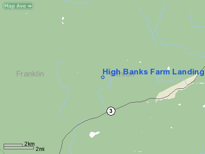
High Banks Farm Landing Area Airport |
Location & QuickFacts
| FAA Information Effective: | 2008-09-25 |
| Airport Identifier: | 1NY4 |
| Airport Status: | Operational |
| Longitude/Latitude: | 073-54-39.5190W/44-37-03.1610N
-73.910977/44.617545 (Estimated) |
| Elevation: | 1520 ft / 463.30 m (Estimated) |
| Land: | 20 acres |
| From nearest city: | 0 nautical miles of Saranac, NY |
| Location: | Clinton County, NY |
| Magnetic Variation: | 15W (1985) |
Owner & Manager
| Ownership: | Privately owned |
| Owner: | R. G. Gadway |
| Address: | Rr 2, Box 40b
South Royalton, VT 05068 |
| Phone number: | 802-763-8313 |
| Manager: | R.g. Gadway |
| Address: | Rr 2, Box 40b
South Royalton, VT 05068 |
| Phone number: | 802-234-4913 |
Airport Operations and Facilities
| Airport Use: | Private |
| Wind indicator: | No |
| Segmented Circle: | No |
| Control Tower: | No |
| Landing fee charge: | No |
| Sectional chart: | Montreal |
| Region: | AEA - Eastern |
| Boundary ARTCC: | ZBW - Boston |
| Tie-in FSS: | BTV - Burlington |
| FSS on Airport: | No |
| FSS Toll Free: | 1-800-WX-BRIEF |
Airport Services
| Airframe Repair: | NONE |
| Power Plant Repair: | NONE |
Runway Information
Runway 10/28
| Dimension: | 3000 x 100 ft / 914.4 x 30.5 m |
| Surface: | TURF, |
| |
Runway 10 |
Runway 28 |
| Traffic Pattern: | Left | Left |
|
Radio Navigation Aids
| ID |
Type |
Name |
Ch |
Freq |
Var |
Dist |
| PTD | NDB | Potsdam | | 400.00 | 14W | 42.0 nm |
| SLK | VOR/DME | Saranac Lake | 029X | 109.20 | 14W | 18.8 nm |
| PLB | VORTAC | Plattsburgh | 116X | 116.90 | 15W | 17.1 nm |
| BTV | VORTAC | Burlington | 122X | 117.50 | 15W | 33.9 nm |
| MSS | VORTAC | Massena | 088X | 114.10 | 14W | 39.0 nm |
| YJN | VORTAC | St Jean | 105X | 115.80 | 16W | 45.8 nm |
| BTV | VOT | Burlington Intl | | 109.00 | | 33.9 nm |
Remarks
- TREES ON APPROACH.
- BRUSH ON RUNWAY-UNABLE TO USE AT PRESENT.
- VFR ONLY.
Images and information placed above are from
http://www.airport-data.com/airport/1NY4/
We thank them for the data!
| General Info
|
| Country |
United States
|
| State |
NEW YORK
|
| FAA ID |
1NY4
|
| Latitude |
44-37-03.161N
|
| Longitude |
073-54-39.519W
|
| Elevation |
1520 feet
|
| Near City |
SARANAC
|
We don't guarantee the information is fresh and accurate. The data may
be wrong or outdated.
For more up-to-date information please refer to other sources.
|
|


