 |
|
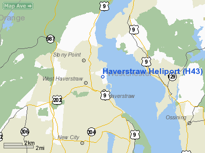
Location & QuickFacts
| FAA Information Effective: | 2008-09-25 |
| Airport Identifier: | H43 |
| Airport Status: | Operational |
| Longitude/Latitude: | 073-58-09.4600W/41-12-39.3300N
-73.969294/41.210925 (Estimated) |
| Elevation: | 12 ft / 3.66 m (Estimated) |
| Land: | 6 acres |
| From nearest city: | 1 nautical miles E of Haverstraw, NY |
| Location: | Rockland County, NY |
| Magnetic Variation: | 13W (1990) |
Owner & Manager
| Ownership: | Privately owned |
| Owner: | Charles J Zanlunghi |
| Address: | 23 Thornwood Dr
New City, NY 10956 |
| Phone number: | 845-429-1200
OFFICE NUMBER IS 212-883-0999 |
| Manager: | Charles J Zanlunghi |
| Address: | Gagan Road
West Haverstraw, NY 10993 |
| Phone number: | 845-429-1200
OFFICE NUMBER IS 212-883-0999 |
Airport Operations and Facilities
| Airport Use: | Open to public |
| Wind indicator: | Yes |
| Segmented Circle: | No |
| Control Tower: | No |
| Lighting Schedule: | PHONE REQ
FOR FLOODLIGHTS CALL 914-429-1200. |
| Sectional chart: | New York |
| Region: | AEA - Eastern |
| Boundary ARTCC: | ZNY - New York |
| Tie-in FSS: | ISP - New York |
| FSS on Airport: | No |
| FSS Toll Free: | 1-800-WX-BRIEF |
| NOTAMs Facility: | ISP (NOTAM-d service avaliable) |
Airport Communications
| CTAF: | 123.050 |
| Unicom: | 123.050 |
Airport Services
| Fuel available: | A |
| Airframe Repair: | NONE |
Runway Information
Helipad H1
| Dimension: | 50 x 50 ft / 15.2 x 15.2 m |
| Surface: | ASPH,
HELICOPTERS DESCEND TO POINT ON TURF AREA WEST OF PAVEMENT AND TAXI TO PAVED LOCATION |
| Edge Lights: | Non-standard lighting system
FLOODLIGHTS. |
| |
Runway H1 |
Runway |
| Traffic Pattern: | Left | Left |
| Markings: | Nonstandard,
YELLOW MALTESE CROSS. | ,
YELLOW MALTESE CROSS. |
| Obstruction: | 30 ft bldg, 90.0 ft from runway, 15 ft left of centerline, 2:1 slope to clear | |
|
Radio Navigation Aids
| ID |
Type |
Name |
Ch |
Freq |
Var |
Dist |
| SKU | FAN MARKER | Stanwyck | | | 12W | 19.4 nm |
| EWR | FAN MARKER | Maryann | | | 11W | 32.1 nm |
| PNJ | NDB | Paterson | | 347.00 | 12W | 17.9 nm |
| SKU | NDB | Stanwyck | | 261.00 | 12W | 19.4 nm |
| SW | NDB | Neely | | 335.00 | 14W | 20.2 nm |
| PO | NDB | Meier | | 403.00 | 12W | 21.9 nm |
| CAT | NDB | Chatham | | 254.00 | 11W | 35.1 nm |
| OGY | NDB | Bridge | | 414.00 | 12W | 38.8 nm |
| OP | NDB | Old Field Point Light | | 316.00 | 13W | 41.0 nm |
| TBY | NDB | Waterbury | | 257.00 | 14W | 41.9 nm |
| BBN | NDB | Babylon | | 275.00 | 14W | 41.9 nm |
| CMK | VOR/DME | Carmel | 113X | 116.60 | 12W | 18.0 nm |
| TEB | VOR/DME | Teterboro | 021X | 108.40 | 11W | 22.2 nm |
| LGA | VOR/DME | La Guardia | 078X | 113.10 | 12W | 25.8 nm |
| IGN | VOR/DME | Kingston | 123X | 117.60 | 12W | 28.1 nm |
| HUO | VOR/DME | Huguenot | 108X | 116.10 | 11W | 30.5 nm |
| JFK | VOR/DME | Kennedy | 106X | 115.90 | 12W | 35.9 nm |
| CRI | VOR/DME | Canarsie | 070X | 112.30 | 11W | 36.1 nm |
| PWL | VOR/DME | Pawling | 090X | 114.30 | 12W | 37.5 nm |
| BDR | VOR/DME | Bridgeport | 25X | 108.80 | 12W | 38.3 nm |
| DPK | VOR/DME | Deer Park | 124X | 117.70 | 12W | 39.3 nm |
| STW | VOR/DME | Stillwater | 033X | 109.60 | 11W | 42.8 nm |
| BWZ | VOR/DME | Broadway | 089X | 114.20 | 11W | 45.9 nm |
| HVN | VOR/DME | New Haven | 035X | 109.80 | 13W | 49.1 nm |
| SAX | VORTAC | Sparta | 104X | 115.70 | 11W | 27.2 nm |
| JFK | VOT | Kennedy | | 115.10 | | 35.7 nm |
| BDR | VOT | Bridgeport | | 109.25 | | 38.3 nm |
| ISP | VOT | Long Island Mac Arthur | | 109.40 | | 47.1 nm |
Remarks
- NOISE ABATEMENT; AVOID RESIDENTIAL AREA W OF HELIPORT.
- PRVDD VFR ONLY; SPHERICAL MARKERS BE INSTALLED ON GUY WIRES OF THE TWR; SECURITY FENCE IS REPAIRED; TREES TO N & S CLEARED OR TRIMMED TO PROVIDE 8:1 APCH SFC; & SERVICE POLE EAST OF SITE IS REMOVED.
Images and information placed above are from
http://www.airport-data.com/airport/H43/
We thank them for the data!
| General Info
|
| Country |
United States
|
| State |
NEW YORK
|
| FAA ID |
H43
|
| Latitude |
41-12-39.330N
|
| Longitude |
073-58-09.460W
|
| Elevation |
12 feet
|
| Near City |
HAVERSTRAW
|
We don't guarantee the information is fresh and accurate. The data may
be wrong or outdated.
For more up-to-date information please refer to other sources.
|
|


