 |
|
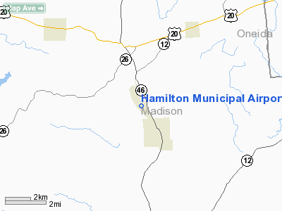
Location & QuickFacts
| FAA Information Effective: | 2008-09-25 |
| Airport Identifier: | VGC |
| Airport Status: | Operational |
| Longitude/Latitude: | 075-33-40.3200W/42-50-36.3800N
-75.561200/42.843439 (Estimated) |
| Elevation: | 1134 ft / 345.64 m (Estimated) |
| Land: | 180 acres |
| From nearest city: | 1 nautical miles NE of Hamilton, NY |
| Location: | Madison County, NY |
| Magnetic Variation: | 11W (1980) |
Owner & Manager
| Ownership: | Publicly owned |
| Owner: | Village Of Hamilton |
| Address: | Po Box 119; 3 Broad St
Hamilton, NY 13346 |
| Phone number: | 315-824-1111 |
| Manager: | Sean Graham |
| Address: | P.o. Box 119
Hamilton, NY 13346 |
| Phone number: | 315-824-1111 |
Airport Operations and Facilities
| Airport Use: | Open to public |
| Wind indicator: | Yes |
| Segmented Circle: | Yes |
| Control Tower: | No |
| Lighting Schedule: | RDO-CTL
ACTVT MIRL RY 17/35; REIL RYS 17 & 35 - 122.7. |
| Landing fee charge: | Yes |
| Sectional chart: | New York |
| Region: | AEA - Eastern |
| Traffic Pattern Alt: | 966 ft |
| Boundary ARTCC: | ZBW - Boston |
| Tie-in FSS: | BUF - Buffalo |
| FSS on Airport: | No |
| FSS Toll Free: | 1-800-WX-BRIEF |
| NOTAMs Facility: | BUF (NOTAM-d service avaliable) |
| Federal Agreements: | N |
Airport Communications
| CTAF: | 123.000 |
| Unicom: | 123.000 |
Airport Services
| Fuel available: | 100LLA
4,000 GAL |
| Bottled Oxygen: | NONE |
| Bulk Oxygen: | NONE |
Runway Information
Runway 17/35
| Dimension: | 5314 x 75 ft / 1619.7 x 22.9 m |
| Surface: | ASPH, Good Condition |
| Weight Limit: | Single wheel: 20000 lbs. |
| Edge Lights: | Medium |
| |
Runway 17 |
Runway 35 |
| Longitude: | 075-33-53.2300W | 075-33-27.4100W |
| Latitude: | 42-51-00.8400N | 42-50-11.9100N |
| Elevation: | 1131.00 ft | 1122.00 ft |
| Alignment: | 127 | 127 |
| Traffic Pattern: | Left | Left |
| Markings: | Basic, Fair Condition | Basic, Fair Condition |
| Crossing Height: | 30.00 ft | 40.00 ft |
| Displaced threshold: | 300.00 ft | 0.00 ft |
| VASI: | 2-light PAPI on left side | 2-light PAPI on left side |
| Visual Glide Angle: | 3.00° | 4.00° |
| Runway End Identifier: | Yes | Yes |
| Centerline Lights: | No | No |
| Touchdown Lights: | No | No |
| Obstruction: | 52 ft trees, 481.0 ft from runway, 210 ft left of centerline, 5:1 slope to clear
10 FT+ BRUSH 60 FT FM RY END. | 8 ft brush, 200.0 ft from runway, 220 ft left of centerline
8FT+ BRUSH 150FT FROM RW END 220FT LEFT |
| Decleard distances: | Take off run available 5314.00 ft
Take off distance available 5314.00 ft
Actual stop distance available 5314.00 ft
Landing distance available 5014.00 ft
| Take off run available 5314.00 ft
Take off distance available 5314.00 ft
Actual stop distance available 5014.00 ft
Landing distance available 5014.00 ft
|
|
Radio Navigation Aids
| ID |
Type |
Name |
Ch |
Freq |
Var |
Dist |
| CJY | NDB | Clay | | 275.00 | 12W | 18.1 nm |
| BK | NDB | Plein | | 329.00 | 12W | 23.0 nm |
| GSS | TACAN | Griffiss | 057X | | 12W | 24.3 nm |
| RKA | VOR/DME | Rockdale | 073X | 112.60 | 11W | 26.8 nm |
| ITH | VOR/DME | Ithaca | 055X | 111.80 | 10W | 44.9 nm |
| DNY | VOR/DME | De Lancey | 058X | 112.10 | 11W | 48.1 nm |
| HNK | VOR/DME | Hancock | 115X | 116.80 | 11W | 48.1 nm |
| GGT | VORTAC | Georgetown | 125X | 117.80 | 11W | 12.2 nm |
| UCA | VORTAC | Utica | 049X | 111.20 | 12W | 20.6 nm |
| SYR | VORTAC | Syracuse | 117X | 117.00 | 11W | 34.1 nm |
| CFB | VORTAC | Binghamton | 059X | 112.20 | 10W | 48.5 nm |
Remarks
- NOISE ABATEMENT PROCEDURES IN EFFECT; ALL ACFT DEPARTURES MAINTAIN RY HEADING UNTIL 2100 FT MSL BEFORE MAKING TURN OUT.
- MAINT SHOP AP & IA AVBL MON-FRI 0900-1700.
- ULTRALGTS ON & INVOF ARPT.
- RY 17/35 SOUTH END HAS 1000 FT SAFETY AREA.
- AFT HR FUEL AVAIL. BY APPT FOR A FEE CTC ARPT MGR.
- TAXI SVC AND CAR RENTAL AVBL.
- DEER ON AND INVOF RY 17/35.
- WIND MILLS NORTH OF RY 35.
Images and information placed above are from
http://www.airport-data.com/airport/VGC/
We thank them for the data!
|
|


