 |
|
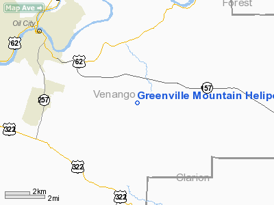
Greenville Mountain Heliport |
Location & QuickFacts
| FAA Information Effective: | 2008-09-25 |
| Airport Identifier: | 4NY3 |
| Airport Status: | Operational |
| Longitude/Latitude: | 079-36-47.0000W/41-22-34.0000N
-79.613056/41.376111 (Estimated) |
| Elevation: | 1044 ft / 318.21 m (Estimated) |
| Land: | 0 acres |
| From nearest city: | 5 nautical miles SE of Port Jervis, NY |
| Location: | Orange County, NY |
| Magnetic Variation: | () |
Owner & Manager
| Ownership: | Privately owned |
| Owner: | David M. Le Blanc |
| Address: | 749 Mountain Rd.
Port Jervis, NY 12771 |
| Phone number: | 845-699-2668 |
| Manager: | David M. Le Blanc |
| Address: | 749 Mountain Rd.
Port Jervis, NY 12771 |
| Phone number: | 845-699-2668 |
Airport Operations and Facilities
| Airport Use: | Private |
| Control Tower: | No |
| Sectional chart: | New York |
| Region: | AEA - Eastern |
| Boundary ARTCC: | ZNY - New York |
| Tie-in FSS: | ISP - New York |
| FSS Toll Free: | 1-800-WX-BRIEF |
Runway Information
Helipad H1
| Dimension: | 50 x 50 ft / 15.2 x 15.2 m |
| Surface: | ASPH, |
| |
Runway H1 |
Runway |
| Traffic Pattern: | Left | Left |
|
Radio Navigation Aids
| ID |
Type |
Name |
Ch |
Freq |
Var |
Dist |
| ORJ | NDB | Corry | | 258.00 | 09W | 32.3 nm |
| UCP | NDB | Castle | | 272.00 | 09W | 42.1 nm |
| HBD | NDB | Hubbard | | 408.00 | 08W | 43.6 nm |
| CQD | NDB | Cascade | | 372.00 | 08W | 49.8 nm |
| FKL | VOR | Franklin | | 109.60 | 06W | 11.6 nm |
| CIP | VOR/DME | Clarion | 076X | 112.90 | 06W | 15.5 nm |
| TDT | VORTAC | Tidioute | 123X | 117.60 | 09W | 22.1 nm |
| EWC | VORTAC | Ellwood City | 105X | 115.80 | 08W | 42.8 nm |
| YNG | VORTAC | Youngstown | 027X | 109.00 | 05W | 48.0 nm |
| ERI | VORTAC | Erie | 031X | 109.40 | 06W | 49.2 nm |
Remarks
- 25 FT PLINE 80 FT EAST OF PAD,
- PRVDD VFR OPNS; PVT USE; AREA IS MARKED AND WIND INDICATOR IS MAINTAINED.
Images and information placed above are from
http://www.airport-data.com/airport/4NY3/
We thank them for the data!
|
|


