 |
|
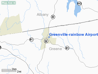
Greenville-rainbow Airport |
Location & QuickFacts
| FAA Information Effective: | 2008-09-25 |
| Airport Identifier: | 1H4 |
| Airport Status: | Operational |
| Longitude/Latitude: | 074-00-58.4760W/42-25-00.2940N
-74.016243/42.416748 (Estimated) |
| Elevation: | 840 ft / 256.03 m (Estimated) |
| Land: | 12 acres |
| From nearest city: | 1 nautical miles E of Greenville, NY |
| Location: | Greene County, NY |
| Magnetic Variation: | 14W (1985) |
Owner & Manager
| Ownership: | Privately owned |
| Owner: | Walter J Birmann |
| Address: | 3822 Route 26
Greenville, NY 12083 |
| Phone number: | 518-966-5343 |
| Manager: | Walter J Birmann |
| Address: | 3822 Route 26
Greenville, NY 12083 |
| Phone number: | 518-966-5343 |
Airport Operations and Facilities
| Airport Use: | Open to public |
| Wind indicator: | Yes |
| Segmented Circle: | No |
| Control Tower: | No |
| Landing fee charge: | No |
| Sectional chart: | New York |
| Region: | AEA - Eastern |
| Boundary ARTCC: | ZBW - Boston |
| Tie-in FSS: | BTV - Burlington |
| FSS on Airport: | No |
| FSS Toll Free: | 1-800-WX-BRIEF |
| NOTAMs Facility: | BTV (NOTAM-d service avaliable) |
Airport Communications
| CTAF: | 122.800 |
| Unicom: | 122.800 |
Airport Services
| Airframe Repair: | NONE |
| Power Plant Repair: | NONE |
Runway Information
Runway 17/35
| Dimension: | 1801 x 75 ft / 548.9 x 22.9 m |
| Surface: | TURF, Fair Condition |
| |
Runway 17 |
Runway 35 |
| Longitude: | 074-00-24.8400W | 074-00-24.7800W |
| Latitude: | 42-25-19.8300N | 42-25-02.0400N |
| Elevation: | 840.00 ft | 800.00 ft |
| Alignment: | 127 | 127 |
| Traffic Pattern: | Left | Left |
| Displaced threshold: | 112.00 ft | 0.00 ft |
| Obstruction: | 50 ft trees, 100 ft right of centerline
0:0 CONTROLLING OBSTRUCTION SLOPE TO DISPLACED THRESHOLD DUE TO +50 FT TREES 100 FT RIGHT | 50 ft trees, 0.0 ft from runway, 110 ft left of centerline |
|
Radio Navigation Aids
| ID |
Type |
Name |
Ch |
Freq |
Var |
Dist |
| GBR | FAN MARKER | Sheffield | | | 13W | 33.8 nm |
| PSF | FAN MARKER | Abyss | | | 13W | 35.7 nm |
| PFH | NDB | Philmont | | 272.00 | 13W | 16.3 nm |
| HEU | NDB | Hunter | | 356.00 | 14W | 26.5 nm |
| GBR | NDB | Great Barrington | | 395.00 | 14W | 30.6 nm |
| DXT | NDB | Dalton | | 370.00 | 15W | 37.7 nm |
| JJH | NDB | Johnstown | | 523.00 | 14W | 37.7 nm |
| PWL | VOR/DME | Pawling | 090X | 114.30 | 12W | 43.1 nm |
| DNY | VOR/DME | De Lancey | 058X | 112.10 | 11W | 44.2 nm |
| CAM | VOR/DME | Cambridge | 097X | 115.00 | 14W | 45.7 nm |
| IGN | VOR/DME | Kingston | 123X | 117.60 | 12W | 46.0 nm |
| CTR | VOR/DME | Chester | 098X | 115.10 | 13W | 48.0 nm |
| ALB | VORTAC | Albany | 100X | 115.30 | 13W | 22.0 nm |
| ALB | VOT | Albany County | | 108.20 | | 21.4 nm |
Remarks
- RY 17/35 MAY BE CLSD AFTER RAINS DUE TO WETNESS.
- RY 17/35 SOFT & WET DURING MAR-JUN.
- APT CLSD DEC 1 THRU APR 1.
- +30 FT POWER LINE PARALLEL TO AND 150 FT WEST OF RY CNTRLN.
- VFR ONLY.
Images and information placed above are from
http://www.airport-data.com/airport/1H4/
We thank them for the data!
| General Info
|
| Country |
United States
|
| State |
NEW YORK
|
| FAA ID |
1H4
|
| Latitude |
42-25-00.294N
|
| Longitude |
074-00-58.476W
|
| Elevation |
840 feet
|
| Near City |
GREENVILLE
|
We don't guarantee the information is fresh and accurate. The data may
be wrong or outdated.
For more up-to-date information please refer to other sources.
|
|


