 |
|
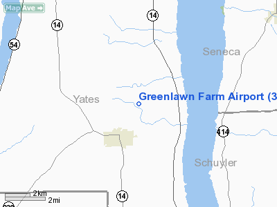
Location & QuickFacts
| FAA Information Effective: | 2008-09-25 |
| Airport Identifier: | 38NY |
| Airport Status: | Operational |
| Longitude/Latitude: | 076-57-28.8680W/42-32-55.2550N
-76.958019/42.548682 (Estimated) |
| Elevation: | 1010 ft / 307.85 m (Estimated) |
| Land: | 0 acres |
| From nearest city: | 2 nautical miles NE of Dundee, NY |
| Location: | Yates County, NY |
| Magnetic Variation: | 11W (1985) |
Owner & Manager
| Ownership: | Privately owned |
| Owner: | Philip W Rider |
| Address: | Rd 1
Dundee, NY 14837 |
| Phone number: | 607-243-5586 |
| Manager: | Philip W Rider |
| Address: | Rd 1
Dundee, NY 14837 |
| Phone number: | 607-243-5586 |
Airport Operations and Facilities
| Airport Use: | Private |
| Wind indicator: | Yes |
| Segmented Circle: | No |
| Control Tower: | No |
| Lighting Schedule: | PHONE REQ
FOR ROTG BCN & LIRL RWY NE/SW CALL 607-243-5586. |
| Beacon Color: | Clear-Green (lighted land airport) |
| Landing fee charge: | No |
| Sectional chart: | New York |
| Region: | AEA - Eastern |
| Boundary ARTCC: | ZOB - Cleveland |
| Tie-in FSS: | BUF - Buffalo |
| FSS on Airport: | No |
| FSS Toll Free: | 1-800-WX-BRIEF |
Airport Services
| Airframe Repair: | NONE |
| Power Plant Repair: | NONE |
Runway Information
Runway NE/SW
| Dimension: | 1950 x 50 ft / 594.4 x 15.2 m |
| Surface: | TURF, |
| Edge Lights: | Low |
| |
Runway NE |
Runway SW |
| Traffic Pattern: | Left | Left |
|
Radio Navigation Aids
| ID |
Type |
Name |
Ch |
Freq |
Var |
Dist |
| PYA | NDB | Penn Yan | | 260.00 | 12W | 7.2 nm |
| ALP | NDB | Alpine | | 245.00 | 12W | 20.5 nm |
| AVN | NDB | Avon | | 344.00 | 09W | 45.3 nm |
| ITH | VOR/DME | Ithaca | 055X | 111.80 | 10W | 22.3 nm |
| ULW | VOR/DME | Elmira | 033Y | 109.65 | 12W | 27.5 nm |
| GEE | VOR/DME | Geneseo | 019X | 108.20 | 09W | 38.3 nm |
| CFB | VORTAC | Binghamton | 059X | 112.20 | 10W | 43.4 nm |
| ROC | VORTAC | Rochester | 037X | 110.00 | 09W | 46.7 nm |
| SYR | VORTAC | Syracuse | 117X | 117.00 | 11W | 49.5 nm |
Remarks
Images and information placed above are from
http://www.airport-data.com/airport/38NY/
We thank them for the data!
| General Info
|
| Country |
United States
|
| State |
NEW YORK
|
| FAA ID |
38NY
|
| Latitude |
42-32-55.255N
|
| Longitude |
076-57-28.868W
|
| Elevation |
1010 feet
|
| Near City |
DUNDEE
|
We don't guarantee the information is fresh and accurate. The data may
be wrong or outdated.
For more up-to-date information please refer to other sources.
|
|


