 |
|
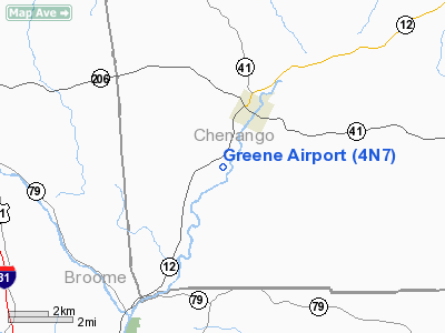
Location & QuickFacts
| FAA Information Effective: | 2008-09-25 |
| Airport Identifier: | 4N7 |
| Airport Status: | Operational |
| Longitude/Latitude: | 075-47-13.6940W/42-18-15.2690N
-75.787137/42.304241 (Estimated) |
| Elevation: | 935 ft / 284.99 m (Estimated) |
| Land: | 24 acres |
| From nearest city: | 2 nautical miles SW of Greene, NY |
| Location: | Chenango County, NY |
| Magnetic Variation: | 12W (1985) |
Owner & Manager
| Ownership: | Privately owned |
| Owner: | Marcel Barrows |
| Address: | 173 Airport Road
Greene, NY 13778 |
| Phone number: | 607-656-8565 |
| Manager: | Marcel Barrows |
| Address: | 173 Airport Road
Greene, NY 13778 |
| Phone number: | 607-656-8565 |
Airport Operations and Facilities
| Airport Use: | Open to public |
| Wind indicator: | Yes |
| Segmented Circle: | No |
| Control Tower: | No |
| Lighting Schedule: | RDO-CTL
ACTVT LIRL RY 07/25 - CTAF. |
| Sectional chart: | New York |
| Region: | AEA - Eastern |
| Boundary ARTCC: | ZBW - Boston |
| Responsible ARTCC: | ZNY - New York |
| Tie-in FSS: | BUF - Buffalo |
| FSS on Airport: | No |
| FSS Toll Free: | 1-800-WX-BRIEF |
| NOTAMs Facility: | BUF (NOTAM-d service avaliable) |
Airport Communications
| CTAF: | 122.800 |
| Unicom: | 122.800 |
Airport Services
| Airframe Repair: | MAJOR |
| Power Plant Repair: | MAJOR |
| Bottled Oxygen: | NONE |
| Bulk Oxygen: | NONE |
Runway Information
Runway 07/25
| Dimension: | 2665 x 200 ft / 812.3 x 61.0 m |
| Surface: | TURF, Good Condition |
| Edge Lights: | Low |
| |
Runway 07 |
Runway 25 |
| Traffic Pattern: | Left | Left |
| Markings: | None, | None, |
| Runway End Identifier: | No | No |
| Obstruction: | 23 ft pole, 582.0 ft from runway, 156 ft left of centerline, 25:1 slope to clear | 34 ft tree, 81.0 ft from runway, 116 ft right of centerline, 2:1 slope to clear |
|
Radio Navigation Aids
| ID |
Type |
Name |
Ch |
Freq |
Var |
Dist |
| ALP | NDB | Alpine | | 245.00 | 12W | 43.6 nm |
| HNK | VOR/DME | Hancock | 115X | 116.80 | 11W | 25.5 nm |
| RKA | VOR/DME | Rockdale | 073X | 112.60 | 11W | 26.2 nm |
| ITH | VOR/DME | Ithaca | 055X | 111.80 | 10W | 32.0 nm |
| DNY | VOR/DME | De Lancey | 058X | 112.10 | 11W | 37.7 nm |
| CFB | VORTAC | Binghamton | 059X | 112.20 | 10W | 17.9 nm |
| GGT | VORTAC | Georgetown | 125X | 117.80 | 11W | 29.2 nm |
Remarks
- DURING WINTER CHECK FSS FOR NOTAMS.
- TOWN RD CROSSES +308 FT LT. & 187 FT RT., IN FM RY 07 BEG.
- DEER AND GEESE ON & INVOF ARPT.
- RY 25, +39 FT TREES, 187 FT FM RY, 43 FT LT.
- EXISTED PRIOR TO 1959.
Images and information placed above are from
http://www.airport-data.com/airport/4N7/
We thank them for the data!
| General Info
|
| Country |
United States
|
| State |
NEW YORK
|
| FAA ID |
4N7
|
| Latitude |
42-18-15.269N
|
| Longitude |
075-47-13.694W
|
| Elevation |
935 feet
|
| Near City |
GREENE
|
We don't guarantee the information is fresh and accurate. The data may
be wrong or outdated.
For more up-to-date information please refer to other sources.
|
|


