 |
|
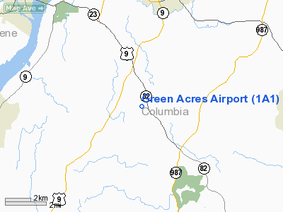
Location & QuickFacts
| FAA Information Effective: | 2008-09-25 |
| Airport Identifier: | 1A1 |
| Airport Status: | Operational |
| Longitude/Latitude: | 073-45-03.4540W/42-08-55.3200N
-73.750959/42.148700 (Estimated) |
| Elevation: | 295 ft / 89.92 m (Estimated) |
| Land: | 78 acres |
| From nearest city: | 2 nautical miles NE of Livingston, NY |
| Location: | Columbia County, NY |
| Magnetic Variation: | 14W (1985) |
Owner & Manager
| Ownership: | Privately owned |
| Owner: | Ms. Eileen Yandik |
| Address: | 269 Schneider Rd.
Hudson, NY 12534-4671 |
| Phone number: | 518-851-7460 |
| Manager: | Stephen Yandik |
| Address: | 269 Schneider Rd.
Hudson, NY 12534-4671 |
| Phone number: | 518-851-7460
OR PHONE 518-225-3858 |
Airport Operations and Facilities
| Airport Use: | Open to public |
| Wind indicator: | Yes |
| Segmented Circle: | No |
| Control Tower: | No |
| Landing fee charge: | No |
| Sectional chart: | New York |
| Region: | AEA - Eastern |
| Boundary ARTCC: | ZBW - Boston |
| Tie-in FSS: | BTV - Burlington |
| FSS on Airport: | No |
| FSS Toll Free: | 1-800-WX-BRIEF |
| NOTAMs Facility: | BTV (NOTAM-d service avaliable) |
Airport Communications
Airport Services
| Airframe Repair: | MINOR |
| Power Plant Repair: | MINOR |
Runway Information
Runway 03/21
| Dimension: | 2275 x 75 ft / 693.4 x 22.9 m |
| Surface: | TURF-DIRT, Fair Condition |
| |
Runway 03 |
Runway 21 |
| Traffic Pattern: | Left | Left |
| Obstruction: | 47 ft tree, 100 ft right of centerline | 40 ft tree, 100.0 ft from runway, 100 ft right of centerline, 2:1 slope to clear |
|
Radio Navigation Aids
| ID |
Type |
Name |
Ch |
Freq |
Var |
Dist |
| GBR | FAN MARKER | Sheffield | | | 13W | 17.3 nm |
| PSF | FAN MARKER | Abyss | | | 13W | 30.2 nm |
| SKU | FAN MARKER | Stanwyck | | | 12W | 39.6 nm |
| PFH | NDB | Philmont | | 272.00 | 13W | 6.4 nm |
| GBR | NDB | Great Barrington | | 395.00 | 14W | 15.6 nm |
| DXT | NDB | Dalton | | 370.00 | 15W | 32.3 nm |
| PO | NDB | Meier | | 403.00 | 12W | 35.8 nm |
| SKU | NDB | Stanwyck | | 261.00 | 12W | 39.6 nm |
| HEU | NDB | Hunter | | 356.00 | 14W | 43.1 nm |
| SW | NDB | Neely | | 335.00 | 14W | 45.2 nm |
| TBY | NDB | Waterbury | | 257.00 | 14W | 46.1 nm |
| PWL | VOR/DME | Pawling | 090X | 114.30 | 12W | 23.7 nm |
| IGN | VOR/DME | Kingston | 123X | 117.60 | 12W | 29.2 nm |
| CTR | VOR/DME | Chester | 098X | 115.10 | 13W | 36.7 nm |
| ALB | VORTAC | Albany | 100X | 115.30 | 13W | 36.1 nm |
| BAF | VORTAC | Barnes | 077X | 113.00 | 14W | 46.1 nm |
| BDL | VORTAC | Bradley | 027X | 109.00 | 14W | 49.0 nm |
| ALB | VOT | Albany County | | 108.20 | | 35.8 nm |
| BDL | VOT | Bradley Intl | | 111.40 | | 49.3 nm |
Remarks
- UNMKD PLINES WEST 1/4 MI, NO OBSTN TO LEFT TFC PAT.
- VFR CONDS; OPNS RSTRD TO E OF ARPT; COORD WITH ALBANY CO ATCT.
Images and information placed above are from
http://www.airport-data.com/airport/1A1/
We thank them for the data!
| General Info
|
| Country |
United States
|
| State |
NEW YORK
|
| FAA ID |
1A1
|
| Latitude |
42-08-55.320N
|
| Longitude |
073-45-03.454W
|
| Elevation |
295 feet
|
| Near City |
LIVINGSTON
|
We don't guarantee the information is fresh and accurate. The data may
be wrong or outdated.
For more up-to-date information please refer to other sources.
|
|


