 |
|
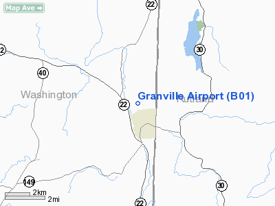
Location & QuickFacts
| FAA Information Effective: | 2008-09-25 |
| Airport Identifier: | B01 |
| Airport Status: | Operational |
| Longitude/Latitude: | 073-16-05.1000W/43-25-22.4900N
-73.268083/43.422914 (Estimated) |
| Elevation: | 420 ft / 128.02 m (Estimated) |
| Land: | 35 acres |
| From nearest city: | 1 nautical miles N of Granville, NY |
| Location: | Washington County, NY |
| Magnetic Variation: | 15W (1985) |
Owner & Manager
| Ownership: | Privately owned |
| Owner: | Neal Hulett |
| Address: | Po Box 183
Granville, NY 12832 |
| Phone number: | 518-642-1380 |
| Manager: | Neal Hulett |
| Address: | Po Box 183
Granville, NY 12832 |
| Phone number: | 518-642-1380 |
Airport Operations and Facilities
| Airport Use: | Open to public |
| Wind indicator: | Yes |
| Segmented Circle: | No |
| Control Tower: | No |
| Lighting Schedule: | PHONE REQ
|
| Landing fee charge: | No |
| Sectional chart: | New York |
| Region: | AEA - Eastern |
| Boundary ARTCC: | ZBW - Boston |
| Tie-in FSS: | BTV - Burlington |
| FSS on Airport: | No |
| FSS Toll Free: | 1-800-WX-BRIEF |
| NOTAMs Facility: | BTV (NOTAM-d service avaliable) |
| Federal Agreements: | N |
Airport Communications
Airport Services
| Airframe Repair: | MAJOR |
| Power Plant Repair: | MINOR |
| Bottled Oxygen: | NONE |
| Bulk Oxygen: | NONE |
Runway Information
Runway 16/34
| Dimension: | 2500 x 36 ft / 762.0 x 11.0 m
SECTIONS OF RY 16/34 WIDTH VARIES 36-46 FT. |
| Surface: | ASPH, Poor Condition
RW 34 SOUTH 1800 FT WAVY, RIPPLED, VEGETATION THROUGH CRACKS, LOOSE ROCKS ON RUNWAY. |
| Weight Limit: | Single wheel: 8000 lbs. |
| Edge Lights: | Low |
| |
Runway 16 |
Runway 34 |
| Longitude: | 073-16-15.3700W | 073-15-54.8300W |
| Latitude: | 43-25-32.3100N | 43-25-12.6700N |
| Traffic Pattern: | Left | Left |
| Markings: | Numbers only, Fair Condition | Numbers only, Fair Condition |
| Runway End Identifier: | No | No |
| Centerline Lights: | No | No |
| Touchdown Lights: | No | No |
| Obstruction: | 75 ft tree, 210.0 ft from runway, 119 ft left of centerline
RWY 16 ROAD 8 FT FROM THLD; TOMBSTONES 38 FT FROM PAVEMENT, 8FT TALL BUSH 90FT FROM RW END. | 65 ft trees, 384.0 ft from runway, 35 ft left of centerline, 3:1 slope to clear
RWY 34 +10 FT ROAD 175 FT FROM THLD ON CENTERLINE, +10FT BRUSH 165 FT ON CENTERLINE. |
|
Radio Navigation Aids
| ID |
Type |
Name |
Ch |
Freq |
Var |
Dist |
| R | FAN MARKER | Chitt | | | 14W | 18.1 nm |
| DYO | NDB | Smuto | | 221.00 | 15W | 21.8 nm |
| SXD | NDB | Springfield | | 265.00 | 15W | 31.2 nm |
| VWD | NDB | Mount Snow | | 224.00 | 15W | 34.6 nm |
| IVV | NDB | White River | | 379.00 | 16W | 36.0 nm |
| CNH | NDB | Claremont | | 233.00 | 16W | 39.3 nm |
| HEU | NDB | Hunter | | 356.00 | 14W | 45.0 nm |
| RUT | VOR/DME | Rutland | 47X | 111.00 | 15W | 15.2 nm |
| CAM | VOR/DME | Cambridge | 097X | 115.00 | 14W | 26.0 nm |
| LEB | VOR/DME | Lebanon | 084X | 113.70 | 15W | 48.3 nm |
| GFL | VORTAC | Glens Falls | 039X | 110.20 | 14W | 15.8 nm |
| ALB | VORTAC | Albany | 100X | 115.30 | 13W | 46.9 nm |
| ALB | VOT | Albany County | | 108.20 | | 47.6 nm |
Remarks
- HIGH TERRAIN IN APCH RY 34.
- EXISTED PRIOR TO 1959.
Images and information placed above are from
http://www.airport-data.com/airport/B01/
We thank them for the data!
| General Info
|
| Country |
United States
|
| State |
NEW YORK
|
| FAA ID |
B01
|
| Latitude |
43-25-30.256N
|
| Longitude |
073-15-43.391W
|
| Elevation |
420 feet
|
| Near City |
GRANVILLE
|
We don't guarantee the information is fresh and accurate. The data may
be wrong or outdated.
For more up-to-date information please refer to other sources.
|
|


