 |
|
Location & QuickFacts
| FAA Information Effective: | 2008-09-25 |
| Airport Identifier: | NY48 |
| Airport Status: | Operational |
| Longitude/Latitude: | 074-44-56.5600W/42-20-17.2970N
-74.749044/42.338138 (Estimated) |
| Elevation: | 1500 ft / 457.20 m (Estimated) |
| Land: | 0 acres |
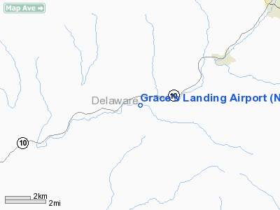
| From nearest city: | 2 nautical miles W of South Kortright, NY |
| Location: | Delaware County, NY |
| Magnetic Variation: | 13W (1985) |
Owner & Manager
| Ownership: | Privately owned |
| Owner: | Cervlean, Inc. |
| Address: | Rich Road, Box 113
Bloomville, NY 13739 |
| Phone number: | 607-538-9267 |
| Manager: | Greg Grace |
| Address: | Rich Road, Box 113
Bloomville, NY 13739 |
| Phone number: | 607-538-9267 |
Airport Operations and Facilities
| Airport Use: | Private
PERSONAL USE. |
| Wind indicator: | Yes |
| Segmented Circle: | No |
| Control Tower: | No |
| Sectional chart: | New York |
| Region: | AEA - Eastern |
| Boundary ARTCC: | ZBW - Boston |
| Tie-in FSS: | ISP - New York |
| FSS Toll Free: | 1-800-WX-BRIEF |
Runway Information
Runway 09/27
| Dimension: | 2800 x 100 ft / 853.4 x 30.5 m |
| Surface: | TURF, |
| |
Runway 09 |
Runway 27 |
| Traffic Pattern: | Left | Right |
|
Radio Navigation Aids
| ID |
Type |
Name |
Ch |
Freq |
Var |
Dist |
| MS | NDB | Monga | | 359.00 | 12W | 34.7 nm |
| JJH | NDB | Johnstown | | 523.00 | 14W | 43.8 nm |
| PFH | NDB | Philmont | | 272.00 | 13W | 45.9 nm |
| HEU | NDB | Hunter | | 356.00 | 14W | 47.5 nm |
| CJY | NDB | Clay | | 275.00 | 12W | 48.6 nm |
| DNY | VOR/DME | De Lancey | 058X | 112.10 | 11W | 13.3 nm |
| RKA | VOR/DME | Rockdale | 073X | 112.60 | 11W | 23.1 nm |
| HNK | VOR/DME | Hancock | 115X | 116.80 | 11W | 30.2 nm |
| UCA | VORTAC | Utica | 049X | 111.20 | 12W | 45.3 nm |
| ALB | VORTAC | Albany | 100X | 115.30 | 13W | 48.6 nm |
| ALB | VOT | Albany County | | 108.20 | | 47.7 nm |
Remarks
- VFR USE ONLY; TFC PTNS BE ORIENTED ON THE NORTH SIDE.
Images and information placed above are from
http://www.airport-data.com/airport/NY48/
We thank them for the data!
| General Info
|
| Country |
United States
|
| State |
NEW YORK
|
| FAA ID |
NY48
|
| Latitude |
42-20-17.297N
|
| Longitude |
074-44-56.560W
|
| Elevation |
1500 feet
|
| Near City |
SOUTH KORTRIGHT
|
We don't guarantee the information is fresh and accurate. The data may
be wrong or outdated.
For more up-to-date information please refer to other sources.
|
|


