 |
|
Location & QuickFacts
| FAA Information Effective: | 2008-09-25 |
| Airport Identifier: | D59 |
| Airport Status: | Operational |
| Longitude/Latitude: | 078-57-02.1240W/42-30-14.2190N
-78.950590/42.503950 (Estimated) |
| Elevation: | 830 ft / 252.98 m (Estimated) |
| Land: | 80 acres |
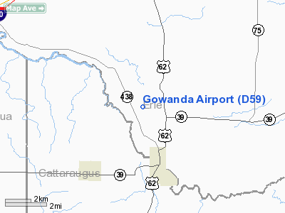
| From nearest city: | 3 nautical miles N of Gowanda, NY |
| Location: | Erie County, NY |
| Magnetic Variation: | 09W (1985) |
Owner & Manager
| Ownership: | Privately owned |
| Owner: | Dan Gernatt Gravel Prod.inc. |
| Address: | P.o. Box 400
Collins, NY 14034 |
| Phone number: | 716-532-3371 |
| Manager: | Dan Gernatt, Jr.
ALSO SAL DICEMBRE. |
| Address: | P.o. Box 400
Collins, NY 14034 |
| Phone number: | 716-532-3371 |
Airport Operations and Facilities
| Airport Use: | Open to public |
| Wind indicator: | Yes |
| Segmented Circle: | No |
| Control Tower: | No |
| Lighting Schedule: | RDO-CTL
FOR RY LGTS KEY 121.65. |
| Landing fee charge: | No |
| Sectional chart: | Detroit |
| Region: | AEA - Eastern |
| Boundary ARTCC: | ZOB - Cleveland |
| Tie-in FSS: | BUF - Buffalo |
| FSS on Airport: | No |
| FSS Toll Free: | 1-800-WX-BRIEF |
| NOTAMs Facility: | BUF (NOTAM-d service avaliable) |
Airport Communications
Airport Services
| Fuel available: | 100 80 |
| Airframe Repair: | NONE |
| Power Plant Repair: | NONE |
| Bottled Oxygen: | NONE |
| Bulk Oxygen: | NONE |
Runway Information
Runway 09/27
| Dimension: | 3430 x 100 ft / 1045.5 x 30.5 m |
| Surface: | TURF, Good Condition |
| Edge Lights: | Non-standard lighting system
RY 09/27 NSTD LIRL; DSPLCD PORTION OF RY HAS HAS BLUE LIGHTS. SEVERAL LGTS KNOCKED DOWN BY FARM EQUIPMENT; BULBS MISSING. NO LGTS ON FIRST 200 FT OF RY 27. |
| |
Runway 09 |
Runway 27 |
| Traffic Pattern: | Right | Right |
| Displaced threshold: | 0.00 ft | 1132.00 ft |
| Runway End Identifier: | Yes
BULBS MISSING FROM REILS. | No |
| Touchdown Lights: | No | No |
| Obstruction: | 60 ft tree, 670.0 ft from runway, 11:1 slope to clear
CORNFIELD ADJACENT TO RUNWAY EDGE. | 69 ft cranes, 138.0 ft from runway, 2:1 slope to clear
RY 27, APPR. SLOPE 18:1 TO DSPLCD THRD. CORNFIELD ADJACENT TO RUNWAY EDGE. |
|
Radio Navigation Aids
| ID |
Type |
Name |
Ch |
Freq |
Var |
Dist |
| LYS | NDB | Olean | | 360.00 | 09W | 30.4 nm |
| SN | NDB | St Catherines | | 408.00 | 01E | 40.9 nm |
| ORJ | NDB | Corry | | 258.00 | 09W | 47.2 nm |
| IAG | TACAN | Niagara Falls | 047X | | 10W | 36.6 nm |
| JHW | VOR/DME | Jamestown | 094X | 114.70 | 07W | 20.4 nm |
| BUF | VOR/DME | Buffalo | 111X | 116.40 | 08W | 28.9 nm |
| BFD | VOR/DME | Bradford | 113X | 116.60 | 07W | 45.6 nm |
| DKK | VORTAC | Dunkirk | 109X | 116.20 | 07W | 14.4 nm |
| ELZ | VORTAC | Wellsville | 051X | 111.40 | 09W | 49.1 nm |
| BUF | VOT | Buffalo | | 109.00 | | 27.9 nm |
Remarks
- TRUCK TRAFFIC NEAR RY 27.
- RY 09 - +40 FT PLINE; 600 FT FROM THLD ON CNTRLN.
- RY 09/27 SOFT & WET MAR-JUN.
- RY 27;77 FT HIGH CONVEYOR BELT/CRANE & DIRT PILE, 170 FT FRM AER, 91 FT LEFT.
- RY 9/27, DIRT ROAD CROSSES RY AT APPROX MID POINT OF RY.
- DSPLCD THLD, SEVERAL LGTS KNOCKED DOWN, BULBS MISSING.
- VFR OPS ONLY.
Images and information placed above are from
http://www.airport-data.com/airport/D59/
We thank them for the data!
| General Info
|
| Country |
United States
|
| State |
NEW YORK
|
| FAA ID |
D59
|
| Latitude |
42-30-14.219N
|
| Longitude |
078-57-02.124W
|
| Elevation |
830 feet
|
| Near City |
GOWANDA
|
We don't guarantee the information is fresh and accurate. The data may
be wrong or outdated.
For more up-to-date information please refer to other sources.
|
|


