 |
|
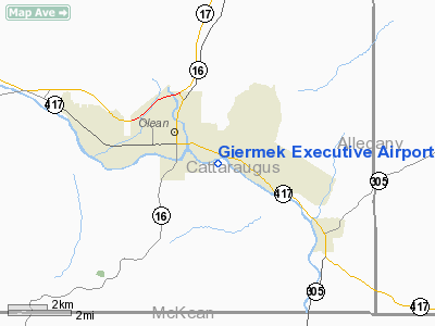
Giermek Executive Airport |
Location & QuickFacts
| FAA Information Effective: | 2008-09-25 |
| Airport Identifier: | 8G3 |
| Airport Status: | Operational |
| Longitude/Latitude: | 078-24-16.0670W/42-04-07.2340N
-78.404463/42.068676 (Estimated) |
| Elevation: | 1420 ft / 432.82 m (Estimated) |
| Land: | 30 acres |
| From nearest city: | 2 nautical miles SE of Olean, NY |
| Location: | Cattaraugus County, NY |
| Magnetic Variation: | 10W (1985) |
Owner & Manager
| Ownership: | Privately owned |
| Owner: | Peter & Paul Giermek |
| Address: | 1920 E River Rd
Olean, NY 14760 |
| Phone number: | 716-372-1201 |
| Manager: | Peter & Paul Giermek |
| Address: | 1920 E River Rd
Olean, NY 14760 |
| Phone number: | 716-307-8966
DURING WEEKDAY DAY HOURS CALL MGR CELL PHONE AT 716-307-8966 OR 716-307-3581. |
Airport Operations and Facilities
| Airport Use: | Open to public |
| Wind indicator: | Yes |
| Segmented Circle: | No |
| Control Tower: | No |
| Landing fee charge: | No |
| Sectional chart: | Detroit |
| Region: | AEA - Eastern |
| Boundary ARTCC: | ZOB - Cleveland |
| Tie-in FSS: | BUF - Buffalo |
| FSS on Airport: | No |
| FSS Toll Free: | 1-800-WX-BRIEF |
| NOTAMs Facility: | BUF (NOTAM-d service avaliable) |
Airport Communications
Airport Services
| Bottled Oxygen: | NONE |
| Bulk Oxygen: | NONE |
Runway Information
Runway 10/28
| Dimension: | 3150 x 80 ft / 960.1 x 24.4 m
RY 10/28 WIDTH VARIES 80 FT-100 FT. |
| Surface: | TURF, Good Condition
RY 10/28 1-2 FT DEEP DEPRESSION/RUT LCTD 50 FT FM BEGINNING OF RY 10 RIGHT OF CNTRLN ACROSS RY. |
| |
Runway 10 |
Runway 28 |
| Traffic Pattern: | Left | Left |
| Markings: | Nonstandard, Good Condition
RY 10/28 RY EDGES MKD WITH WHITE CONES. | Nonstandard, Good Condition |
| Obstruction: | 30 ft trees, 90 ft right of centerline | 20 ft trees, 0.0 ft from runway |
|
Radio Navigation Aids
| ID |
Type |
Name |
Ch |
Freq |
Var |
Dist |
| LYS | NDB | Olean | | 360.00 | 09W | 13.3 nm |
| EL | NDB | Halos | | 269.00 | 09W | 22.0 nm |
| BFD | VOR/DME | Bradford | 113X | 116.60 | 07W | 19.5 nm |
| JHW | VOR/DME | Jamestown | 094X | 114.70 | 07W | 32.8 nm |
| SFK | VOR/DME | Stonyfork | 023X | 108.60 | 08W | 49.4 nm |
| ELZ | VORTAC | Wellsville | 051X | 111.40 | 09W | 18.1 nm |
| SLT | VORTAC | Slate Run | 086X | 113.90 | 08W | 38.7 nm |
| DKK | VORTAC | Dunkirk | 109X | 116.20 | 07W | 46.2 nm |
Remarks
- ARPT CLSD NGTS.
- DEER CROSSINGS EVENINGS.
- RY NOT SNOW PLOWED. CALL 716-307-8966 OR 716-307-3581 FOR CONDITIONS.
- PUBLIC USE IN ACCORDANCE WITH VFR.
Images and information placed above are from
http://www.airport-data.com/airport/8G3/
We thank them for the data!
| General Info
|
| Country |
United States
|
| State |
NEW YORK
|
| FAA ID |
8G3
|
| Latitude |
42-04-07.234N
|
| Longitude |
078-24-16.067W
|
| Elevation |
1420 feet
|
| Near City |
OLEAN
|
We don't guarantee the information is fresh and accurate. The data may
be wrong or outdated.
For more up-to-date information please refer to other sources.
|
|


