 |
|
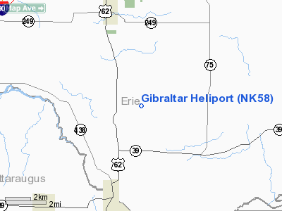
Location & QuickFacts
| FAA Information Effective: | 2008-09-25 |
| Airport Identifier: | NK58 |
| Airport Status: | Operational |
| Longitude/Latitude: | 078-54-26.1200W/42-31-42.2190N
-78.907256/42.528394 (Estimated) |
| Elevation: | 770 ft / 234.70 m (Estimated) |
| Land: | 0 acres |
| From nearest city: | 5 nautical miles NW of Hamburg, NY |
| Location: | Erie County, NY |
| Magnetic Variation: | 09W (1985) |
Owner & Manager
| Ownership: | Privately owned |
| Owner: | The V Associated Ltd |
| Address: | 3556 Lake Shore Rd
Buffalo, NY 14219 |
| Phone number: | 716-826-6500
EXT 241. |
| Manager: | Coletta M Lowell |
| Address: | 3556 Lake Shore Rd
Buffalo, NY 14219 |
| Phone number: | 716-826-6500
EXT 229. |
Airport Operations and Facilities
| Airport Use: | Private |
| Wind indicator: | Yes |
| Segmented Circle: | No |
| Control Tower: | No |
| Sectional chart: | Detroit |
| Region: | AEA - Eastern |
| Boundary ARTCC: | ZOB - Cleveland |
| Tie-in FSS: | BUF - Buffalo |
| FSS on Airport: | No |
| FSS Toll Free: | 1-800-WX-BRIEF |
Airport Communications
Airport Services
Runway Information
Helipad H1
| Dimension: | 60 x 60 ft / 18.3 x 18.3 m |
| Surface: | CONC, |
| |
Runway H1 |
Runway |
| Traffic Pattern: | Left | Left |
|
Radio Navigation Aids
| ID |
Type |
Name |
Ch |
Freq |
Var |
Dist |
| LYS | NDB | Olean | | 360.00 | 09W | 29.4 nm |
| SN | NDB | St Catherines | | 408.00 | 01E | 40.2 nm |
| ORJ | NDB | Corry | | 258.00 | 09W | 49.6 nm |
| IAG | TACAN | Niagara Falls | 047X | | 10W | 35.2 nm |
| JHW | VOR/DME | Jamestown | 094X | 114.70 | 07W | 22.5 nm |
| BUF | VOR/DME | Buffalo | 111X | 116.40 | 08W | 26.7 nm |
| BFD | VOR/DME | Bradford | 113X | 116.60 | 07W | 46.4 nm |
| DKK | VORTAC | Dunkirk | 109X | 116.20 | 07W | 16.4 nm |
| ELZ | VORTAC | Wellsville | 051X | 111.40 | 09W | 48.2 nm |
| BUF | VOT | Buffalo | | 109.00 | | 25.8 nm |
Images and information placed above are from
http://www.airport-data.com/airport/NK58/
We thank them for the data!
| General Info
|
| Country |
United States
|
| State |
NEW YORK
|
| FAA ID |
NK58
|
| Latitude |
42-31-42.219N
|
| Longitude |
078-54-26.120W
|
| Elevation |
770 feet
|
| Near City |
HAMBURG
|
We don't guarantee the information is fresh and accurate. The data may
be wrong or outdated.
For more up-to-date information please refer to other sources.
|
|


