 |
|
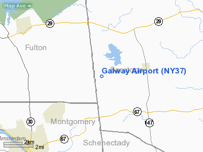
Location & QuickFacts
| FAA Information Effective: | 2008-09-25 |
| Airport Identifier: | NY37 |
| Airport Status: | Operational |
| Longitude/Latitude: | 074-05-28.4600W/43-00-33.2700N
-74.091239/43.009242 (Estimated) |
| Elevation: | 950 ft / 289.56 m (Estimated) |
| Land: | 41 acres |
| From nearest city: | 3 nautical miles W of Galway, NY |
| Location: | Saratoga County, NY |
| Magnetic Variation: | 14W (1995) |
Owner & Manager
| Ownership: | Privately owned |
| Owner: | John & Donald Schleich |
| Address: | 1080 Perth Rd
Hagaman, NY 12086 |
| Phone number: | 518-882-9241 |
| Manager: | John Schleich |
| Address: | 1080 Perth Rd
Hagaman, NY 12086 |
| Phone number: | 518-882-9241 |
Airport Operations and Facilities
| Airport Use: | Private |
| Wind indicator: | Yes |
| Segmented Circle: | No |
| Control Tower: | No |
| Lighting Schedule: | RDO-CTL
ACTVT LIRL RY 10/28 - 122.9. |
| Sectional chart: | New York |
| Region: | AEA - Eastern |
| Boundary ARTCC: | ZBW - Boston |
| Tie-in FSS: | BTV - Burlington |
| FSS on Airport: | No |
| FSS Toll Free: | 1-800-WX-BRIEF |
Runway Information
Runway 10/28
| Dimension: | 2200 x 90 ft / 670.6 x 27.4 m |
| Surface: | TURF, Good Condition |
| Edge Lights: | Low |
| |
Runway 10 |
Runway 28 |
| Traffic Pattern: | Left | Left |
| Obstruction: | 50 ft trees, 500.0 ft from runway | |
|
Radio Navigation Aids
| ID |
Type |
Name |
Ch |
Freq |
Var |
Dist |
| JJH | NDB | Johnstown | | 523.00 | 14W | 10.6 nm |
| HEU | NDB | Hunter | | 356.00 | 14W | 11.7 nm |
| PFH | NDB | Philmont | | 272.00 | 13W | 48.3 nm |
| CAM | VOR/DME | Cambridge | 097X | 115.00 | 14W | 32.9 nm |
| ALB | VORTAC | Albany | 100X | 115.30 | 13W | 20.2 nm |
| GFL | VORTAC | Glens Falls | 039X | 110.20 | 14W | 29.0 nm |
| UCA | VORTAC | Utica | 049X | 111.20 | 12W | 47.2 nm |
| ALB | VOT | Albany County | | 108.20 | | 20.0 nm |
Remarks
- PRVDD DALGT OPNS ONLY; IFR OPNS ARE NOT CONDUCTED; A CLEAR 20:1 APCH & ALL OPNS IN COMPLIANCE W/FAA STANDARDS.
Images and information placed above are from
http://www.airport-data.com/airport/NY37/
We thank them for the data!
| General Info
|
| Country |
United States
|
| State |
NEW YORK
|
| FAA ID |
NY37
|
| Latitude |
43-00-33.270N
|
| Longitude |
074-05-28.460W
|
| Elevation |
950 feet
|
| Near City |
GALWAY
|
We don't guarantee the information is fresh and accurate. The data may
be wrong or outdated.
For more up-to-date information please refer to other sources.
|
|


