 |
|
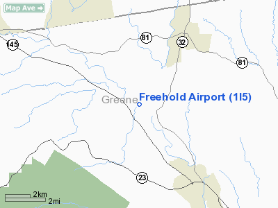
Location & QuickFacts
| FAA Information Effective: | 2008-09-25 |
| Airport Identifier: | 1I5 |
| Airport Status: | Operational |
| Longitude/Latitude: | 074-03-57.4850W/42-21-51.3000N
-74.065968/42.364250 (Estimated) |
| Elevation: | 440 ft / 134.11 m (Estimated) |
| Land: | 54 acres |
| From nearest city: | 1 nautical miles NW of Freehold, NY |
| Location: | Greene County, NY |
| Magnetic Variation: | 14W (1985) |
Owner & Manager
| Ownership: | Privately owned |
| Owner: | Freehold Airport, Llc |
| Address: | C/o Bruce Stein, Po Box 1182
Stratford, CT 06615 |
| Phone number: | 518-622-3307 |
| Manager: | Clements J Hoovler Jr |
| Address: | Po Box 44
South Cairo, NY 12482 |
| Phone number: | 518-634-7626 |
Airport Operations and Facilities
| Airport Use: | Open to public |
| Wind indicator: | Yes |
| Segmented Circle: | No |
| Control Tower: | No |
| Landing fee charge: | No |
| Sectional chart: | New York |
| Region: | AEA - Eastern |
| Boundary ARTCC: | ZBW - Boston |
| Tie-in FSS: | BTV - Burlington |
| FSS on Airport: | No |
| FSS Toll Free: | 1-800-WX-BRIEF |
| NOTAMs Facility: | BTV (NOTAM-d service avaliable) |
| Federal Agreements: | N |
Airport Communications
| CTAF: | 122.800 |
| Unicom: | 122.800 |
Airport Services
| Airframe Repair: | MINOR |
| Power Plant Repair: | MINOR |
Runway Information
Runway 12/30
| Dimension: | 2275 x 22 ft / 693.4 x 6.7 m
100 FT BY 2640 FT TURF RWY ADJACENT TO PAVED RWY (S EDGE) BEGINNING AT 735 FT FROM RWY 30 THLD. |
| Surface: | ASPH, Fair Condition |
| Surface Treatment: | Aggregate Friction Seal Coat |
| |
Runway 12 |
Runway 30 |
| Traffic Pattern: | Left | Left |
| Markings: | Numbers only, Fair Condition | Numbers only, Fair Condition |
| Obstruction: | 3 ft fence, 34 ft left of centerline
10 FT HIGH FENCE 50 NW OF RWY THRESHOLD RUNNING WNW FOR APPROX. 700 FT. | 89 ft trees, 333.0 ft from runway, 125 ft right of centerline, 7:1 slope to clear |
|
Radio Navigation Aids
| ID |
Type |
Name |
Ch |
Freq |
Var |
Dist |
| GBR | FAN MARKER | Sheffield | | | 13W | 34.3 nm |
| PSF | FAN MARKER | Abyss | | | 13W | 38.2 nm |
| PFH | NDB | Philmont | | 272.00 | 13W | 16.6 nm |
| HEU | NDB | Hunter | | 356.00 | 14W | 29.9 nm |
| GBR | NDB | Great Barrington | | 395.00 | 14W | 31.4 nm |
| JJH | NDB | Johnstown | | 523.00 | 14W | 39.9 nm |
| DXT | NDB | Dalton | | 370.00 | 15W | 40.3 nm |
| PO | NDB | Meier | | 403.00 | 12W | 47.6 nm |
| DNY | VOR/DME | De Lancey | 058X | 112.10 | 11W | 41.2 nm |
| PWL | VOR/DME | Pawling | 090X | 114.30 | 12W | 41.3 nm |
| IGN | VOR/DME | Kingston | 123X | 117.60 | 12W | 43.4 nm |
| CAM | VOR/DME | Cambridge | 097X | 115.00 | 14W | 49.5 nm |
| CTR | VOR/DME | Chester | 098X | 115.10 | 13W | 49.8 nm |
| ALB | VORTAC | Albany | 100X | 115.30 | 13W | 25.8 nm |
| ALB | VOT | Albany County | | 108.20 | | 25.2 nm |
Remarks
- EXTENSIVE GLIDER ACTIVITY, ESPECIALLY ON WEEKENDS.
- RY 12 ORCHARDS 100 FT LEFT & 112 FT RIGHT RY CNTRLN & 59 FT TREES IN APCH TO RY 288 FT FM THLD.
- RGT TFC FOR GLIDERS RY 12 ONLY.
- PPR FOR LDG UNTIL 01 APR; SNOW ON RY.
- VFR OPNS ONLY.
Images and information placed above are from
http://www.airport-data.com/airport/1I5/
We thank them for the data!
| General Info
|
| Country |
United States
|
| State |
NEW YORK
|
| FAA ID |
1I5
|
| Latitude |
42-21-51.300N
|
| Longitude |
074-03-57.485W
|
| Elevation |
440 feet
|
| Near City |
FREEHOLD
|
We don't guarantee the information is fresh and accurate. The data may
be wrong or outdated.
For more up-to-date information please refer to other sources.
|
|


