 |
|
Location & QuickFacts
| FAA Information Effective: | 2008-09-25 |
| Airport Identifier: | 19NY |
| Airport Status: | Operational |
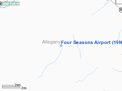
| Longitude/Latitude: | 077-57-39.0100W/42-24-22.2390N
-77.960836/42.406177 (Estimated) |
| Elevation: | 1650 ft / 502.92 m (Estimated) |
| Land: | 72 acres |
| From nearest city: | 4 nautical miles SW of Reading, NY |
| Location: | Schuyler County, NY |
| Magnetic Variation: | 11W (1990) |
Owner & Manager
| Ownership: | Privately owned |
| Owner: | Edwin J Koch |
| Address: | 3632 County Road 27
Watkins Glen, NY 14891 |
| Phone number: | 607-535-9329 |
| Manager: | Edwin J Koch |
| Address: | 3632 County Road 27
Watkins Glen, NY 14891 |
| Phone number: | 607-535-9329 |
Airport Operations and Facilities
| Airport Use: | Private |
| Wind indicator: | Yes |
| Segmented Circle: | No |
| Control Tower: | No |
| Sectional chart: | Detroit |
| Region: | AEA - Eastern |
| Boundary ARTCC: | ZOB - Cleveland |
| Tie-in FSS: | BUF - Buffalo |
| FSS on Airport: | No |
| FSS Toll Free: | 1-800-WX-BRIEF |
Runway Information
Runway 17/35
| Dimension: | 2500 x 60 ft / 762.0 x 18.3 m |
| Surface: | TURF, |
| |
Runway 17 |
Runway 35 |
| Traffic Pattern: | Left | Left |
| Obstruction: | 25 ft trees, 200.0 ft from runway | 20 ft trees, 200.0 ft from runway |
|
Radio Navigation Aids
| ID |
Type |
Name |
Ch |
Freq |
Var |
Dist |
| EL | NDB | Halos | | 269.00 | 09W | 17.9 nm |
| LYS | NDB | Olean | | 360.00 | 09W | 18.2 nm |
| AVN | NDB | Avon | | 344.00 | 09W | 37.3 nm |
| PYA | NDB | Penn Yan | | 260.00 | 12W | 42.5 nm |
| GEE | VOR/DME | Geneseo | 019X | 108.20 | 09W | 27.6 nm |
| BUF | VOR/DME | Buffalo | 111X | 116.40 | 08W | 43.7 nm |
| ULW | VOR/DME | Elmira | 033Y | 109.65 | 12W | 45.7 nm |
| BFD | VOR/DME | Bradford | 113X | 116.60 | 07W | 47.4 nm |
| SFK | VOR/DME | Stonyfork | 023X | 108.60 | 08W | 49.1 nm |
| ELZ | VORTAC | Wellsville | 051X | 111.40 | 09W | 19.1 nm |
| ROC | VORTAC | Rochester | 037X | 110.00 | 09W | 44.8 nm |
| BUF | VOT | Buffalo | | 109.00 | | 46.8 nm |
Remarks
- DALGT VFR USE ONLY; THR DSPLCD TO PRVD 20:1 APCH SLP.
Images and information placed above are from
http://www.airport-data.com/airport/19NY/
We thank them for the data!
| General Info
|
| Country |
United States
|
| State |
NEW YORK
|
| FAA ID |
19NY
|
| Latitude |
42-24-22.239N
|
| Longitude |
077-57-39.010W
|
| Elevation |
1650 feet
|
| Near City |
READING
|
We don't guarantee the information is fresh and accurate. The data may
be wrong or outdated.
For more up-to-date information please refer to other sources.
|
|


