 |
|
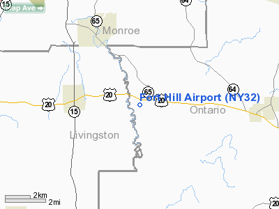
Location & QuickFacts
| FAA Information Effective: | 2008-09-25 |
| Airport Identifier: | NY32 |
| Airport Status: | Operational |
| Longitude/Latitude: | 077-32-51.9840W/42-54-07.2290N
-77.547773/42.902008 (Estimated) |
| Elevation: | 915 ft / 278.89 m (Estimated) |
| Land: | 100 acres |
| From nearest city: | 1 nautical miles W of West Bloomfield, NY |
| Location: | Ontario County, NY |
| Magnetic Variation: | 11W (1985) |
Owner & Manager
| Ownership: | Privately owned |
| Owner: | Charles Kircher |
| Address: | 9193 Buffalo Albany Rd
West Bloomfield, NY 14585 |
| Phone number: | 716-624-3180 |
| Manager: | Susan Kircher |
| Address: | Po Box 12
West Bloomfield, NY 14585 |
| Phone number: | 716-624-5916 |
Airport Operations and Facilities
| Airport Use: | Private |
| Wind indicator: | Yes |
| Segmented Circle: | No |
| Control Tower: | No |
| Landing fee charge: | Yes |
| Sectional chart: | Detroit |
| Region: | AEA - Eastern |
| Boundary ARTCC: | ZOB - Cleveland |
| Tie-in FSS: | BUF - Buffalo |
| FSS on Airport: | No |
| FSS Toll Free: | 1-800-WX-BRIEF |
Airport Services
| Airframe Repair: | MAJOR |
| Power Plant Repair: | MAJOR |
| Bottled Oxygen: | NONE |
| Bulk Oxygen: | NONE |
Runway Information
Runway 02/20
| Dimension: | 2000 x 100 ft / 609.6 x 30.5 m |
| Surface: | TURF, |
| |
Runway 02 |
Runway 20 |
| Traffic Pattern: | Left | Left |
| Runway End Identifier: | No | No |
| Centerline Lights: | No | No |
| Touchdown Lights: | No | No |
|
Radio Navigation Aids
| ID |
Type |
Name |
Ch |
Freq |
Var |
Dist |
| AVN | NDB | Avon | | 344.00 | 09W | 11.7 nm |
| PYA | NDB | Penn Yan | | 260.00 | 12W | 26.7 nm |
| GEE | VOR/DME | Geneseo | 019X | 108.20 | 09W | 9.1 nm |
| BUF | VOR/DME | Buffalo | 111X | 116.40 | 08W | 48.4 nm |
| ROC | VORTAC | Rochester | 037X | 110.00 | 09W | 14.3 nm |
Remarks
- BARN 600 FT N.
- OPERN CONDUCTED UNDER VFR CONDS ONLY.
Images and information placed above are from
http://www.airport-data.com/airport/NY32/
We thank them for the data!
| General Info
|
| Country |
United States
|
| State |
NEW YORK
|
| FAA ID |
NY32
|
| Latitude |
42-54-07.229N
|
| Longitude |
077-32-51.984W
|
| Elevation |
915 feet
|
| Near City |
WEST BLOOMFIELD
|
We don't guarantee the information is fresh and accurate. The data may
be wrong or outdated.
For more up-to-date information please refer to other sources.
|
|


