 |
|
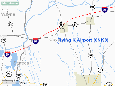
Location & QuickFacts
| FAA Information Effective: | 2008-09-25 |
| Airport Identifier: | 6NK8 |
| Airport Status: | Operational |
| Longitude/Latitude: | 076-38-25.8000W/43-00-35.2300N
-76.640500/43.009786 (Estimated) |
| Elevation: | 1350 ft / 411.48 m (Estimated) |
| Land: | 38 acres |
| From nearest city: | 5 nautical miles E of Oneida, NY |
| Location: | Madison County, NY |
| Magnetic Variation: | 12W (1995) |
Owner & Manager
| Ownership: | Privately owned |
| Owner: | Lpuis Robert Kobelia |
| Address: | Rr1 368a
Oneida, NY 13421 |
| Phone number: | 315-495-2273 |
| Manager: | Louis Robert Kobelia |
| Address: | Rr1 368a
Oneida, NY 13421 |
| Phone number: | 315-495-2273 |
Airport Operations and Facilities
| Airport Use: | Private |
| Wind indicator: | Yes |
| Segmented Circle: | No |
| Control Tower: | No |
| Sectional chart: | New York |
| Region: | AEA - Eastern |
| Boundary ARTCC: | ZBW - Boston |
| Tie-in FSS: | BUF - Buffalo |
| FSS Toll Free: | 1-800-WX-BRIEF |
Runway Information
Runway 09/27
| Dimension: | 2386 x 418 ft / 727.3 x 127.4 m |
| Surface: | TURF, |
| |
Runway 09 |
Runway 27 |
| Traffic Pattern: | Left | Right |
| Displaced threshold: | 0.00 ft | 600.00 ft |
| Obstruction: | 30 ft trees | 30 ft pline, 50.0 ft from runway |
|
Radio Navigation Aids
| ID |
Type |
Name |
Ch |
Freq |
Var |
Dist |
| PYA | NDB | Penn Yan | | 260.00 | 12W | 28.6 nm |
| ALP | NDB | Alpine | | 245.00 | 12W | 46.7 nm |
| AVN | NDB | Avon | | 344.00 | 09W | 49.6 nm |
| ITH | VOR/DME | Ithaca | 055X | 111.80 | 10W | 32.0 nm |
| GEE | VOR/DME | Geneseo | 019X | 108.20 | 09W | 49.2 nm |
| SYR | VORTAC | Syracuse | 117X | 117.00 | 11W | 21.2 nm |
| GGT | VORTAC | Georgetown | 125X | 117.80 | 11W | 38.2 nm |
| ROC | VORTAC | Rochester | 037X | 110.00 | 09W | 45.9 nm |
Remarks
- OWNER DESIRES ARPT NOT BE CHARTED.
- PRVDD VFR ONLY, SPHERICAL MARKERS PLACED ON PLINES, & CLEAR 20:1 APCH/DEP PATH.
Images and information placed above are from
http://www.airport-data.com/airport/6NK8/
We thank them for the data!
| General Info
|
| Country |
United States
|
| State |
NEW YORK
|
| FAA ID |
6NK8
|
| Latitude |
43-00-35.230N
|
| Longitude |
076-38-25.800W
|
| Elevation |
1350 feet
|
| Near City |
ONEIDA
|
We don't guarantee the information is fresh and accurate. The data may
be wrong or outdated.
For more up-to-date information please refer to other sources.
|
|


