 |
|
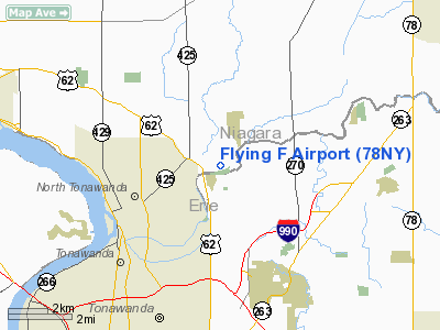
Location & QuickFacts
| FAA Information Effective: | 2008-09-25 |
| Airport Identifier: | 78NY |
| Airport Status: | Operational |
| Longitude/Latitude: | 078-48-58.1260W/43-03-20.2050N
-78.816146/43.055612 (Estimated) |
| Elevation: | 580 ft / 176.78 m (Estimated) |
| Land: | 100 acres |
| From nearest city: | 1 nautical miles N of Pendleton, NY |
| Location: | Niagara County, NY |
| Magnetic Variation: | 10W (1985) |
Owner & Manager
| Ownership: | Privately owned |
| Owner: | Francis J. Ferland |
| Address: | 7100 Campbell Blvd
North Tonowanda, NY 14120 |
| Phone number: | 716-695-2231 |
| Manager: | Francis J. Ferland |
| Address: | 7100 Campbell Blvd
North Tonowanda, NY 14120 |
| Phone number: | 716-695-2231 |
Airport Operations and Facilities
| Airport Use: | Private
PRIVATE. |
| Wind indicator: | Yes |
| Segmented Circle: | Yes |
| Control Tower: | No |
| Lighting Schedule: | PHONE REQ
FOR RWY LGTS PRIOR REQ PHONE 716-695-2231. |
| Landing fee charge: | No |
| Sectional chart: | Detroit |
| Region: | AEA - Eastern |
| Boundary ARTCC: | ZOB - Cleveland |
| Tie-in FSS: | BUF - Buffalo |
| FSS on Airport: | No |
| FSS Toll Free: | 1-800-WX-BRIEF |
Airport Services
Runway Information
Runway E/W
| Dimension: | 3750 x 75 ft / 1143.0 x 22.9 m |
| Surface: | TURF-GRVL, |
| Edge Lights: | Low |
| |
Runway E |
Runway W |
| Traffic Pattern: | Right | Left |
|
Radio Navigation Aids
| ID |
Type |
Name |
Ch |
Freq |
Var |
Dist |
| SN | NDB | St Catherines | | 408.00 | 01E | 20.0 nm |
| TZ | NDB | Gibraltar Point | | 257.00 | 10W | 41.7 nm |
| AVN | NDB | Avon | | 344.00 | 09W | 46.1 nm |
| L | NDB | Lima | | 368.00 | 10W | 46.6 nm |
| IAG | TACAN | Niagara Falls | 047X | | 10W | 7.2 nm |
| BUF | VOR/DME | Buffalo | 111X | 116.40 | 08W | 10.7 nm |
| GEE | VOR/DME | Geneseo | 019X | 108.20 | 09W | 49.5 nm |
| DKK | VORTAC | Dunkirk | 109X | 116.20 | 07W | 39.5 nm |
| BUF | VOT | Buffalo | | 109.00 | | 7.9 nm |
Remarks
- APT CLSD WHEN WIND TEE IS REMOVED.
- PERSONAL USE;VFR ONLY OPERATIONS ARE CONDUCTED IN ACCORDANCE WITH FAR PART 91 & REMAIN WELL CLEAR OF OPERATIONS AT PENDLETON AIRPORT.
Images and information placed above are from
http://www.airport-data.com/airport/78NY/
We thank them for the data!
| General Info
|
| Country |
United States
|
| State |
NEW YORK
|
| FAA ID |
78NY
|
| Latitude |
43-03-20.205N
|
| Longitude |
078-48-58.126W
|
| Elevation |
580 feet
|
| Near City |
PENDLETON
|
We don't guarantee the information is fresh and accurate. The data may
be wrong or outdated.
For more up-to-date information please refer to other sources.
|
|


