 |
|
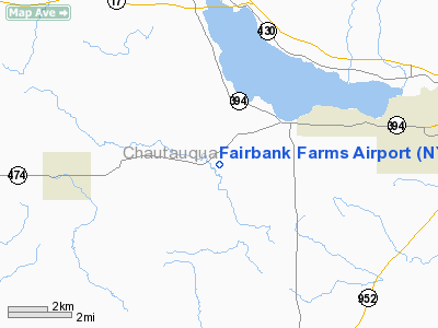
Location & QuickFacts
| FAA Information Effective: | 2008-09-25 |
| Airport Identifier: | NY89 |
| Airport Status: | Operational |
| Longitude/Latitude: | 079-23-29.1770W/42-04-48.2040N
-79.391438/42.080057 (Estimated) |
| Elevation: | 1350 ft / 411.48 m (Estimated) |
| Land: | 180 acres |
| From nearest city: | 10 nautical miles W of Jamestown, NY |
| Location: | Chautauqua County, NY |
| Magnetic Variation: | 09W (1990) |
Owner & Manager
| Ownership: | Privately owned |
| Owner: | Jeffrey Carlson |
| Address: | Rd 2 Box 572 Stoneledge Rd
Ashville, NY 14710 |
| Phone number: | 716-782-2000 |
| Manager: | Jeffrey D. Carlson |
| Address: | Rd 2 Box 572 Stoneledge Rd
Ashville, NY 14710 |
| Phone number: | 716-763-3306 |
Airport Operations and Facilities
| Airport Use: | Private |
| Segmented Circle: | No |
| Control Tower: | No |
| Lighting Schedule: | PHONE REQ
FOR LIRL RY 15L/33R CALL 716-763-3306. |
| Sectional chart: | Detroit |
| Region: | AEA - Eastern |
| Boundary ARTCC: | ZOB - Cleveland |
| Tie-in FSS: | BUF - Buffalo |
| FSS on Airport: | No |
| FSS Toll Free: | 1-800-WX-BRIEF |
Airport Services
Runway Information
Runway 09W/27W
| Dimension: | 1700 x 50 ft / 518.2 x 15.2 m |
| Surface: | WATER, |
| |
Runway 09W |
Runway 27W |
| Traffic Pattern: | Left | Left |
|
Runway 15L/33R
| Dimension: | 2800 x 50 ft / 853.4 x 15.2 m |
| Surface: | ASPH, |
| Edge Lights: | Low |
| |
Runway 15L |
Runway 33R |
| Traffic Pattern: | Left | Left |
| Obstruction: | 50 ft trees, 2620.0 ft from runway | |
|
Runway 15R/33L
| Dimension: | 2800 x 125 ft / 853.4 x 38.1 m |
| Surface: | TURF, |
| |
Runway 15R |
Runway 33L |
| Traffic Pattern: | Left | Left |
| Obstruction: | 50 ft trees, 2620.0 ft from runway | |
|
Radio Navigation Aids
| ID |
Type |
Name |
Ch |
Freq |
Var |
Dist |
| ORJ | NDB | Corry | | 258.00 | 09W | 15.3 nm |
| CQD | NDB | Cascade | | 372.00 | 08W | 31.9 nm |
| LYS | NDB | Olean | | 360.00 | 09W | 48.6 nm |
| FKL | VOR | Franklin | | 109.60 | 06W | 43.8 nm |
| JHW | VOR/DME | Jamestown | 094X | 114.70 | 07W | 13.7 nm |
| BFD | VOR/DME | Bradford | 113X | 116.60 | 07W | 38.8 nm |
| TDT | VORTAC | Tidioute | 123X | 117.60 | 09W | 22.1 nm |
| DKK | VORTAC | Dunkirk | 109X | 116.20 | 07W | 25.2 nm |
| ERI | VORTAC | Erie | 031X | 109.40 | 06W | 40.4 nm |
Remarks
Images and information placed above are from
http://www.airport-data.com/airport/NY89/
We thank them for the data!
| General Info
|
| Country |
United States
|
| State |
NEW YORK
|
| FAA ID |
NY89
|
| Latitude |
42-04-48.204N
|
| Longitude |
079-23-29.177W
|
| Elevation |
1350 feet
|
| Near City |
JAMESTOWN
|
We don't guarantee the information is fresh and accurate. The data may
be wrong or outdated.
For more up-to-date information please refer to other sources.
|
|


