 |
|
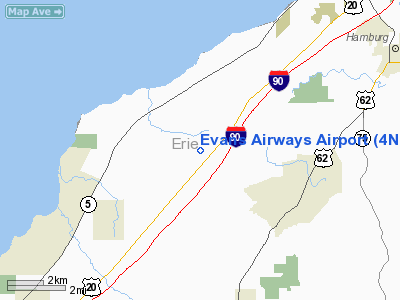
Location & QuickFacts
| FAA Information Effective: | 2008-09-25 |
| Airport Identifier: | 4NK3 |
| Airport Status: | Operational |
| Longitude/Latitude: | 078-58-01.1300W/42-40-21.0000N
-78.966981/42.672500 (Estimated) |
| Elevation: | 940 ft / 286.51 m (Estimated) |
| Land: | 18 acres |
| From nearest city: | 4 nautical miles E of Evans, NY |
| Location: | Erie County, NY |
| Magnetic Variation: | 10W (1995) |
Owner & Manager
| Ownership: | Privately owned |
| Owner: | W J Milligan |
| Address: | 4995 Southwestern Blvd
Hamburg, NY 14075 |
| Phone number: | 716-947-5888 |
| Manager: | J M Productions Inc |
| Address: | 4995 Southwestern Blvd
Hamburg, NY 14075 |
| Phone number: | 716-648-5100 |
Airport Operations and Facilities
| Airport Use: | Private |
| Wind indicator: | Yes |
| Segmented Circle: | No |
| Control Tower: | No |
| Sectional chart: | Detroit |
| Region: | AEA - Eastern |
| Boundary ARTCC: | ZOB - Cleveland |
| Tie-in FSS: | BUF - Buffalo |
| FSS Toll Free: | 1-800-WX-BRIEF |
Runway Information
Runway 10/28
| Dimension: | 2000 x 30 ft / 609.6 x 9.1 m |
| Surface: | TURF, |
| |
Runway 10 |
Runway 28 |
| Traffic Pattern: | Left | Left |
| Obstruction: | | 60 ft pline, 1000.0 ft from runway |
|
Helipad H1
| Dimension: | 50 x 50 ft / 15.2 x 15.2 m |
| Surface: | ASPH, |
| |
Runway H1 |
Runway |
| Traffic Pattern: | Left | Left |
|
Radio Navigation Aids
| ID |
Type |
Name |
Ch |
Freq |
Var |
Dist |
| SN | NDB | St Catherines | | 408.00 | 01E | 31.2 nm |
| LYS | NDB | Olean | | 360.00 | 09W | 36.5 nm |
| IAG | TACAN | Niagara Falls | 047X | | 10W | 26.5 nm |
| BUF | VOR/DME | Buffalo | 111X | 116.40 | 08W | 20.9 nm |
| JHW | VOR/DME | Jamestown | 094X | 114.70 | 07W | 29.9 nm |
| DKK | VORTAC | Dunkirk | 109X | 116.20 | 07W | 17.4 nm |
| BUF | VOT | Buffalo | | 109.00 | | 19.0 nm |
Remarks
- PRVDD HELICOPTER OPNS LIMITED TO ACFT LESS THAN 12,500 LBS, VFR ONLY, 8:1 INGRESS/EGRESS, NO SIMULTANEOUS OPNS, 20:1 APCH CLEARANCE FOR RY 10/28.
Images and information placed above are from
http://www.airport-data.com/airport/4NK3/
We thank them for the data!
| General Info
|
| Country |
United States
|
| State |
NEW YORK
|
| FAA ID |
4NK3
|
| Latitude |
42-40-21.000N
|
| Longitude |
078-58-01.130W
|
| Elevation |
940 feet
|
| Near City |
EVANS
|
We don't guarantee the information is fresh and accurate. The data may
be wrong or outdated.
For more up-to-date information please refer to other sources.
|
|


