 |
|
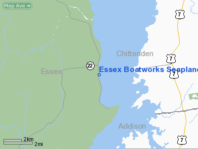
Essex Boatworks Seaplane Base Airport |
Location & QuickFacts
| FAA Information Effective: | 2008-09-25 |
| Airport Identifier: | NY83 |
| Airport Status: | Operational |
| Longitude/Latitude: | 073-20-58.4590W/44-18-00.1840N
-73.349572/44.300051 (Estimated) |
| Elevation: | 95 ft / 28.96 m (Estimated) |
| Land: | 1 acres |
| From nearest city: | 0 nautical miles W of Essex, NY |
| Location: | Essex County, NY |
| Magnetic Variation: | 15W (1985) |
Owner & Manager
| Ownership: | Privately owned |
| Owner: | Todd William Burley |
| Address: | S Main St
Essex, NY 12936 |
| Manager: | Todd Burley |
| Address: | S Main St
Essex, NY 12936 |
| Phone number: | 518-963-8840 |
Airport Operations and Facilities
| Airport Use: | Private |
| Wind indicator: | No |
| Segmented Circle: | No |
| Control Tower: | No |
| Landing fee charge: | No |
| Sectional chart: | Montreal |
| Region: | AEA - Eastern |
| Boundary ARTCC: | ZBW - Boston |
| Tie-in FSS: | BTV - Burlington |
| FSS on Airport: | No |
| FSS Toll Free: | 1-800-WX-BRIEF |
Airport Services
| Fuel available: | 100
MARINE FUEL F/12/15/18 AVBL. |
| Airframe Repair: | MINOR |
| Power Plant Repair: | MINOR |
Runway Information
Runway ALL/WAY
| Dimension: | 15000 x 4000 ft / 4572.0 x 1219.2 m
LNDG AREA 50 MI BY 3 MI ALL DIRECTIONS PSBL. |
| Surface: | WATER, |
| |
Runway ALL |
Runway WAY |
| Traffic Pattern: | Left | Left |
|
Radio Navigation Aids
| ID |
Type |
Name |
Ch |
Freq |
Var |
Dist |
| MPV | FAN MARKER | Brook | | | | 29.8 nm |
| R | FAN MARKER | Chitt | | | 14W | 43.0 nm |
| VKN | NDB | Mount Mansfield | | 268.00 | 16W | 28.7 nm |
| JRV | NDB | Morrisville/stowe | | 375.00 | 16W | 36.7 nm |
| DYO | NDB | Smuto | | 221.00 | 15W | 39.5 nm |
| SLK | VOR/DME | Saranac Lake | 029X | 109.20 | 14W | 37.1 nm |
| MPV | VOR/DME | Montpelier | 045X | 110.80 | 16W | 40.9 nm |
| RUT | VOR/DME | Rutland | 47X | 111.00 | 15W | 49.6 nm |
| BTV | VORTAC | Burlington | 122X | 117.50 | 15W | 9.2 nm |
| PLB | VORTAC | Plattsburgh | 116X | 116.90 | 15W | 24.3 nm |
| BTV | VOT | Burlington Intl | | 109.00 | | 13.2 nm |
Images and information placed above are from
http://www.airport-data.com/airport/NY83/
We thank them for the data!
| General Info
|
| Country |
United States
|
| State |
NEW YORK
|
| FAA ID |
NY83
|
| Latitude |
44-18-00.184N
|
| Longitude |
073-20-58.459W
|
| Elevation |
95 feet
|
| Near City |
ESSEX
|
We don't guarantee the information is fresh and accurate. The data may
be wrong or outdated.
For more up-to-date information please refer to other sources.
|
|


