 |
|
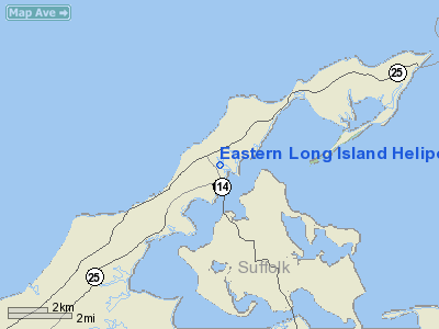
Eastern Long Island Heliport |
Location & QuickFacts
| FAA Information Effective: | 2008-09-25 |
| Airport Identifier: | NK48 |
| Airport Status: | Operational |
| Longitude/Latitude: | 072-21-36.0000W/41-06-35.0000N
-72.360000/41.109722 (Estimated) |
| Elevation: | 6 ft / 1.83 m (Estimated) |
| Land: | 5 acres |
| From nearest city: | 1 nautical miles N of Greenport, NY |
| Location: | Suffolk County, NY |
| Magnetic Variation: | 14W (1985) |
Owner & Manager
| Ownership: | Privately owned |
| Owner: | Eastern Long Island Hosp |
| Address: | 201 Manor Place
Greenport, NY 11944 |
| Phone number: | 516-477-1000 |
| Manager: | Thomas B Doolan |
| Address: | 201 Manor Place
Greenport, NY 11944 |
| Phone number: | 516-477-1000
EXT 100. |
Airport Operations and Facilities
| Airport Use: | Private
MEDICAL USE. |
| Wind indicator: | Yes |
| Segmented Circle: | No |
| Control Tower: | No |
| Sectional chart: | New York |
| Region: | AEA - Eastern |
| Boundary ARTCC: | ZBW - Boston |
| Responsible ARTCC: | ZNY - New York |
| Tie-in FSS: | ISP - New York |
| FSS on Airport: | No |
| FSS Toll Free: | 1-800-WX-BRIEF |
Runway Information
Helipad H1
| Dimension: | 40 x 40 ft / 12.2 x 12.2 m |
| Surface: | CONC, |
| |
Runway H1 |
Runway |
| Traffic Pattern: | Left | Left |
|
Radio Navigation Aids
| ID |
Type |
Name |
Ch |
Freq |
Var |
Dist |
| MMK | NDB | Meriden | | 238.00 | 14W | 32.1 nm |
| HF | NDB | Lomis | | 244.00 | 15W | 33.8 nm |
| OP | NDB | Old Field Point Light | | 316.00 | 13W | 35.3 nm |
| TBY | NDB | Waterbury | | 257.00 | 14W | 43.5 nm |
| FOK | TACAN | Suffolk Co | 047X | | 13W | 20.5 nm |
| GON | VOR/DME | Groton | 45Y | 110.85 | 14W | 19.2 nm |
| MAD | VOR/DME | Madison | 041X | 110.40 | 13W | 19.4 nm |
| CCC | VOR/DME | Calverton | 119X | 117.20 | 13W | 22.7 nm |
| HVN | VOR/DME | New Haven | 035X | 109.80 | 13W | 25.5 nm |
| ORW | VOR/DME | Norwich | 037X | 110.00 | 14W | 31.4 nm |
| HFD | VOR/DME | Hartford | 096X | 114.90 | 13W | 33.0 nm |
| BDR | VOR/DME | Bridgeport | 25X | 108.80 | 12W | 34.7 nm |
| SEY | VOR/DME | Sandy Point | 125X | 117.80 | 15W | 35.7 nm |
| DPK | VOR/DME | Deer Park | 124X | 117.70 | 12W | 46.9 nm |
| HTO | VORTAC | Hampton | 083X | 113.60 | 13W | 11.6 nm |
| GON | VOT | Groton | | 110.25 | | 19.1 nm |
| BDR | VOT | Bridgeport | | 109.25 | | 34.8 nm |
| ISP | VOT | Long Island Mac Arthur | | 109.40 | | 38.5 nm |
| HFD | VOT | Hartford | | 108.20 | | 39.8 nm |
Remarks
Images and information placed above are from
http://www.airport-data.com/airport/NK48/
We thank them for the data!
| General Info
|
| Country |
United States
|
| State |
NEW YORK
|
| FAA ID |
NK48
|
| Latitude |
41-06-41.356N
|
| Longitude |
072-20-08.297W
|
| Elevation |
6 feet
|
| Near City |
GREENPORT
|
We don't guarantee the information is fresh and accurate. The data may
be wrong or outdated.
For more up-to-date information please refer to other sources.
|
|


