 |
|
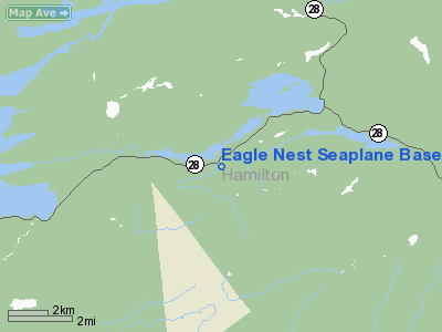
Eagle Nest Seaplane Base Airport |
Location & QuickFacts
| FAA Information Effective: | 2008-09-25 |
| Airport Identifier: | NY61 |
| Airport Status: | Operational |
| Longitude/Latitude: | 074-29-43.5800W/43-49-47.2290N
-74.495439/43.829786 (Estimated) |
| Elevation: | 1790 ft / 545.59 m (Estimated) |
| Land: | 0 acres |
| From nearest city: | 3 nautical miles SW of Blue Mountain Lake, NY |
| Location: | Hamilton County, NY |
| Magnetic Variation: | 14W (1985) |
Owner & Manager
| Ownership: | Privately owned |
| Owner: | Eagle Nest Corp |
| Address: |
Blue Mountain Lake, NY 12812 |
| Phone number: | 518-352-7334 |
| Manager: | Albert Blanchard |
| Address: |
Blue Mountain Lake, NY 12812 |
| Phone number: | 518-352-7334 |
Airport Operations and Facilities
| Airport Use: | Private |
| Wind indicator: | Yes |
| Segmented Circle: | No |
| Control Tower: | No |
| Landing fee charge: | No |
| Sectional chart: | New York |
| Region: | AEA - Eastern |
| Boundary ARTCC: | ZBW - Boston |
| Tie-in FSS: | BUF - Buffalo |
| FSS on Airport: | No |
| FSS Toll Free: | 1-800-WX-BRIEF |
Airport Services
| Airframe Repair: | NONE |
| Power Plant Repair: | NONE |
Runway Information
Runway E/W
| Dimension: | 10000 x 700 ft / 3048.0 x 213.4 m |
| Surface: | WATER, |
| |
Runway E |
Runway W |
| Traffic Pattern: | Left | Left |
|
Radio Navigation Aids
| ID |
Type |
Name |
Ch |
Freq |
Var |
Dist |
| SLK | VOR/DME | Saranac Lake | 029X | 109.20 | 14W | 35.6 nm |
| GFL | VORTAC | Glens Falls | 039X | 110.20 | 14W | 48.4 nm |
Remarks
Images and information placed above are from
http://www.airport-data.com/airport/NY61/
We thank them for the data!
| General Info
|
| Country |
United States
|
| State |
NEW YORK
|
| FAA ID |
NY61
|
| Latitude |
43-49-47.229N
|
| Longitude |
074-29-43.580W
|
| Elevation |
1790 feet
|
| Near City |
BLUE MOUNTAIN LAKE
|
We don't guarantee the information is fresh and accurate. The data may
be wrong or outdated.
For more up-to-date information please refer to other sources.
|
|


