 |
|
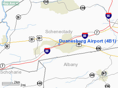
Location & QuickFacts
| FAA Information Effective: | 2008-09-25 |
| Airport Identifier: | 4B1 |
| Airport Status: | Operational |
| Longitude/Latitude: | 074-07-58.4570W/42-45-30.2720N
-74.132905/42.758409 (Estimated) |
| Elevation: | 710 ft / 216.41 m (Estimated) |
| Land: | 30 acres |
| From nearest city: | 0 nautical miles S of Duanesburg, NY |
| Location: | Schenectady County, NY |
| Magnetic Variation: | 14W (1985) |
Owner & Manager
| Ownership: | Privately owned |
| Owner: | Duanesburg Avn Corp |
| Address: | Po Box 131
Duanesburg, NY 12056 |
| Phone number: | 518-895-8900 |
| Manager: | Robt. Rawlings |
| Address: | Po Box 131
Duanesburg, NY 12056 |
| Phone number: | 518-895-8140 |
Airport Operations and Facilities
| Airport Use: | Open to public |
| Wind indicator: | Yes |
| Segmented Circle: | No |
| Control Tower: | No |
| Landing fee charge: | No |
| Sectional chart: | New York |
| Region: | AEA - Eastern |
| Traffic Pattern Alt: | 800 ft |
| Boundary ARTCC: | ZBW - Boston |
| Tie-in FSS: | BTV - Burlington |
| FSS on Airport: | No |
| FSS Toll Free: | 1-800-WX-BRIEF |
| NOTAMs Facility: | BTV (NOTAM-d service avaliable) |
| Federal Agreements: | N |
Airport Communications
| CTAF: | 123.000 |
| Unicom: | 123.000 |
Airport Services
| Airframe Repair: | NONE |
| Power Plant Repair: | NONE |
| Bottled Oxygen: | NONE |
| Bulk Oxygen: | NONE |
Runway Information
Runway 10/28
| Dimension: | 2600 x 45 ft / 792.5 x 13.7 m |
| Surface: | ASPH, Poor Condition
BROKEN ASPH AND MAY HAVE LOOSE MATERIAL, CHECK WITH ARPT MANAGEMENT FOR CURRENT CONDITION AT 518-895-4184. |
| |
Runway 10 |
Runway 28 |
| Traffic Pattern: | Left | Left |
| Markings: | None, | None, |
| Runway End Identifier: | No | No |
| Centerline Lights: | No | No |
| Touchdown Lights: | No | No |
| Obstruction: | 30 ft tree, 240.0 ft from runway, 1:1 slope to clear
RY 10 +6 FT VEHICLE ON ROAD 151 FT FM THLD. | 60 ft trees, 200.0 ft from runway, 125 ft right of centerline
+20 FT HILL AT RY END; 80 FT R. |
|
Radio Navigation Aids
| ID |
Type |
Name |
Ch |
Freq |
Var |
Dist |
| PSF | FAN MARKER | Abyss | | | 13W | 44.6 nm |
| HEU | NDB | Hunter | | 356.00 | 14W | 10.4 nm |
| JJH | NDB | Johnstown | | 523.00 | 14W | 16.9 nm |
| PFH | NDB | Philmont | | 272.00 | 13W | 35.4 nm |
| DXT | NDB | Dalton | | 370.00 | 15W | 46.0 nm |
| GBR | NDB | Great Barrington | | 395.00 | 14W | 47.3 nm |
| CAM | VOR/DME | Cambridge | 097X | 115.00 | 14W | 37.5 nm |
| ALB | VORTAC | Albany | 100X | 115.30 | 13W | 14.6 nm |
| GFL | VORTAC | Glens Falls | 039X | 110.20 | 14W | 41.9 nm |
| UCA | VORTAC | Utica | 049X | 111.20 | 12W | 48.2 nm |
| ALB | VOT | Albany County | | 108.20 | | 13.8 nm |
Remarks
- WET SPOTS DEFINED BY CONE MARKERS/IN SPRING/.
- RY 10 SAFETYAREA HAS -20 FT SLOPE 25 FT FM THLD.
- NON COMPLIANCE WITH FAR 157.
Images and information placed above are from
http://www.airport-data.com/airport/4B1/
We thank them for the data!
| General Info
|
| Country |
United States
|
| State |
NEW YORK
|
| FAA ID |
4B1
|
| Latitude |
42-45-30.272N
|
| Longitude |
074-07-58.457W
|
| Elevation |
710 feet
|
| Near City |
DUANESBURG
|
We don't guarantee the information is fresh and accurate. The data may
be wrong or outdated.
For more up-to-date information please refer to other sources.
|
|


