 |
|
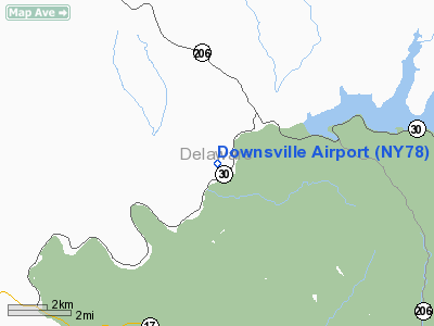
Location & QuickFacts
| FAA Information Effective: | 2008-09-25 |
| Airport Identifier: | NY78 |
| Airport Status: | Operational |
| Longitude/Latitude: | 075-01-13.5930W/42-03-30.3130N
-75.020443/42.058420 (Estimated) |
| Elevation: | 1087 ft / 331.32 m (Estimated) |
| Land: | 15 acres |
| From nearest city: | 2 nautical miles SW of Downsville, NY |
| Location: | Delaware County, NY |
| Magnetic Variation: | 13W (1985) |
Owner & Manager
| Ownership: | Privately owned |
| Owner: | H. B. Klindt |
| Address: | Box A
Downsville, NY 13755 |
| Phone number: | 607-363-7253 |
| Manager: | H. B. Klindt |
| Address: | Box A
Downsville, NY 13755 |
| Phone number: | 607-363-7253 |
Airport Operations and Facilities
| Airport Use: | Private |
| Wind indicator: | Yes |
| Segmented Circle: | No |
| Control Tower: | No |
| Landing fee charge: | No |
| Sectional chart: | New York |
| Region: | AEA - Eastern |
| Boundary ARTCC: | ZBW - Boston |
| Tie-in FSS: | BUF - Buffalo |
| FSS on Airport: | No |
| FSS Toll Free: | 1-800-WX-BRIEF |
Airport Services
| Airframe Repair: | NONE |
| Power Plant Repair: | NONE |
Runway Information
Runway 06/24
| Dimension: | 2700 x 75 ft / 823.0 x 22.9 m |
| Surface: | TURF, |
| |
Runway 06 |
Runway 24 |
| Traffic Pattern: | Left | Left |
|
Radio Navigation Aids
| ID |
Type |
Name |
Ch |
Freq |
Var |
Dist |
| MS | NDB | Monga | | 359.00 | 12W | 18.9 nm |
| SW | NDB | Neely | | 335.00 | 14W | 49.5 nm |
| DNY | VOR/DME | De Lancey | 058X | 112.10 | 11W | 7.7 nm |
| HNK | VOR/DME | Hancock | 115X | 116.80 | 11W | 13.2 nm |
| RKA | VOR/DME | Rockdale | 073X | 112.60 | 11W | 26.4 nm |
| HUO | VOR/DME | Huguenot | 108X | 116.10 | 11W | 43.5 nm |
| LHY | VORTAC | Lake Henry | 045X | 110.80 | 10W | 40.7 nm |
Remarks
- TREES BOTH RY ENDS.
- EXISTED PRIOR TO 1959.
Images and information placed above are from
http://www.airport-data.com/airport/NY78/
We thank them for the data!
| General Info
|
| Country |
United States
|
| State |
NEW YORK
|
| FAA ID |
NY78
|
| Latitude |
42-03-30.313N
|
| Longitude |
075-01-13.593W
|
| Elevation |
1087 feet
|
| Near City |
DOWNSVILLE
|
We don't guarantee the information is fresh and accurate. The data may
be wrong or outdated.
For more up-to-date information please refer to other sources.
|
|


