 |
|
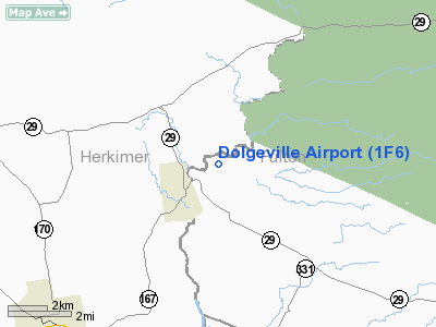
Location & QuickFacts
| FAA Information Effective: | 2008-09-25 |
| Airport Identifier: | 1F6 |
| Airport Status: | Operational |
| Longitude/Latitude: | 074-44-58.5350W/43-07-00.2530N
-74.749593/43.116737 (Estimated) |
| Elevation: | 945 ft / 288.04 m (Estimated) |
| Land: | 10 acres |
| From nearest city: | 1 nautical miles NE of Dolgeville, NY |
| Location: | Fulton County, NY |
| Magnetic Variation: | 13W (1985) |
Owner & Manager
| Ownership: | Privately owned |
| Owner: | Dolgeville Atheletic Assn |
| Address: | 139 Lottville Road
Dolgeville, NY 13329 |
| Phone number: | 315-429-3341 |
| Manager: | Wilson Dodge |
| Address: | 139 Lottville Road
Dolgeville, NY 13329 |
| Phone number: | 315-429-3341 |
Airport Operations and Facilities
| Airport Use: | Open to public |
| Wind indicator: | Yes |
| Segmented Circle: | No |
| Control Tower: | No |
| Landing fee charge: | No |
| Sectional chart: | New York |
| Region: | AEA - Eastern |
| Boundary ARTCC: | ZBW - Boston |
| Tie-in FSS: | BUF - Buffalo |
| FSS on Airport: | No |
| FSS Toll Free: | 1-800-WX-BRIEF |
| NOTAMs Facility: | BUF (NOTAM-d service avaliable) |
Airport Communications
Airport Services
| Airframe Repair: | NONE |
| Power Plant Repair: | NONE |
Runway Information
Runway 11/29
| Dimension: | 1360 x 100 ft / 414.5 x 30.5 m |
| Surface: | TURF, Good Condition
SOFT & WET DURING SPRING. |
| |
Runway 11 |
Runway 29 |
| Traffic Pattern: | Left | Left |
| Markings: | None, | None, |
| Obstruction: | 15 ft road, 70.0 ft from runway, 4:1 slope to clear | 80 ft trees, 351.0 ft from runway, 62 ft right of centerline, 4:1 slope to clear |
|
Radio Navigation Aids
| ID |
Type |
Name |
Ch |
Freq |
Var |
Dist |
| JJH | NDB | Johnstown | | 523.00 | 14W | 19.6 nm |
| CJY | NDB | Clay | | 275.00 | 12W | 22.9 nm |
| BK | NDB | Plein | | 329.00 | 12W | 32.8 nm |
| HEU | NDB | Hunter | | 356.00 | 14W | 39.2 nm |
| GSS | TACAN | Griffiss | 057X | | 12W | 29.8 nm |
| RKA | VOR/DME | Rockdale | 073X | 112.60 | 11W | 44.7 nm |
| UCA | VORTAC | Utica | 049X | 111.20 | 12W | 19.0 nm |
| ALB | VORTAC | Albany | 100X | 115.30 | 13W | 47.2 nm |
| ALB | VOT | Albany County | | 108.20 | | 46.6 nm |
Remarks
- RY 11 IS PART OF A PLAYING FLD. ATHLETICS MAY BE GOING ON FM AUG TO NOV.
- RADIO CTL AIRPLANES IN VICINITY OF RY THROUGHOUT THE YEAR.
- RWY 11/29 EDGES NOT CLEARLY DEFINED.
- VFR OPERNS ONLY.
Images and information placed above are from
http://www.airport-data.com/airport/1F6/
We thank them for the data!
| General Info
|
| Country |
United States
|
| State |
NEW YORK
|
| FAA ID |
1F6
|
| Latitude |
43-07-00.253N
|
| Longitude |
074-44-58.535W
|
| Elevation |
945 feet
|
| Near City |
DOLGEVILLE
|
We don't guarantee the information is fresh and accurate. The data may
be wrong or outdated.
For more up-to-date information please refer to other sources.
|
|


