 |
|
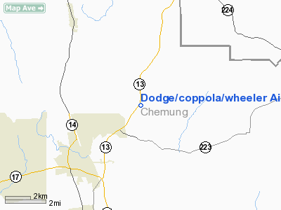
Dodge/coppola/wheeler Airport |
Location & QuickFacts
| FAA Information Effective: | 2008-09-25 |
| Airport Identifier: | NK53 |
| Airport Status: | Operational |
| Longitude/Latitude: | 076-46-13.8330W/42-12-20.2690N
-76.770509/42.205630 (Estimated) |
| Elevation: | 1030 ft / 313.94 m (Estimated) |
| Land: | 40 acres |
| From nearest city: | 4 nautical miles SW of Sullivanville, NY |
| Location: | Chemung County, NY |
| Magnetic Variation: | 11W (1985) |
Owner & Manager
| Ownership: | Privately owned |
| Owner: | M. C. Dodge/r. Coppola |
| Address: | 3025 Vargord
Horseheads, NY 14845 |
| Phone number: | 607-732-1490 |
| Manager: | M. C. Dodge |
| Address: | 3025 Vargord
Horseheads, NY 14845 |
| Phone number: | 607-732-1490 |
Airport Operations and Facilities
| Airport Use: | Private |
| Wind indicator: | Yes |
| Segmented Circle: | No |
| Control Tower: | No |
| Landing fee charge: | No |
| Sectional chart: | New York |
| Region: | AEA - Eastern |
| Boundary ARTCC: | ZNY - New York |
| Tie-in FSS: | BUF - Buffalo |
| FSS on Airport: | No |
| FSS Toll Free: | 1-800-WX-BRIEF |
Runway Information
Runway 05/23
| Dimension: | 1000 x 75 ft / 304.8 x 22.9 m |
| Surface: | TURF, |
| |
Runway 05 |
Runway 23 |
| Traffic Pattern: | Left | Left |
|
Runway 05U/23U
| Dimension: | 550 x 100 ft / 167.6 x 30.5 m |
| Surface: | TURF, |
| |
Runway 05U |
Runway 23U |
| Traffic Pattern: | Left | Left |
|
Radio Navigation Aids
| ID |
Type |
Name |
Ch |
Freq |
Var |
Dist |
| ALP | NDB | Alpine | | 245.00 | 12W | 2.0 nm |
| PYA | NDB | Penn Yan | | 260.00 | 12W | 29.2 nm |
| ULW | VOR/DME | Elmira | 033Y | 109.65 | 12W | 13.2 nm |
| ITH | VOR/DME | Ithaca | 055X | 111.80 | 10W | 22.2 nm |
| SFK | VOR/DME | Stonyfork | 023X | 108.60 | 08W | 42.2 nm |
| CFB | VORTAC | Binghamton | 059X | 112.20 | 10W | 28.4 nm |
Remarks
- PROVIDED PLINE PARALLEL TO HIGHWAY 13 IS MARKED.
Images and information placed above are from
http://www.airport-data.com/airport/NK53/
We thank them for the data!
| General Info
|
| Country |
United States
|
| State |
NEW YORK
|
| FAA ID |
NK53
|
| Latitude |
42-12-20.269N
|
| Longitude |
076-46-13.833W
|
| Elevation |
1030 feet
|
| Near City |
SULLIVANVILLE
|
We don't guarantee the information is fresh and accurate. The data may
be wrong or outdated.
For more up-to-date information please refer to other sources.
|
|


