 |
|
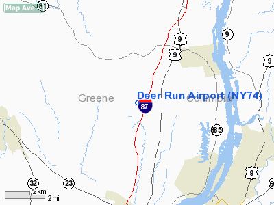
Location & QuickFacts
| FAA Information Effective: | 2008-09-25 |
| Airport Identifier: | NY74 |
| Airport Status: | Operational |
| Longitude/Latitude: | 073-52-23.4600W/42-19-25.3060N
-73.873183/42.323696 (Estimated) |
| Elevation: | 320 ft / 97.54 m (Estimated) |
| Land: | 0 acres |
| From nearest city: | 3 nautical miles SW of Coxsackie, NY |
| Location: | Greene County, NY |
| Magnetic Variation: | 14W (1985) |
Owner & Manager
| Ownership: | Privately owned |
| Owner: | Herman Sameisky |
| Address: | Rd 1 Box 57a Limestreet Rd
Coxsackie, NEW YORK 12051 |
| Phone number: | 518-945-1894 |
| Address: |
|
Airport Operations and Facilities
| Airport Use: | Private |
| Wind indicator: | No |
| Segmented Circle: | No |
| Control Tower: | No |
| Landing fee charge: | No |
| Sectional chart: | New York |
| Region: | AEA - Eastern |
| Boundary ARTCC: | ZBW - Boston |
| Tie-in FSS: | BTV - Burlington |
| FSS on Airport: | No |
| FSS Toll Free: | 1-800-WX-BRIEF |
Airport Services
| Airframe Repair: | NONE |
| Power Plant Repair: | NONE |
Runway Information
Runway 02/20
| Dimension: | 2450 x 50 ft / 746.8 x 15.2 m |
| Surface: | TURF, |
| |
Runway 02 |
Runway 20 |
| Traffic Pattern: | Left | Left |
|
Radio Navigation Aids
| ID |
Type |
Name |
Ch |
Freq |
Var |
Dist |
| GBR | FAN MARKER | Sheffield | | | 13W | 25.6 nm |
| PSF | FAN MARKER | Abyss | | | 13W | 30.3 nm |
| SKU | FAN MARKER | Stanwyck | | | 12W | 48.4 nm |
| PFH | NDB | Philmont | | 272.00 | 13W | 7.9 nm |
| GBR | NDB | Great Barrington | | 395.00 | 14W | 22.5 nm |
| HEU | NDB | Hunter | | 356.00 | 14W | 31.9 nm |
| DXT | NDB | Dalton | | 370.00 | 15W | 32.4 nm |
| PO | NDB | Meier | | 403.00 | 12W | 45.2 nm |
| JJH | NDB | Johnstown | | 523.00 | 14W | 45.4 nm |
| SKU | NDB | Stanwyck | | 261.00 | 12W | 48.4 nm |
| PWL | VOR/DME | Pawling | 090X | 114.30 | 12W | 35.4 nm |
| IGN | VOR/DME | Kingston | 123X | 117.60 | 12W | 39.6 nm |
| CTR | VOR/DME | Chester | 098X | 115.10 | 13W | 41.1 nm |
| CAM | VOR/DME | Cambridge | 097X | 115.00 | 14W | 46.6 nm |
| DNY | VOR/DME | De Lancey | 058X | 112.10 | 11W | 49.0 nm |
| ALB | VORTAC | Albany | 100X | 115.30 | 13W | 25.6 nm |
| ALB | VOT | Albany County | | 108.20 | | 25.3 nm |
Remarks
- TREES BOTH SIDES OF RWY 02/20 & 300' SOUTH.
- VFR USE ONLY
Images and information placed above are from
http://www.airport-data.com/airport/NY74/
We thank them for the data!
| General Info
|
| Country |
United States
|
| State |
NEW YORK
|
| FAA ID |
NY74
|
| Latitude |
42-19-25.306N
|
| Longitude |
073-52-23.460W
|
| Elevation |
320 feet
|
| Near City |
COXSACKIE
|
We don't guarantee the information is fresh and accurate. The data may
be wrong or outdated.
For more up-to-date information please refer to other sources.
|
|


