 |
|
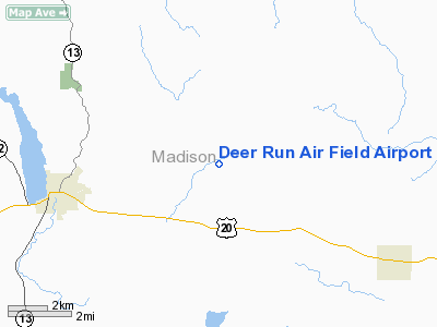
Deer Run Air Field Airport |
Location & QuickFacts
| FAA Information Effective: | 2008-09-25 |
| Airport Identifier: | 7NK1 |
| Airport Status: | Operational |
| Longitude/Latitude: | 075-45-13.0000W/42-56-35.0000N
-75.753611/42.943056 (Estimated) |
| Elevation: | 1725 ft / 525.78 m (Estimated) |
| Land: | 26 acres |
| From nearest city: | 2 nautical miles NE of Nelson, NY |
| Location: | Madison County, NY |
| Magnetic Variation: | 13W (1995) |
Owner & Manager
| Ownership: | Privately owned |
| Owner: | William O. Groetz |
| Address: | 4051 Argos Rd
Cazenovia, NY 13035 |
| Phone number: | 315-655-4626 |
| Manager: | William O. Groetz |
| Address: | 4051 Argos Rd
Cazenovia, NY 13035 |
| Phone number: | 315-655-4626 |
Airport Operations and Facilities
| Airport Use: | Private |
| Wind indicator: | Yes |
| Segmented Circle: | No |
| Control Tower: | No |
| Sectional chart: | New York |
| Region: | AEA - Eastern |
| Boundary ARTCC: | ZBW - Boston |
| Tie-in FSS: | BUF - Buffalo |
| FSS Toll Free: | 1-800-WX-BRIEF |
Airport Communications
Runway Information
Runway 01/19
| Dimension: | 2400 x 50 ft / 731.5 x 15.2 m |
| Surface: | TURF, Good Condition |
| |
Runway 01 |
Runway 19 |
| Traffic Pattern: | Left | Left |
|
Radio Navigation Aids
| ID |
Type |
Name |
Ch |
Freq |
Var |
Dist |
| BK | NDB | Plein | | 329.00 | 12W | 20.6 nm |
| CJY | NDB | Clay | | 275.00 | 12W | 22.5 nm |
| GSS | TACAN | Griffiss | 057X | | 12W | 23.0 nm |
| RKA | VOR/DME | Rockdale | 073X | 112.60 | 11W | 36.6 nm |
| ITH | VOR/DME | Ithaca | 055X | 111.80 | 10W | 41.2 nm |
| GGT | VORTAC | Georgetown | 125X | 117.80 | 11W | 9.8 nm |
| SYR | VORTAC | Syracuse | 117X | 117.00 | 11W | 23.7 nm |
| UCA | VORTAC | Utica | 049X | 111.20 | 12W | 26.4 nm |
Remarks
- PRVDD IFR ONLY, CLEAR 20:1 APCH/DEP PATH, RY PRIMARY SFC 125 FT, RECOMMENDED THAT HANGAR AT RY 10 BE LGTD.
Images and information placed above are from
http://www.airport-data.com/airport/7NK1/
We thank them for the data!
| General Info
|
| Country |
United States
|
| State |
NEW YORK
|
| FAA ID |
7NK1
|
| Latitude |
42-56-35.000N
|
| Longitude |
075-45-13.000W
|
| Elevation |
1725 feet
|
| Near City |
NELSON
|
We don't guarantee the information is fresh and accurate. The data may
be wrong or outdated.
For more up-to-date information please refer to other sources.
|
|


