 |
|
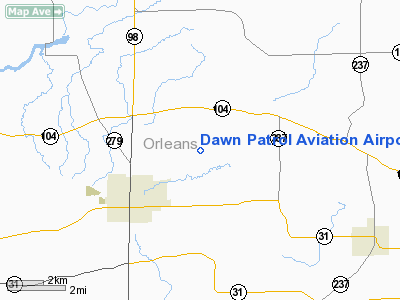
Dawn Patrol Aviation Airport |
Location & QuickFacts
| FAA Information Effective: | 2008-09-25 |
| Airport Identifier: | NK31 |
| Airport Status: | Operational |
| Longitude/Latitude: | 078-08-43.0700W/43-16-10.2110N
-78.145297/43.269503 (Estimated) |
| Elevation: | 480 ft / 146.30 m (Estimated) |
| Land: | 4 acres |
| From nearest city: | 2 nautical miles SW of Albion, NY |
| Location: | Orleans County, NY |
| Magnetic Variation: | 10W (1985) |
Owner & Manager
| Ownership: | Privately owned |
| Owner: | Edward Paul Steuber |
| Address: | 3049 Lattin Road
Albion, NY 14411 |
| Phone number: | 716-589-6882 |
| Manager: | Edward Paul Steuber |
| Address: | 3049 Lattin Road
Albion, NY 14411 |
| Phone number: | 716-589-6882 |
Airport Operations and Facilities
| Airport Use: | Private |
| Wind indicator: | Yes |
| Segmented Circle: | No |
| Control Tower: | No |
| Sectional chart: | Detroit |
| Region: | AEA - Eastern |
| Boundary ARTCC: | ZOB - Cleveland |
| Tie-in FSS: | BUF - Buffalo |
| FSS on Airport: | No |
| FSS Toll Free: | 1-800-WX-BRIEF |
Runway Information
Runway 09/27
| Dimension: | 1450 x 60 ft / 442.0 x 18.3 m |
| Surface: | TURF, |
| |
Runway 09 |
Runway 27 |
| Traffic Pattern: | Left | Left |
| Displaced threshold: | 550.00 ft | 0.00 ft |
|
Radio Navigation Aids
| ID |
Type |
Name |
Ch |
Freq |
Var |
Dist |
| AVN | NDB | Avon | | 344.00 | 09W | 22.7 nm |
| SN | NDB | St Catherines | | 408.00 | 01E | 49.2 nm |
| IAG | TACAN | Niagara Falls | 047X | | 10W | 36.9 nm |
| BUF | VOR/DME | Buffalo | 111X | 116.40 | 08W | 30.0 nm |
| GEE | VOR/DME | Geneseo | 019X | 108.20 | 09W | 31.8 nm |
| ROC | VORTAC | Rochester | 037X | 110.00 | 09W | 22.5 nm |
| BUF | VOT | Buffalo | | 109.00 | | 32.6 nm |
Remarks
- OWNER DESIRES ARPT NOT BE CHARTED.
- PRVDD VFR DALGT OPNS ONLY; RY 09 DSPLCD 550' AND PROPERLY MKD.
Images and information placed above are from
http://www.airport-data.com/airport/NK31/
We thank them for the data!
| General Info
|
| Country |
United States
|
| State |
NEW YORK
|
| FAA ID |
NK31
|
| Latitude |
43-16-10.211N
|
| Longitude |
078-08-43.070W
|
| Elevation |
480 feet
|
| Near City |
ALBION
|
We don't guarantee the information is fresh and accurate. The data may
be wrong or outdated.
For more up-to-date information please refer to other sources.
|
|


