 |
|
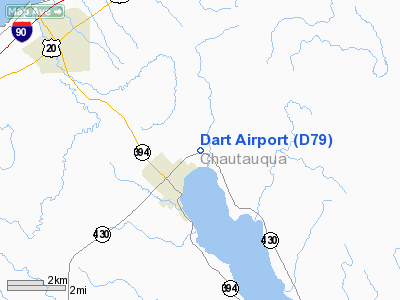
Location & QuickFacts
| FAA Information Effective: | 2008-09-25 |
| Airport Identifier: | D79 |
| Airport Status: | Operational |
| Longitude/Latitude: | 079-28-54.1680W/42-16-05.2080N
-79.481713/42.268113 (Estimated) |
| Elevation: | 1330 ft / 405.38 m (Estimated) |
| Land: | 209 acres |
| From nearest city: | 2 nautical miles E of Mayville, NY |
| Location: | Chautauqua County, NY |
| Magnetic Variation: | 09W (1985) |
Owner & Manager
| Ownership: | Privately owned |
| Owner: | Robert G. Dart |
| Address: | Po Box 211
Mayville, NY 14757 |
| Phone number: | 716-753-2160 |
| Manager: | Robert G. Dart |
| Address: | Po Box 211
Mayville, NY 14757 |
| Phone number: | 716-753-2160 |
Airport Operations and Facilities
| Airport Use: | Open to public |
| Wind indicator: | Yes |
| Segmented Circle: | No |
| Control Tower: | No |
| Landing fee charge: | No |
| Sectional chart: | Detroit |
| Region: | AEA - Eastern |
| Traffic Pattern Alt: | 800 ft |
| Boundary ARTCC: | ZOB - Cleveland |
| Tie-in FSS: | BUF - Buffalo |
| FSS on Airport: | No |
| FSS Toll Free: | 1-800-WX-BRIEF |
| NOTAMs Facility: | BUF (NOTAM-d service avaliable) |
Airport Communications
Airport Services
| Airframe Repair: | NONE |
| Power Plant Repair: | NONE |
| Bottled Oxygen: | NONE |
| Bulk Oxygen: | NONE |
Runway Information
Runway 06/24
| Dimension: | 1840 x 80 ft / 560.8 x 24.4 m |
| Surface: | TURF, Good Condition |
| |
Runway 06 |
Runway 24 |
| Traffic Pattern: | Left | Left |
| Obstruction: | 46 ft tree, 103 ft left of centerline | 30 ft pline, 51.0 ft from runway, 1:1 slope to clear |
|
Runway 13/31
| Dimension: | 2750 x 60 ft / 838.2 x 18.3 m |
| Surface: | TURF, Good Condition |
| |
Runway 13 |
Runway 31 |
| Traffic Pattern: | Left | Left |
| Obstruction: | 47 ft pline, 82.0 ft from runway, 112 ft left of centerline, 1:1 slope to clear | 30 ft pline, 45.0 ft from runway, 52 ft right of centerline, 1:1 slope to clear |
|
Radio Navigation Aids
| ID |
Type |
Name |
Ch |
Freq |
Var |
Dist |
| ORJ | NDB | Corry | | 258.00 | 09W | 22.6 nm |
| CQD | NDB | Cascade | | 372.00 | 08W | 29.1 nm |
| JHW | VOR/DME | Jamestown | 094X | 114.70 | 07W | 16.7 nm |
| BFD | VOR/DME | Bradford | 113X | 116.60 | 07W | 48.2 nm |
| DKK | VORTAC | Dunkirk | 109X | 116.20 | 07W | 16.2 nm |
| TDT | VORTAC | Tidioute | 123X | 117.60 | 09W | 33.5 nm |
| ERI | VORTAC | Erie | 031X | 109.40 | 06W | 39.2 nm |
Remarks
- EXTSV GLIDER OPNS ON & INVOF ARPT.
- ULTRALIGHT ACTIVITY ON & INVOF ARPT.
Images and information placed above are from
http://www.airport-data.com/airport/D79/
We thank them for the data!
| General Info
|
| Country |
United States
|
| State |
NEW YORK
|
| FAA ID |
D79
|
| Latitude |
42-16-05.208N
|
| Longitude |
079-28-54.168W
|
| Elevation |
1330 feet
|
| Near City |
MAYVILLE
|
We don't guarantee the information is fresh and accurate. The data may
be wrong or outdated.
For more up-to-date information please refer to other sources.
|
|


