 |
|
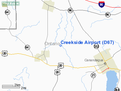
Location & QuickFacts
| FAA Information Effective: | 2008-09-25 |
| Airport Identifier: | D67 |
| Airport Status: | Operational |
| Longitude/Latitude: | 077-22-56.9570W/42-54-58.2300N
-77.382488/42.916175 (Estimated) |
| Elevation: | 820 ft / 249.94 m (Estimated) |
| Land: | 10 acres |
| From nearest city: | 2 nautical miles NE of Holcomb, NY |
| Location: | Ontario County, NY |
| Magnetic Variation: | 11W (1985) |
Owner & Manager
| Ownership: | Privately owned |
| Owner: | W.b. Creekside, Llc. |
| Address: | 783 County Road 42
Fishers, NY 14453 |
| Phone number: | 585-924-5200 |
| Manager: | Gary L. Pooler |
| Address: | 783 County Road 42
Fishers, NY 14453 |
| Phone number: | 585-924-5200 |
Airport Operations and Facilities
| Airport Use: | Open to public |
| Wind indicator: | Yes |
| Segmented Circle: | No |
| Control Tower: | No |
| Landing fee charge: | No |
| Sectional chart: | Detroit |
| Region: | AEA - Eastern |
| Boundary ARTCC: | ZOB - Cleveland |
| Tie-in FSS: | BUF - Buffalo |
| FSS on Airport: | No |
| FSS Toll Free: | 1-800-WX-BRIEF |
| NOTAMs Facility: | BUF (NOTAM-d service avaliable) |
Airport Communications
Airport Services
| Airframe Repair: | NONE |
| Power Plant Repair: | NONE |
Runway Information
Runway 15/33
| Dimension: | 1245 x 25 ft / 379.5 x 7.6 m |
| Surface: | ASPH-TRTD, |
| |
Runway 15 |
Runway 33 |
| Traffic Pattern: | Left | Left |
|
Radio Navigation Aids
| ID |
Type |
Name |
Ch |
Freq |
Var |
Dist |
| AVN | NDB | Avon | | 344.00 | 09W | 17.9 nm |
| PYA | NDB | Penn Yan | | 260.00 | 12W | 21.8 nm |
| ALP | NDB | Alpine | | 245.00 | 12W | 49.1 nm |
| GEE | VOR/DME | Geneseo | 019X | 108.20 | 09W | 16.2 nm |
| ITH | VOR/DME | Ithaca | 055X | 111.80 | 10W | 48.0 nm |
| ROC | VORTAC | Rochester | 037X | 110.00 | 09W | 17.7 nm |
Remarks
- PLINES ON WEST SIDE OF ARPT ENTRANCE ROAD.
- (137-1) PLINE E OF RWY.
Images and information placed above are from
http://www.airport-data.com/airport/D67/
We thank them for the data!
| General Info
|
| Country |
United States
|
| State |
NEW YORK
|
| FAA ID |
D67
|
| Latitude |
42-54-58.230N
|
| Longitude |
077-22-56.957W
|
| Elevation |
820 feet
|
| Near City |
HOLCOMB
|
We don't guarantee the information is fresh and accurate. The data may
be wrong or outdated.
For more up-to-date information please refer to other sources.
|
|


