 |
|
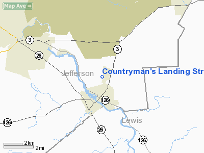
Countryman's Landing Strip Airport |
Location & QuickFacts
| FAA Information Effective: | 2008-09-25 |
| Airport Identifier: | NK01 |
| Airport Status: | Operational |
| Longitude/Latitude: | 075-36-17.6940W/43-59-58.2440N
-75.604915/43.999512 (Estimated) |
| Elevation: | 790 ft / 240.79 m (Estimated) |
| Land: | 100 acres |
| From nearest city: | 1 nautical miles N of Carthage, NY |
| Location: | Jefferson County, NY |
| Magnetic Variation: | 13W (1985) |
Owner & Manager
| Ownership: | Privately owned |
| Owner: | Edgar Countryman |
| Address: | 23009 Alexandria St Road
Carthage, NY 13619 |
| Phone number: | 315-493-3128 |
| Manager: | Edgar Countryman |
| Address: | 23009 Alexandria St Road
Carthage, NY 13619 |
| Phone number: | 315-493-3128 |
Airport Operations and Facilities
| Airport Use: | Private |
| Wind indicator: | Yes |
| Segmented Circle: | No |
| Control Tower: | No |
| Lighting Schedule: | PHONE REQ
FOR ROTG BCN CALL 315-493-3128. |
| Beacon Color: | Clear (unlighted land airport) |
| Landing fee charge: | No |
| Sectional chart: | New York |
| Region: | AEA - Eastern |
| Boundary ARTCC: | ZBW - Boston |
| Tie-in FSS: | BTV - Burlington |
| FSS on Airport: | No |
| FSS Toll Free: | 1-800-WX-BRIEF |
Runway Information
Runway 11/29
| Dimension: | 1800 x 150 ft / 548.6 x 45.7 m |
| Surface: | TURF, |
| |
Runway 11 |
Runway 29 |
| Traffic Pattern: | Left | Left |
|
Radio Navigation Aids
| ID |
Type |
Name |
Ch |
Freq |
Var |
Dist |
| GTB | NDB | Drum | | 257.00 | 13W | 7.0 nm |
| BK | NDB | Plein | | 329.00 | 12W | 47.0 nm |
| GSS | TACAN | Griffiss | 057X | | 12W | 46.9 nm |
| ART | VORTAC | Watertown | 035X | 109.80 | 12W | 20.1 nm |
Images and information placed above are from
http://www.airport-data.com/airport/NK01/
We thank them for the data!
| General Info
|
| Country |
United States
|
| State |
NEW YORK
|
| FAA ID |
NK01
|
| Latitude |
43-59-58.244N
|
| Longitude |
075-36-17.694W
|
| Elevation |
790 feet
|
| Near City |
CARTHAGE
|
We don't guarantee the information is fresh and accurate. The data may
be wrong or outdated.
For more up-to-date information please refer to other sources.
|
|


