 |
|
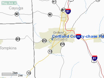
Cortland County-chase Field Airport |
Location & QuickFacts
| FAA Information Effective: | 2008-09-25 |
| Airport Identifier: | N03 |
| Airport Status: | Operational |
| Longitude/Latitude: | 076-12-53.5770W/42-35-33.5230N
-76.214883/42.592645 (Estimated) |
| Elevation: | 1198 ft / 365.15 m (Surveyed) |
| Land: | 105 acres |
| From nearest city: | 2 nautical miles SW of Cortland, NY |
| Location: | Cortland County, NY |
| Magnetic Variation: | 13W (2000) |
Owner & Manager
| Ownership: | Publicly owned |
| Owner: | Cortland Co. Joseph Eggleton |
| Address: | 60 Central Ave.
Cortland, NY 13045 |
| Phone number: | 607-753-5021 |
| Manager: | Cortland Co., Robert Buerkle |
| Address: | 60 Central Ave.
Cortland, NY 13045 |
| Phone number: | 607-753-0250 |
Airport Operations and Facilities
| Airport Use: | Open to public |
| Wind indicator: | Yes |
| Segmented Circle: | Yes |
| Control Tower: | No |
| Lighting Schedule: | DUSK-DAWN
ACTVT MIRL RY 06/24; REIL & PAPI RWY; 24 & TWY LGTS - CTAF. |
| Beacon Color: | Clear-Green (lighted land airport) |
| Landing fee charge: | No |
| Sectional chart: | New York |
| Region: | AEA - Eastern |
| Boundary ARTCC: | ZNY - New York |
| Responsible ARTCC: | ZBW - Boston |
| Tie-in FSS: | BUF - Buffalo |
| FSS on Airport: | No |
| FSS Toll Free: | 1-800-WX-BRIEF |
| NOTAMs Facility: | N03 (NOTAM-d service avaliable) |
| Federal Agreements: | NGY |
Airport Communications
| CTAF: | 122.800 |
| Unicom: | 122.800 |
Airport Services
| Fuel available: | 100LLMOGAS
SELF SVC FUEL AVBL 24 HRS WITH CREDIT CARD. |
| Airframe Repair: | MAJOR |
| Power Plant Repair: | MAJOR |
| Bottled Oxygen: | NONE |
| Bulk Oxygen: | NONE |
Runway Information
Runway 06/24
| Dimension: | 3400 x 75 ft / 1036.3 x 22.9 m |
| Surface: | ASPH, Good Condition |
| Weight Limit: | Single wheel: 12000 lbs. |
| Edge Lights: | Medium |
| |
Runway 06 |
Runway 24 |
| Longitude: | 076-13-10.0130W | 076-12-37.1380W |
| Latitude: | 42-35-21.9270N | 42-35-45.1180N |
| Elevation: | 1198.00 ft | 1165.00 ft |
| Alignment: | 46 | 127 |
| Traffic Pattern: | Left | Left |
| Markings: | Non-precision instrument, Good Condition | Non-precision instrument, Good Condition |
| Crossing Height: | 0.00 ft | 45.00 ft |
| VASI: | | 2-light PAPI on left side |
| Visual Glide Angle: | 0.00° | 4.00° |
| Runway End Identifier: | No | Yes |
| Centerline Lights: | No | No |
| Touchdown Lights: | No | No |
| Obstruction: | 50 ft tree, 351.0 ft from runway, 224 ft left of centerline, 3:1 slope to clear | 64 ft trees, 719.0 ft from runway, 276 ft right of centerline, 9:1 slope to clear |
|
Radio Navigation Aids
| ID |
Type |
Name |
Ch |
Freq |
Var |
Dist |
| ALP | NDB | Alpine | | 245.00 | 12W | 32.3 nm |
| PYA | NDB | Penn Yan | | 260.00 | 12W | 37.3 nm |
| BK | NDB | Plein | | 329.00 | 12W | 49.7 nm |
| ITH | VOR/DME | Ithaca | 055X | 111.80 | 10W | 12.3 nm |
| RKA | VOR/DME | Rockdale | 073X | 112.60 | 11W | 43.9 nm |
| ULW | VOR/DME | Elmira | 033Y | 109.65 | 12W | 46.8 nm |
| GGT | VORTAC | Georgetown | 125X | 117.80 | 11W | 20.8 nm |
| CFB | VORTAC | Binghamton | 059X | 112.20 | 10W | 26.4 nm |
| SYR | VORTAC | Syracuse | 117X | 117.00 | 11W | 34.1 nm |
Remarks
- SNOW REMOVAL DURG DAY ONLY.
- HEAVY CONCENTRATION OF GEESE AND GULLS ON AND INVOF THE ARPT.
- FILED FOR RECORD PURPOSES ONLY.
Images and information placed above are from
http://www.airport-data.com/airport/N03/
We thank them for the data!
| General Info
|
| Country |
United States
|
| State |
NEW YORK
|
| FAA ID |
N03
|
| Latitude |
42-35-33.523N
|
| Longitude |
076-12-53.577W
|
| Elevation |
1198 feet
|
| Near City |
CORTLAND
|
We don't guarantee the information is fresh and accurate. The data may
be wrong or outdated.
For more up-to-date information please refer to other sources.
|
|


