 |
|
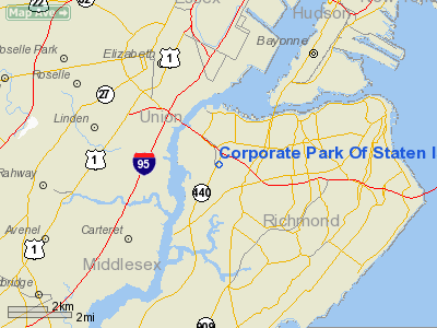
Corporate Park Of Staten Island Heliport |
Location & QuickFacts
| FAA Information Effective: | 2008-09-25 |
| Airport Identifier: | 4NK9 |
| Airport Status: | Operational |
| Longitude/Latitude: | 074-10-33.0000W/40-37-02.0000N
-74.175833/40.617222 (Estimated) |
| Elevation: | 5 ft / 1.52 m (Estimated) |
| Land: | 0 acres |
| From nearest city: | 0 nautical miles N of Staten Island, NY |
| Location: | Richmond County, NY |
| Magnetic Variation: | () |
Owner & Manager
| Ownership: | Privately owned |
| Owner: | Nicotra Group Llc |
| Address: | 110 South Ave
Staten Island, NY 10314 |
| Phone number: | 718-494-8666 |
| Manager: | Anthony Cassillo |
| Address: | 33 Shirra Avenue
Staten Island, NY 10314 |
| Phone number: | 718-494-8666 |
Airport Operations and Facilities
| Airport Use: | Private |
| Wind indicator: | Yes |
| Control Tower: | No |
| Lighting Schedule: | PHONE REQ
FOR PERIMETER LGTS CALL 718-494-8666. |
| Sectional chart: | New York |
| Region: | AEA - Eastern |
| Boundary ARTCC: | ZNY - New York |
| Tie-in FSS: | ISP - New York |
| FSS Toll Free: | 1-800-WX-BRIEF |
Runway Information
Helipad H1
| Dimension: | 70 x 70 ft / 21.3 x 21.3 m |
| Surface: | ASPH, |
| |
Runway H1 |
Runway |
| Traffic Pattern: | Left | Left |
|
Radio Navigation Aids
| ID |
Type |
Name |
Ch |
Freq |
Var |
Dist |
| EWR | FAN MARKER | Maryann | | | 11W | 5.2 nm |
| OGY | NDB | Bridge | | 414.00 | 12W | 13.7 nm |
| CAT | NDB | Chatham | | 254.00 | 11W | 13.8 nm |
| PNJ | NDB | Paterson | | 347.00 | 12W | 19.8 nm |
| NEL | NDB | Lakehurst | | 396.00 | 13W | 35.2 nm |
| BBN | NDB | Babylon | | 275.00 | 14W | 36.2 nm |
| DYL | NDB | Doylestown | | 237.00 | 10W | 46.5 nm |
| NEL | TACAN | Lakehurst | 055X | | 11W | 35.8 nm |
| NEL | UHF/NDB | Lakehurst | | 274.80 | 13W | 35.2 nm |
| PNE | VOR | North Philadelphia | | 112.00 | 10W | 49.9 nm |
| CRI | VOR/DME | Canarsie | 070X | 112.30 | 11W | 12.8 nm |
| TEB | VOR/DME | Teterboro | 021X | 108.40 | 11W | 14.8 nm |
| LGA | VOR/DME | La Guardia | 078X | 113.10 | 12W | 17.0 nm |
| COL | VOR/DME | Colts Neck | 101X | 115.40 | 11W | 18.4 nm |
| JFK | VOR/DME | Kennedy | 106X | 115.90 | 12W | 18.5 nm |
| SBJ | VOR/DME | Solberg | 076X | 112.90 | 10W | 25.9 nm |
| BWZ | VOR/DME | Broadway | 089X | 114.20 | 11W | 31.4 nm |
| STW | VOR/DME | Stillwater | 033X | 109.60 | 11W | 38.9 nm |
| ARD | VOR/DME | Yardley | 019X | 108.20 | 10W | 40.0 nm |
| DPK | VOR/DME | Deer Park | 124X | 117.70 | 12W | 41.1 nm |
| CMK | VOR/DME | Carmel | 113X | 116.60 | 12W | 48.1 nm |
| RBV | VORTAC | Robbinsville | 085X | 113.80 | 10W | 28.9 nm |
| SAX | VORTAC | Sparta | 104X | 115.70 | 11W | 31.7 nm |
| GXU | VORTAC | Mc Guire | 043X | 110.60 | 11W | 41.3 nm |
| CYN | VORTAC | Coyle | 081X | 113.40 | 10W | 49.5 nm |
| JFK | VOT | Kennedy | | 115.10 | | 18.1 nm |
Remarks
- PRVDD A CLEAR 8:1 INGRESS/EGRESS; OPERATE IN A MANNER TO MINIMIZE NOISE; VEHICULA TFC AROUND SITE CONTROL; LGTD WINDSOCK INSTALLED IF NIGHT TIME OPNS; APPROPRIATE LIGHT.
Images and information placed above are from
http://www.airport-data.com/airport/4NK9/
We thank them for the data!
|
|


