|
|
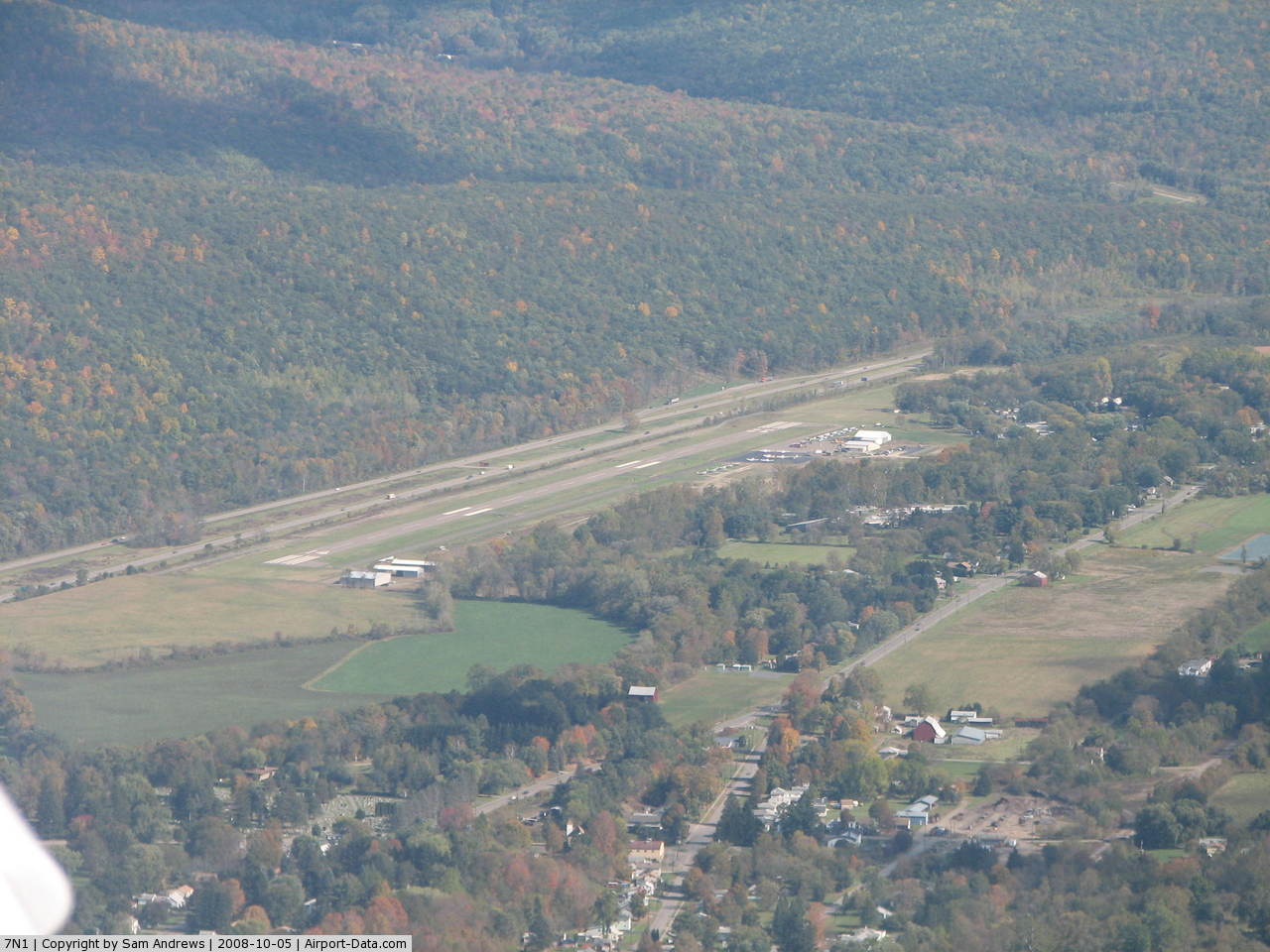
Corning-painted Post Airport |
 |
(Click on the photo to enlarge) |
 |
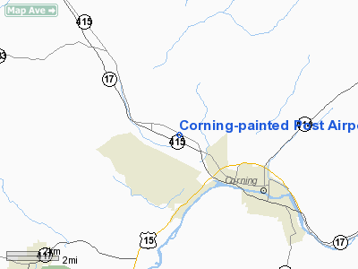
(Click on the photo to enlarge) |
Location & QuickFacts
| FAA Information Effective: | 2008-09-25 |
| Airport Identifier: | 7N1 |
| Airport Status: | Operational |
| Longitude/Latitude: | 077-07-14.1200W/42-10-47.0800N
-77.120589/42.179744 (Estimated) |
| Elevation: | 962 ft / 293.22 m (Estimated) |
| Land: | 76 acres |
| From nearest city: | 2 nautical miles NW of Corning, NY |
| Location: | Steuben County, NY |
| Magnetic Variation: | 11W (1985) |
Owner & Manager
| Ownership: | Publicly owned |
| Owner: | Town Of Erwin Ida
MS. RITA MCCARTHY IS CONTACT PERSON. |
| Address: | 117 West Water Street
Painted Post,, NY 14870 |
| Phone number: | 607-962-7021 |
| Manager: | J.r.costa |
| Address: | 342 Victory Hwy Rt 415
Painted Post, NY 14870 |
| Phone number: | 607-962-0053 |
Airport Operations and Facilities
| Airport Use: | Open to public |
| Wind indicator: | Yes |
| Segmented Circle: | No |
| Control Tower: | No |
| Lighting Schedule: | RDO-CTL
ACTVT ROTG BCN - CTAF. |
| Beacon Color: | Clear-Green (lighted land airport) |
| Landing fee charge: | No |
| Sectional chart: | Detroit |
| Region: | AEA - Eastern |
| Boundary ARTCC: | ZNY - New York |
| Tie-in FSS: | BUF - Buffalo |
| FSS on Airport: | No |
| FSS Toll Free: | 1-800-WX-BRIEF |
| NOTAMs Facility: | BUF (NOTAM-d service avaliable) |
| Federal Agreements: | N |
Airport Communications
| CTAF: | 122.800 |
| Unicom: | 122.800 |
Airport Services
| Fuel available: | 100LL |
| Airframe Repair: | MAJOR |
| Power Plant Repair: | MINOR |
| Bottled Oxygen: | NONE |
| Bulk Oxygen: | NONE |
Runway Information
Runway 14/32
| Dimension: | 3270 x 75 ft / 996.7 x 22.9 m |
| Surface: | ASPH, |
| Weight Limit: | Single wheel: 30000 lbs. |
| Edge Lights: | Medium |
| |
Runway 14 |
Runway 32 |
| Longitude: | 077-07-37.3551W | 077-06-58.9031W |
| Latitude: | 42-10-55.8670N | 42-10-40.8453N |
| Traffic Pattern: | Right | Left |
| Markings: | Non-precision instrument, Good Condition | Non-precision instrument, Good Condition |
| Runway End Identifier: | Yes | Yes |
| Centerline Lights: | No | No |
| Touchdown Lights: | No | No |
| Obstruction: | 100 ft tree, 1650.0 ft from runway, 65 ft right of centerline, 14:1 slope to clear | 30 ft tree, 360.0 ft from runway, 141 ft left of centerline, 5:1 slope to clear |
|
Radio Navigation Aids
| ID |
Type |
Name |
Ch |
Freq |
Var |
Dist |
| ALP | NDB | Alpine | | 245.00 | 12W | 16.3 nm |
| PYA | NDB | Penn Yan | | 260.00 | 12W | 28.1 nm |
| EL | NDB | Halos | | 269.00 | 09W | 35.7 nm |
| ULW | VOR/DME | Elmira | 033Y | 109.65 | 12W | 6.7 nm |
| SFK | VOR/DME | Stonyfork | 023X | 108.60 | 08W | 32.0 nm |
| ITH | VOR/DME | Ithaca | 055X | 111.80 | 10W | 34.9 nm |
| GEE | VOR/DME | Geneseo | 019X | 108.20 | 09W | 47.8 nm |
| ELZ | VORTAC | Wellsville | 051X | 111.40 | 09W | 39.6 nm |
| CFB | VORTAC | Binghamton | 059X | 112.20 | 10W | 43.9 nm |
Remarks
Images and information placed above are from
http://www.airport-data.com/airport/7N1/
We thank them for the data!
| General Info
|
| Country |
United States
|
| State |
NEW YORK
|
| FAA ID |
7N1
|
| Latitude |
42-10-33.266N
|
| Longitude |
077-06-43.894W
|
| Elevation |
951 feet
|
| Near City |
CORNING
|
We don't guarantee the information is fresh and accurate. The data may
be wrong or outdated.
For more up-to-date information please refer to other sources.
|
|