 |
|
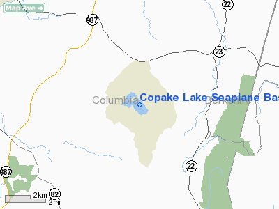
Copake Lake Seaplane Base Airport |
Location & QuickFacts
| FAA Information Effective: | 2008-09-25 |
| Airport Identifier: | NK59 |
| Airport Status: | Operational |
| Longitude/Latitude: | 073-35-28.4360W/42-08-35.3230N
-73.591232/42.143145 (Estimated) |
| Elevation: | 715 ft / 217.93 m (Estimated) |
| Land: | 350 acres |
| From nearest city: | 2 nautical miles NW of Copake, NY |
| Location: | Columbia County, NY |
| Magnetic Variation: | 14W (1985) |
Owner & Manager
| Ownership: | Privately owned |
| Owner: | Michael B. Braunstein |
| Address: | Country Club Road, Po Box 137
Craryville, NY 12521 |
| Phone number: | 518-325-4616 |
| Manager: | Michael B. Braunstein |
| Address: | 181 Golf Cours Rd
Craryville, NY 12521 |
| Phone number: | 518-325-4616 |
Airport Operations and Facilities
| Airport Use: | Private |
| Wind indicator: | No |
| Segmented Circle: | No |
| Control Tower: | No |
| Lighting Schedule: | NONE |
| Landing fee charge: | No |
| Sectional chart: | New York |
| Region: | AEA - Eastern |
| Boundary ARTCC: | ZBW - Boston |
| Tie-in FSS: | BTV - Burlington |
| FSS Toll Free: | 1-800-WX-BRIEF |
Runway Information
Runway 14/32
| Dimension: | 6800 x 700 ft / 2072.6 x 213.4 m |
| Surface: | WATER, |
| |
Runway 14 |
Runway 32 |
| Traffic Pattern: | Left | Left |
|
Radio Navigation Aids
| ID |
Type |
Name |
Ch |
Freq |
Var |
Dist |
| GBR | FAN MARKER | Sheffield | | | 13W | 10.2 nm |
| PSF | FAN MARKER | Abyss | | | 13W | 25.2 nm |
| SKU | FAN MARKER | Stanwyck | | | 12W | 42.2 nm |
| GBR | NDB | Great Barrington | | 395.00 | 14W | 8.7 nm |
| PFH | NDB | Philmont | | 272.00 | 13W | 8.9 nm |
| DXT | NDB | Dalton | | 370.00 | 15W | 27.2 nm |
| PO | NDB | Meier | | 403.00 | 12W | 38.0 nm |
| TBY | NDB | Waterbury | | 257.00 | 14W | 42.0 nm |
| SKU | NDB | Stanwyck | | 261.00 | 12W | 42.2 nm |
| HEU | NDB | Hunter | | 356.00 | 14W | 45.3 nm |
| SW | NDB | Neely | | 335.00 | 14W | 48.7 nm |
| PWL | VOR/DME | Pawling | 090X | 114.30 | 12W | 22.4 nm |
| CTR | VOR/DME | Chester | 098X | 115.10 | 13W | 29.9 nm |
| IGN | VOR/DME | Kingston | 123X | 117.60 | 12W | 30.5 nm |
| ALB | VORTAC | Albany | 100X | 115.30 | 13W | 37.5 nm |
| BAF | VORTAC | Barnes | 077X | 113.00 | 14W | 39.0 nm |
| BDL | VORTAC | Bradley | 027X | 109.00 | 14W | 42.1 nm |
| CEF | VORTAC | Westover | 87X | 114.00 | 14W | 47.6 nm |
| ALB | VOT | Albany County | | 108.20 | | 37.4 nm |
| BDL | VOT | Bradley Intl | | 111.40 | | 42.4 nm |
| HFD | VOT | Hartford | | 108.20 | | 48.7 nm |
Remarks
- OWNER DESIRES SPB NOT TO BE CHARTED.
Images and information placed above are from
http://www.airport-data.com/airport/NK59/
We thank them for the data!
| General Info
|
| Country |
United States
|
| State |
NEW YORK
|
| FAA ID |
NK59
|
| Latitude |
42-08-35.323N
|
| Longitude |
073-35-28.436W
|
| Elevation |
715 feet
|
| Near City |
COPAKE
|
We don't guarantee the information is fresh and accurate. The data may
be wrong or outdated.
For more up-to-date information please refer to other sources.
|
|


